Allocations DPD Discussion and Consultation Document
(2) 5. Community Facilities
(3) Education
The housing quantum and locations proposed result in the need for new single form entry primary schools in Rochford and Rayleigh as a minimum. At least 1.1 hectares will be required within areas allocated for residential development to accommodate these schools. Additionally, King Edmund School in Rochford will be allocated the additional 3 hectares required for expansion to meet additional need.
The following locations will be required to provide land for single form entry primary schools:
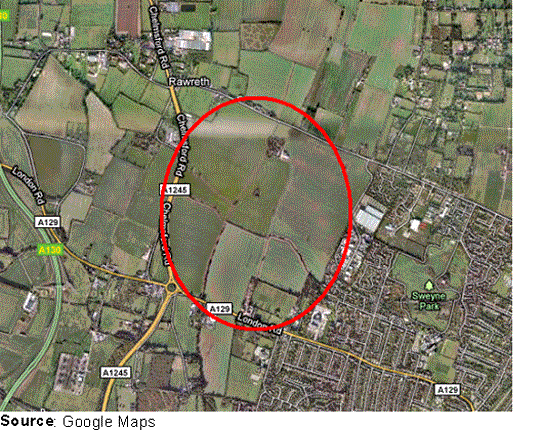
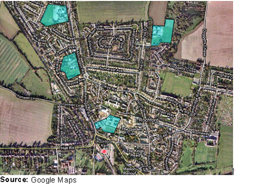
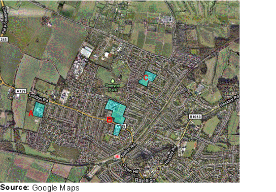
(2) Site North of London Road Rayleigh
A site within this location is required to be identified for 550 dwellings and a new single-form entry primary school. The site for the primary school will be required to be well-related to new and existing residential areas. As such, the allocation for the new primary school will be dependent on the specific site allocated for 550 additional dwellings North of London Road, discussed in Housing Chapter of this document.
The preferred option for the allocation of a single-form entry primary school is to identify an area within the residential allocation. The area within the residential allocations should have the following characteristics:
- Roughly rectangular shape
- Flat ground
- Outside of flood risk area
- Away from high-voltage power lines
- Served by safe, direct pedestrian access well linked to nearby housing
- Well related to new public transport links
- Accessible via an adopted public highway with access to service buildings
- Nearby roads can be traffic calmed
(6) Do you agree with the approach of allocating land for a new primary school within a future residential allocation in this location?
(2) Do you agree with the characteristics that such a site would be judged against?
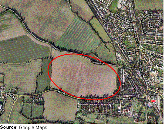
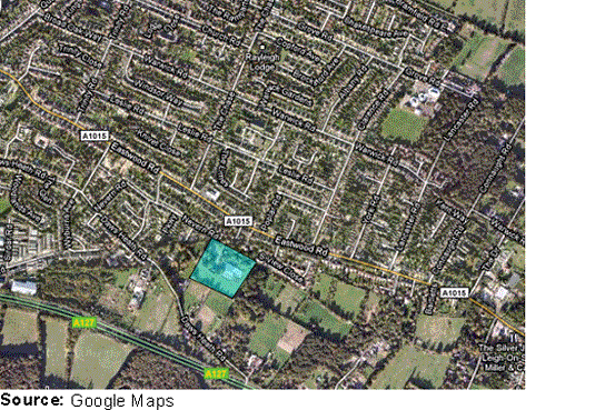
(3) Site to the West of Rochford
The site located to the west of Rochford is currently used as open fields, adjacent to existing development along Hall Road.
As with the new primary school to the North of London Road, Rayleigh, the allocation for the new primary school in West Rochford will be dependent on the specific site allocated for housing in this location.
The preferred option for the allocation of a single-form entry primary school is to identify an area within the residential allocation.
- Roughly rectangular shape
- Flat ground
- Outside of flood risk area
- Served by safe, direct pedestrian access well linked to nearby housing
- Well related to new public transport links
- Accessible via an adopted public highway with access to service buildings
- Nearby roads can be traffic calmed
(3) Do you agree with the approach of allocating land for a new primary school within a future residential allocation in this location?
(2) Do you agree with the characteristics that such a site would be judged against?
(2) King Edmund School
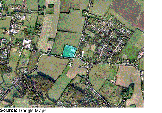
As identified in the emerging Core Strategy, new residential development to the East of Ashingdon will be required to incorporate additional access to King Edmund School and provide an additional 3 ha of land in order to accommodate the required expansion of the school to meet the additional need.
As such, additional land is required to be allocated to allow for the school to expand.
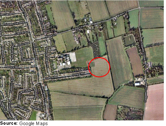
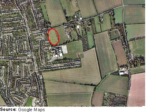
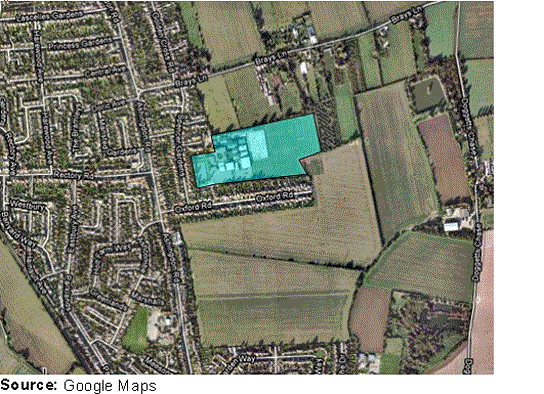
(5) Option KES1
This area is located to the east of Oxford Road which would allow for access enhancements, and also allow for the expansion of the school site. However the access to the school will be concentrated along Oxford Road, already very narrow. The extension to the school may also be located a distance away from the main school buildings.
(3) Option KES2
This area is located to the north of King Edmund School, and would enable access to be gained through Brays Lane. The area is also located to the north of the main building of the school meaning that any expansion will be within close proximity to the existing building.
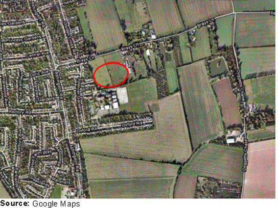
(2) Option KES3
This area is located to the north of King Edmund School and extends to Brays Lane. This will enable access to be obtained directly from Brays Lane, and for the school to expand northwards.
(2) Do you agree that the allocation of land to enable the expansion of King Edmund School is dependent on the future residential allocation in this general location?
(2) Do you have any views on the three general areas identified as options for school expansion?
In addition to new educational facilities, it is important that existing educational facilities are protected from development that would undermine their important function, and that planning allows them to develop appropriately where required. As such, it is suggested that the Allocations Development Plan Document includes the allocation of land for existing educational facilities. The proposed allocations are indicated in the following:
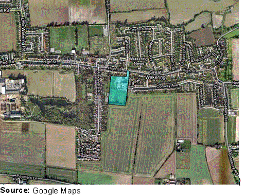
(1) Option EDU1 - Great Wakering
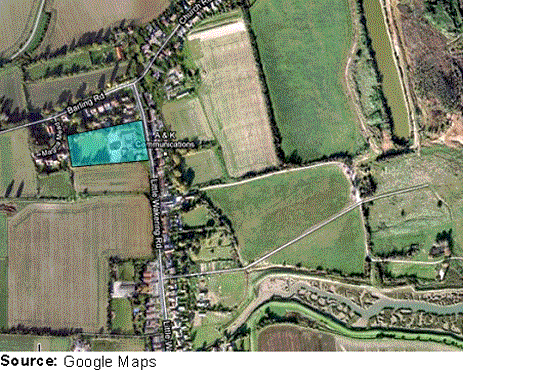
(1) Option EDU2 – Barling
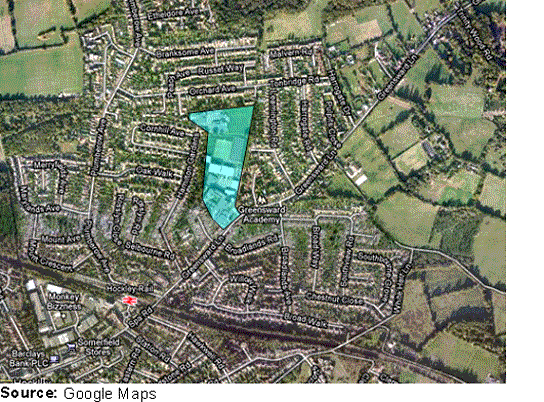
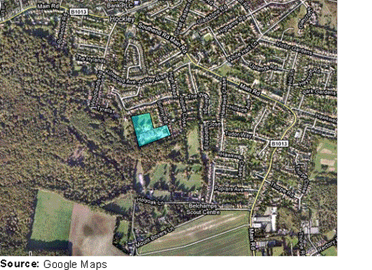
(3) Option EDU7 – Greensward Academy, Hockley
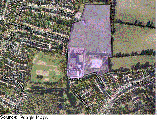
(1) Option EDU8 – The Westerings Primary School, Hawkwell
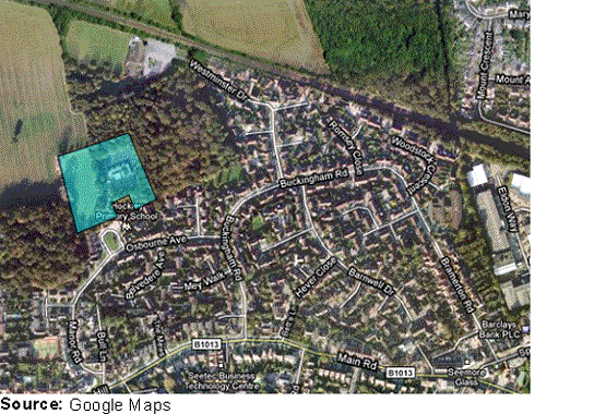
(1) Option EDU9 – Hockley Primary School, Hockley
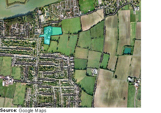
(2) Option EDU10 – Riverside Junior and Infant School, Hullbridge
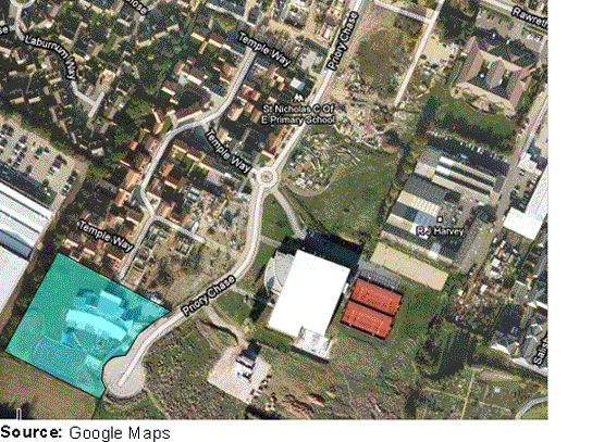
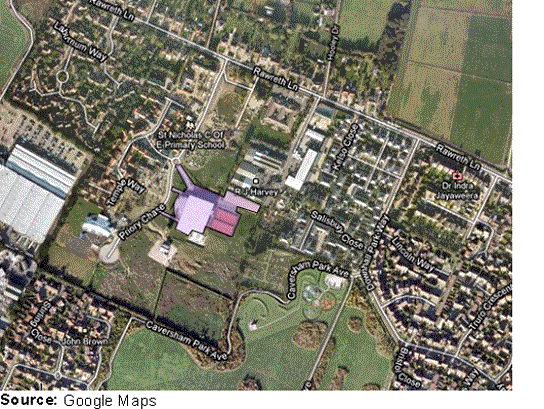
(1) Option EDU11 – St. Nicholas C of E Primary School, Rayleigh
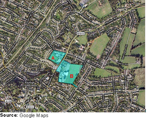
Option EDU12 – Our Lady Of Ransom Primary School, Rayleigh (A)
(1) Option EDU13 – Sweyne Park School, Glebe Junior School (B)
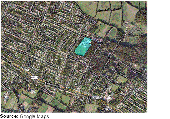
Option EDU14 – Down Hall Primary School (C)
Option EDU15 – Edward Francis Junior and Infant School (A)
(1) Option EDU16 – FitzWimarc School (B)
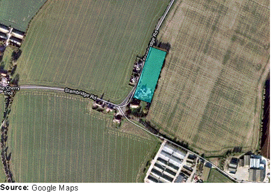
(1) Option EDU19 – Stambridge Primary School
(5) Do you agree with the areas identified?
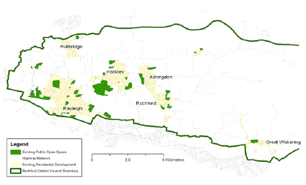
(6) Open Space
The land mass of Rochford District is currently 76% Greenbelt, and thus contains numerous open spaces, open green areas, privately and publicly owned, both formal and informal.
However, it is of vital importance that any new development integrates publicly accessible open space into its design, and as such the provision of new parks, allotments, amenity areas, playing pitches and open space of high townscape value will be encouraged, including development within town centres.
As such the emerging Core Strategy notes that of the locations designated most suitable for reallocation of land use, a condition of the reallocation will be the provision of open space and community facilities
In particular, the emerging Core Strategy proposes that land to the west of the residential development proposed for North of London Road, Rayleigh be allocated as a park to provide a buffer between the built environment and the A1245.
Additional public open space will be allocated alongside new residential development at the following locations:
- West Rochford
- West Hockley
- East Ashingdon
- South West Hullbridge
- South East Ashingdon
- West Great Wakering
- Rawreth Industrial Estate
- Eldon Way/Foundry Industrial Estate
- Stambridge Mills
- Star Lane Industrial Estate
However, the exact allocation of land for additional public open space will be dependent on the sites ultimately allocated for residential development.
The Upper Roach Valley has been identified within the Core Strategy as having significant potential to provide informal recreational opportunities, including through the enhancement of open spaces there.
In addition to new public open space, it is proposed that existing public open space will be delineated and will be protected from development which would undermine its role. The existing sites identified comprise the following sites:
- Plumberow Woods, Hockley
- Maryland’s Avenue open space, Hockley
- Pooles Lane Playing Field, Hullbridge
- Bedloes corner, Rawreth
- Rawreth Lane Playing Fields, Rawreth
- King George Playing Field, Rayleigh
- Fairview Playing Field, Rayleigh
- Turret House open space, Rayleigh
- Land South of Nelson Road, Rayleigh
- Brooklands Public Gardens, Rayleigh
- Great Wakering Playing Field, Great Wakering
- Glencroft Nurseries open space, Hockley
- Clements Hall Playing Fields, Hawkwell
- Spencers Park, Hawkwell
- Woodlands Avenue open space and Weir buffer strip, Hockley
- Lower Wyburns, Rayleigh
- Holly Tree Gardens open space, Rayleigh
- Kingley Wood, Rayleigh
- Wheatley Wood, Rayleigh
- St John Fisher Playing Field, Rayleigh
- Sweyne Park, Rayleigh
- Doggetts Wildlife Area, Rochford
- Rochford Recreation Ground, Rochford
- Magnolia Nature Reserve, Hawkwell
- King George Playing Field, Ashingdon Road, Ashingdon
- Bett’s Wood, Hockley
- Rochford Reservoir, Rochford
- Millview Meadow open space, Rochford
- Hockley Woods
- Grove Road open space and playing field, Rayleigh
- Hambro Hill open space, Rayleigh
- Hawkwell Common
- Canewdon Village Green
- Laburnham Grove play space, Hockley
- Lower Lambricks open space, Rayleigh
- Grove Road open space, Rayleigh
- Canewdon Playing Field
The extent of these areas is illustrated below on Figure 5.1
(3) Option OS1 entails the allocation of these sites as shown in Figure 5.1 for open space.
An alternative option ( (1) Option OS2) is not to allocate specific sites, but to seek to safeguard open spaces through the development management process on a case by case basis. The disadvantage to such an approach is that it lacks certainty for prospective developers and the users of community facilities. The advantage is that it ensures there is no question of less weight being applied to the protection of other open spaces which may appear after the adoption of the Allocations Development Plan Document.
(4) Which approach to the safeguarding of open space do you think would be most effective?
(3) Do you agree with the open spaces proposed to be safeguarded?
(4) Are there other public open spaces that should be protected?
Figure 5.1 Map showing existing public open space allocations
(2) Leisure Facilities
Leisure activities, and places to accommodate them play an important role in daily life, particularly in health, quality of life and the economy. The District contains a plethora of private and public sports facilities, and a study in 2006 carried out by Sport England found that 74.7%of the District’s adult population were satisfied or very satisfied with the level of sports provision in their area. In contrast to this however, less than 7% of the District’s population reside within 20 minutes of at least 3 different leisure facilities. This highlights the importance of ensuring that future leisure developments are in locations accessible by a range of transport modes
Having regard to the findings of the Open Space Study (2009), the emerging Core Strategy shows that where Green Belt land is potentially being reallocated for residential use, a proportion of the site will be required to be provided for leisure uses.
In addition, the Core Strategy also proposes that enhancements are, in particular, made to Rayleigh and Great Wakering Leisure Centres. As such it is proposed to allocate the land in question for leisure use, in order to safeguard it for such use.
The three sites proposed to be allocated are as follows:
(4) Are there any other spaces within the District that should be allocated for leisure use?
(6) Community Facilities
The emerging Core Strategy recognises the importance of community facilities to the District, and seeks to ensure that existing facilities are safeguarded from development which would undermine their role.
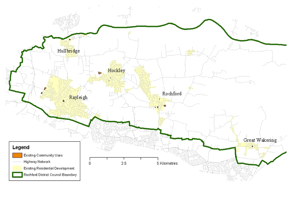
One option to help achieve this aim is to allocate specific sites for community use ( (4) Option CF1). The potential sites are illustrated below on Figure 5.2, and comprise the following:
- Hullbridge Community Association Community Centre
- The Grange Community Centre, Rayleigh
- Pope John Paul Hall, Rayleigh
- Mill Hall, Rayleigh
- Hockley Community Centre
- Hockley and Hawkwell Day Centre
- Rochford Adult Community College, Rochford
- St Mark Hall, Rochford
- Day Centre, Back Lane, Rochford
- Southwell House, Rochford
- Freight House, Rochford
- Great Wakering Community Centre
Figure 5.2 Map showing existing community facilities allocations
An alternative option ( (1) Option CF2) is not to allocate specific sites, but to seek to protect community facilities through the development management process on a case by case basis.