Foulness Churchend Conservation Area Appraisal and Management Plan
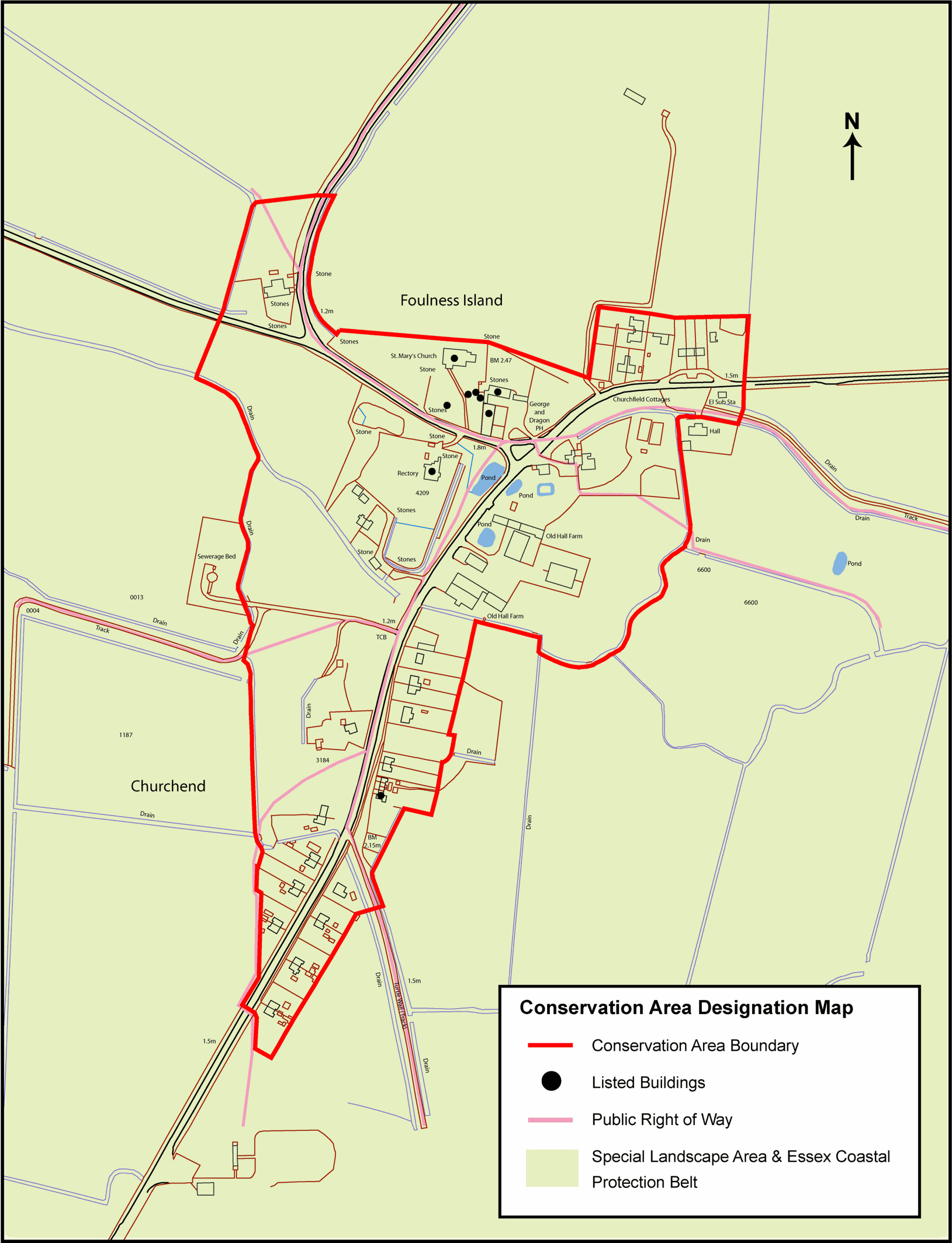
3. Statutory Protection within the Conservation Area(Fig. 1)
3.1 Foulness Churchend conservation area was designated in March 1992.
3.2 There are nine listed buildings or groups of buildings of special architectural or historic interest in the conservation area. These are the George and Dragon pub, the walled garden to the south of the pub, the parish church, three headstones and a further group of three headstones in the churchyard, the Old Rectory, and a row of cottages known as Kents Cottages. These are all Grade II listed.
3.3 There are no scheduled ancient monuments within the conservation area.
3.4 There are eight public rights of way in the conservation area marked on the Definitive Map of footpaths in Essex. However for safety and security reasons these rights of way may be subject to byelaws restricting public access under the terms of the Military Lands Act.
3.5 There are no trees protected by Tree Preservation Orders in the conservation area. However trees within the conservation area enjoy protection in as much as anyone within a conservation area carrying out works to a tree must give written notification to the local planning department at least six weeks beforehand.
3.6 The conservation area lies within a Special Landscape Area (SLA), designated as being of great landscape value. The Crouch/Roach marshes SLA consists of a number of islands, creeks and channels with salt marsh, mudflats, and drainage ditches predominating. There is a presumption against development in the SLA unless it accords with the character of the area. Further information on the special landscape character of Foulness and Maplin Sands is contained within Landscape Character Assessment of the Essex Coast1.
3.7 The conservation area lies within the Essex Coastal Protection Belt, which recognises the special and undeveloped character of parts of the Essex coastline.
Fig. 1 Churchend conservation area map showing statutory designations within the conservation area.
Reproduced by permission of Ordnance Survey® on behalf of the Controller of Her majesty's Stationery Office. ©Crown Copyright. Licence number LA100019602
1 This document was commissioned by Essex County Council and Schéma d'Aménagement Intègre du Littoral and aimed to collate current information about landscape character of the Essex coast in a structure designed to help inform future planning decisions. It is available through the Essex County Council website.