London Southend Airport & Environs Joint Area Action Plan Issues & Options Paper
2 Assets, Opportunities and Constraints
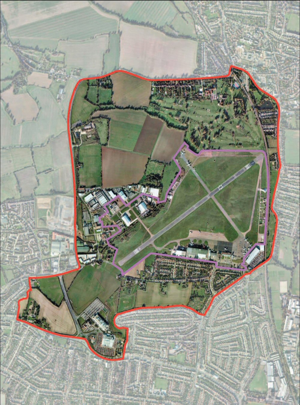
(9) 2.1 The JAAP Area
The site area covered by the JAAP is shown in Figure 2.1. The area straddles the administrative boundary between Rochford District Council and Southend-on-Sea Borough Council and lies partly within the Thames Gateway South Essex growth area. It is bounded by the A127/Prince Avenue to the south; Cherry Orchard Way to the west; Hall Road to the north and Southend Road to the east.
The area essentially comprises:
- London Southend Airport
- Adjoining employment areas (including Aviation Way and Laurence Industrial Estate)
- Open countryside, redundant brickworks and recreational facilities to the north
- Residential areas and agricultural land to the south. The residential area stretches from Wells Avenue (adjacent to southern airport boundary) to Prince Avenue in the south.
The northern part of the study area falls within Rochford District Council. The airport runways are predominantly zoned Metropolitan Green Belt (Rochford Replacement Local Plan). Current policy and emerging policy on the Metropolitan Green Belt has a presumption against development unless it is agricultural or exceptional circumstances can be proven. Rochford District Council undertook a comprehensive review of the Metropolitan Green Belt and made minor boundary modifications to make it both more logical and defensible.
Figure 2.1 - JAAP Area
The Southend-London mainline railway line runs along the eastern boundary of the study area. The proposed Southend Airport railway station will be served by this line thereby reinforcing its importance. Southend Road, which is one of the major road links between Rochford and Southend, runs parallel to the railway line. An established residential area fronts onto Southend Road.
The western boundary of the area is Cherry Orchard Way. Most of the north-eastern part of the study area is within the Metropolitan Green Belt. Stroud Green, a relatively small settlement is located at the north-western corner of the study boundary off Cherry Orchard Way/Hall Road junction. The former Brickworks' site within the boundary has been put forward in the emerging Rochford Core Strategy as a potential residential site. To the west of Cherry Orchard Way is the Cherry Orchard Jubilee Country Park. A golf course together with a row of large detached houses is adjacent to the airport boundary.
Based on existing land use, particularly the Metropolitan Green Belt designation, existing transport network and established residential areas there appears to be very limited opportunities for expansion within the northern part of the study area. Britannia Business Park is contiguous to the western boundary of the study area.
The southern portion of the study area lies within Southend Borough and is well built up. The south eastern part of the study area comprises an established residential area, allotment gardens, open arable land and the employment area off Nestuda Way. To the south of Eastwoodbury Lane is land currently used as small holdings and is designated in the current Southend-on-Sea Borough Local Plan as Land of High Grade Agricultural Quality (G2). Development, other than agricultural is currently restricted on this land.
In the western part of the study area are Laurence Industrial Area and Avaiation Way Business Park. The western edge of the JAAP, Cherry Orchard Way, bisects this area from other employment on Britannia Business Park and Comet Way. Nestuda Way and Cherry Orchard Way are major transport routes serving not only the immediate areas but also connecting Southend with Rochford.
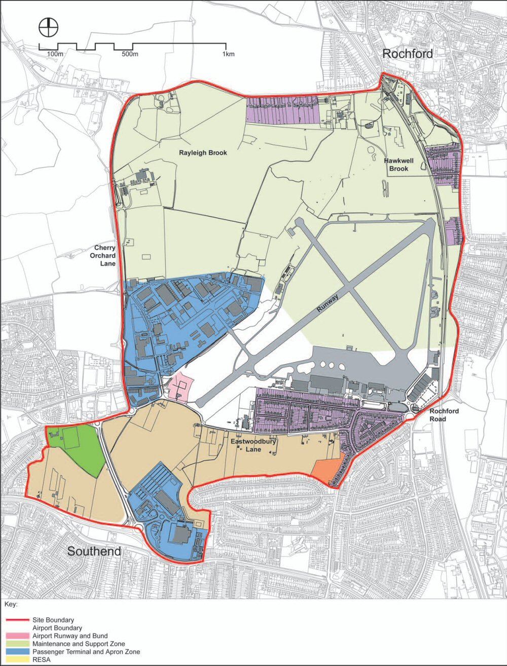
(12) 2.2 London Southend Airport
A thriving airport and related activity will act as catalysts for the economic growth within the study area and environs. Expansion of the airport operations and the adjoining employment cluster are fundamental in realising the shared vision for the future development of Southend Airport and growth of the associated and adjoining employment cluster/ hub.
London Southend Airport currently occupies 125ha. within the central part of the JAAP. It is leased by Southend-on-Sea Borough Council to the London Southend Airport Company Limited (LSACL), currently part of Regional Airports Ltd. There were no regular commercial scheduled or charter flights for a number of years until 2005 when Flybe reinstated a weekly scheduled service to Jersey during the summer.
Current traffic through the airport is estimated at around 39,000 aircraft movements and passenger movements of around 30,000 passengers per annum6. The flying clubs located at the airport account for around 55% of aircraft movements, followed by business aviation (comprising business aviation, air taxi and private aircraft movements) which represent around 30% of movements.
Current operations at the airport are constrained by its facilities, including its runway which at 1,610 metres long and 37 metres wide is capable of handling a range of aircraft types up to and including Boeing 757s for maintenance, but is restricted in respect of ‘fully laden’ aircraft it can accommodate. For example, it is not long enough for fully laden Boeing 737s that are commonly used by low cost carriers. In addition, the range of facilities, such as the terminal building and accessibility to the airport, restrict the airport’s attractiveness as a location for Fixed Base Operators (FBOs) and carriers that may be looking for a base.
To move beyond its current operational model it is recognised that further investment will be needed in the airport and LSACL has identified proposals for a major two phase redevelopment programme. Phase One started in 2007 and completion is expected in 2010. It comprises the following projects:
- Refurbishment of the current terminal
- Development of a quality hotel
- A new control tower
- A new airport railway station for which planning consent has been granted
This initial phase would increase the airport’s passenger catchment into the London market and make the airport more attractive to potential operators. These improvements would help increase passenger movements to around 1 million passengers per annum (mppa) by 2012-15.
Phase Two involves the building of an entirely new, re-sited terminal building (for which planning approval exists) and the possibility of a runway extension to accommodate the new generation of medium capacity, high-efficiency jets being adopted by regional airlines. This development phase is at an early planning stage. LSACL intends to seek the necessary planning permissions and approvals to enable work to progress for completion by 2011 (in time for the 2012 London Olympics162).
While analysis suggests that the airport could reach a maximum capacity of 2 mppa by 2030 using its current constrained runway, an extended runway would increase the attractiveness of the airport to a wider range of commercial and business operators and increase the potential for the airport to reach its capacity figure. This would also be reached sooner, increasing the overall economic benefit for the subregion.
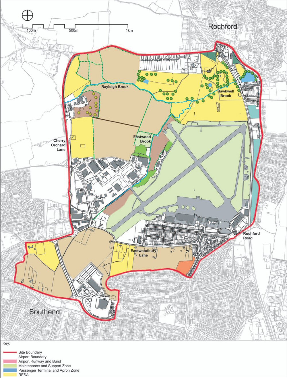
Figure 2.2 - Current and Future Land Use Constraints of Southend Airport
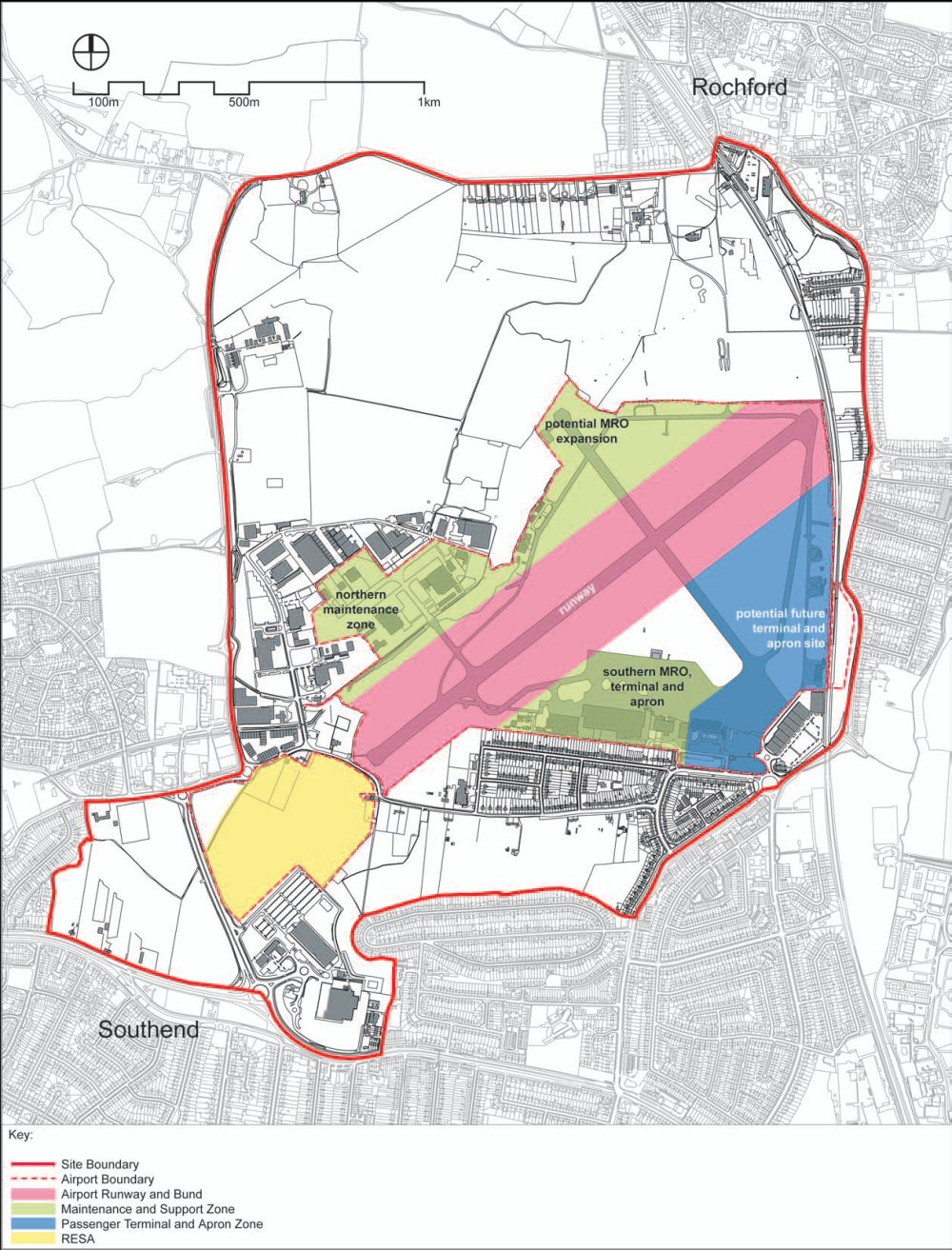
This map is reproduced from Ordnance Survey® material by Halcrow on behalf of Rochford District Council of Council Offices South Street Rochford SS4 1BW with the permission of the Controller of Her Majesty’s Stationery Office, ©Crown copyright. Unauthorised reproduction infringes Crown copyright and may lead to prosecution or civil proceedings. Licence Number: 1000018109, 2007.
The potential opportunity presented by London Southend Airport is a key factor in determining the future of the JAAP area and raises a number of important issues.
- The future role of the airport and its environs will be determined by investment in its facilities and not least whether or not the runway is extended to 1,799 metres.
- Future development plans within the airport boundary need to maximise the efficient use of land. Given the operational constraints within the airport boundary (see Figure 2.2), land opportunities are limited to more efficient use of southern and northern maintenance zones; re-use of the flying club area to the east of the airport; and potential redevelopment of land around the existing terminal area.
- Realisation of the economic potential of the airport asset can be achieved through improving the offer to aviation operators, businesses and passengers. This includes improved accessibility via the rail network (to increase the size of the passenger catchment) and improved facilities for passengers and business operators.
- The wider potential created by an active airport will need to be harnessed by the rationalisation and use of employment land opportunities adjacent to the airport.
- Balancing the growth of the airport with necessary controls to mitigate environmental impacts.
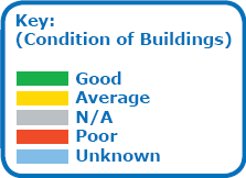
Figure 2.3 - Condition of buildings
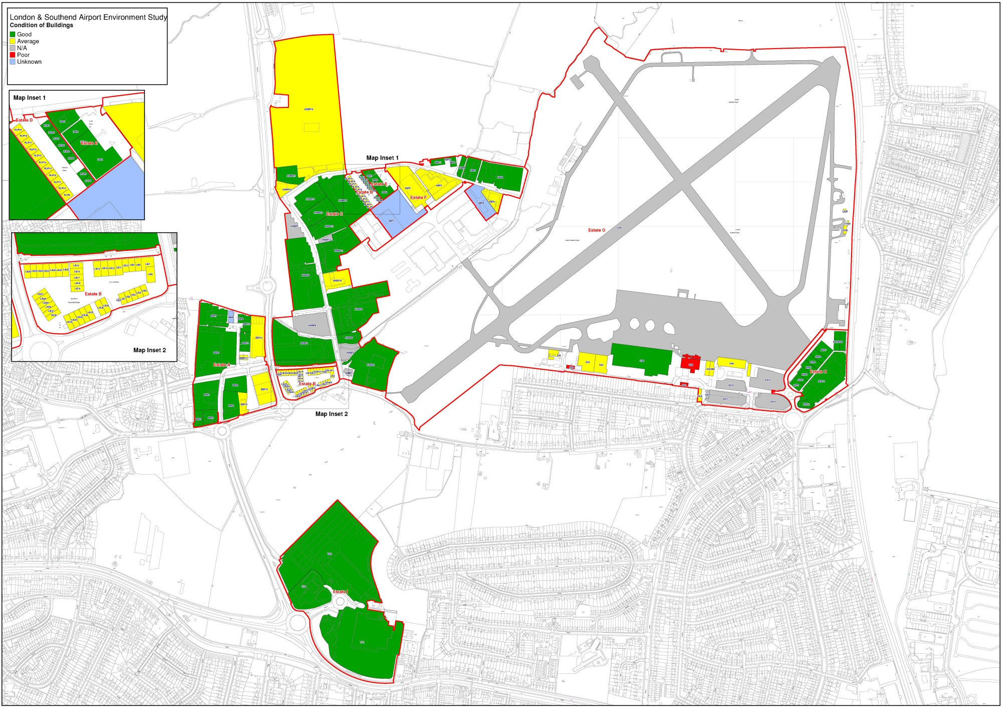
This map is reproduced from Ordnance Survey® material by Halcrow on behalf of Rochford District Council of Council Offices South Street Rochford SS4 1BW with the permission of the Controller of Her Majesty’s Stationery Office, ©Crown copyright. Unauthorised reproduction infringes Crown copyright and may lead to prosecution or civil proceedings. Licence Number: 1000018109, 2007.
(4) 2.3 Supply and demand for employment areas
The JAAP area plays an important role in the provision of employment opportunities for residents in the sub-region. In total there are eight industrial estates and retail parks in or adjacent to the JAAP area. These include Britannia Business Park; Comet Way; Laurence Industrial Estate; Aviation Way Business Park; Robert Leonard Industrial Park; Lancaster Business Park; Aviation Business Park; the Airport Retail Park and the retail park at Thanet Grange. It is estimated a total of 51 ha. of land is accounted for by these areas.
An assessment of these employment areas was undertaken in 2007 via a site-based survey. Overall within the JAAP area the current employment land allocations are generally of good quality, well occupied and vibrant. The area is home to a diverse mix of businesses (not just B-class uses); the stock is generally modern (78% of sites) and condition is either good (42%) or average (48%) - see Figure 2.3. While there were vacant sites at the time of the survey, there is generally a limited amount of land for future development opportunities. The main area of opportunity is the intensification of employment land close to the airport, in particular within Aviation Way Business Park. Here there are a number of potential sites but also opportunity to better use existing development land which in parts is inefficiently occupied.
Businesses in the JAAP study area are generally long standing businesses, located in their premises for a significant period of time (24% had been there for over 20 years). The characteristics of the area that were important to them and attracted businesses were clearly:
- access to the main road network
- the quality of land and premises
- the relative cost
- the quality of the environment
Proximity to the airport was not an important factor for the majority of businesses, reflecting the current nature of business in the area and the lack of relationship between businesses and airport activity. However, two-thirds of businesses welcome the potential airport expansion.
Within the context of wider employment land allocations in Southend, the JAAP area provides a relatively attractive location that is likely to attract investment. The area forms part of a wider concentration of employment sites located along the A127 corridor that are the most attractive and accessible locations for business. Even within this concentration the quality of stock is sometimes poor and very constrained in terms of expansion land. Sites further east in the borough tend to be struggling for investment and the strategic approach in the sub-region is to maximise opportunities in areas where investment might be possible.
In terms of the wider market demand in Southend, the relatively low level of take-up reflects the fact that demand is being constrained by poor stock. Given the low importance of an airport in the general location decision making process, the direct impact of airport expansion on office demand in the area is uncertain. But case studies show that office provision around smaller airports can attract occupiers (and RBS demonstrates the potential of the JAAP location for offices). There is a view that new and improved industrial-related property offering around the airport would be a stronger proposition and attract current and potential future demand.
Growth targets for the sub-region, based on the Regional Spatial Strategy, indicate that to meet targets, up to 43% of future employment growth could come from the B-class sectors and that the trends within this show a strong growth in Offices & Light Industrial (B1) uses supported by more constrained growth in the Storage and Distribution (B8) market. General Industry (B2) is set to continue declining. This growth translates into an anticipated future need of employment land across Southend and Rochford that is likely to be accommodated in accessible locations (along the A127 corridor) to the west of the sub-region.
In considering the future potential of the JAAP area as an employment location the following considerations will be prevalent.
- The JAAP area is already a vibrant employment area that attracts investment and development. Its prominence as a business location is evident when analysed alongside other employment sites within Southend. As such there is potential for the area to play an increasing role in supporting wider employment in the sub-region.
- While the current employment offer is relatively strong, there are limited opportunities within existing allocations for expansion. Opportunities are largely restricted to infill sites or redevelopment of existing sites.
- Expansion of employment land is currently constrained by the Metropolitan Green Belt designation that covers a significant part of the northern JAAP area. Outside of this area there is limited scope for additional employment allocation.
- Therefore, any future allocation of employment land would require robust justification. It also requires to be clearly focused towards meeting future demand and needs by supplying investment opportunities that are currently not catered for in Southend and Rochford.
- While the current link between businesses and the airport is weak, in developing the future role of the JAAP creating greater synergy between these two assets will generate additional opportunities for investment and employment.
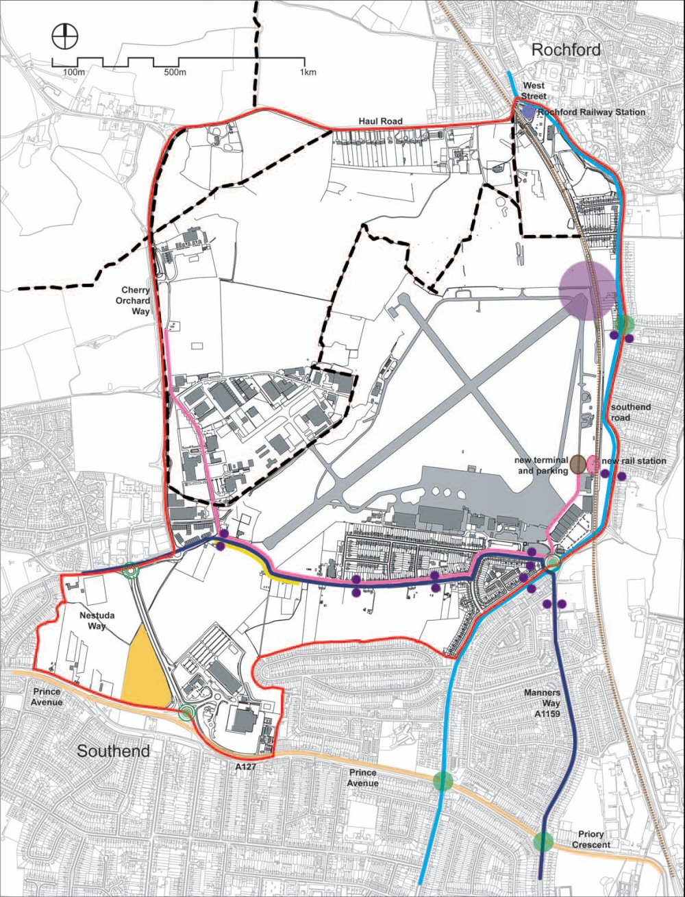
(15) 2.4 Transport & Accessibility
Transport and accessibility are significant issues throughout the sub-region and clearly any development in the JAAP area will have an impact upon the whole highway network in the wider area. Any development will therefore need to take into account existing congestion along the main corridors in the region, notably the A127 and A13 which suffer from significant levels of congestion and major improvements are planned or are currently taking place along these two roads.
The current transport and accessibility character of the JAAP area is summarised as follows.
- Highway Network. Most of the highway network is operating at or near capacity. Recent junction capacity assessments carried out highlight a number of local capacity problems during the peak hours - in particular at the Anne Boleyn roundabout (Sutton Road – Southend Road roundabout), the Prince Avenue/Rochford Road/ Hobleythick Lane signalised junction and the Manners Way / Priory Crescent / Victoria Avenue/Prince Avenue (Cuckoo corner) roundabout.
- Bus Services, Cycle Routes and Pedestrian Facilities. Analysis has also highlighted that the current bus services, pedestrian and cyclist facilities serving the area are not considered to be a valid alternative to the car, as confirmed from the airport staff who find it more convenient to drive to work. Two bus stops are located within a 5-minute walk from the airport entrance. However, there is no connectivity with the adjoining Aviation Way Business Park.
- Railway. Although the airport is within 2.5km - 3.5km to four railway stations, connectivity with the JAAP area is relatively poor. However, a new airport related railway station is proposed to support the growth of the airport. From the perspective of the airport, a new station will provide direct accessibility to the London market, which has been identified as a target market for growth in the future. It will make the airport more attractive to potential fixed based passenger operators. From a railway/commuting perspective, a new station with accompanying car parking would be an attractive offer for London commuters, an issue that would need to be explored and addressed.
- Eastwoodbury Lane. The current and future role of Eastwoodbury Lane is critical to the JAAP area. As the airport grows in terms of the number of aircraft movements the road will be increasingly constrained (i.e. shut to allow aircraft movements). The ultimate result will be the eventual closure and/or diversion of the route.
Development of the JAAP area would increase the traffic flows on the highway network as the new development would become a destination in its own right and potentially attract additional vehicle traffic from visitors and servicing. Any proposals to redevelop the study area should take into account the existing congestion in the area – especially along the A127 - and suggest appropriate measures and solutions in order to alleviate the congestion and improve connectivity. In doing so, transport solutions proposed for the JAAP area would need to integrate with wider transport strategies across the local authority areas and key proposals such as the South Essex Rapid Transit (SERT).
Transport issues and opportunities are shown in Figure 2.4.
Figure 2.4 - Transport Issues and Opportunities
This map is reproduced from Ordnance Survey® material by Halcrow on behalf of Rochford District Council of Council Offices South Street Rochford SS4 1BW with the permission of the Controller of Her Majesty’s Stationery Office, ©Crown copyright. Unauthorised reproduction infringes Crown copyright and may lead to prosecution or civil proceedings. Licence Number: 1000018109, 2007.
The transport strategy is likely to require a broadranging approach, including:
- Improved connections within the site to public transport.
- Improved public transport connections between the study area and Rochford, Rayleigh and Southend railway stations. The potential SERT and railway station at the airport will have a very important role in improving public transport connections.
- Considerations of the wider impact of the redevelopment upon the whole highway network in the area, beyond the agreed study area of the JAAP.
- Detailed review of operation of junctions and pedestrian crossings in the area, to ensure that roundabouts and signals are providing the most effective levels of service for pedestrians, cyclists, buses and vehicles.
- Consideration of all planned developments and highway schemes in the area.
- Examine the potential for community bus services, utilising smaller vehicles that penetrate individual neighbourhoods within Southend-on-Sea, Rayleigh and Rochford, to facilitate local movements throughout the day.
- Public realm improvements, including enhanced pedestrian and cycle facilities within the study area and other routes in the town centre.
- A workforce travel plan.
(9) 2.5 Environmental Character and Assets
The JAAP area is situated within the London Basin Natural Area which is characterised by urban areas and agricultural landscapes that contain semi-natural habitats. The northern section of the JAAP which is mostly open countryside (Metropolitan Green Belt) accommodates recreation areas, a network of Public Rights of Way, and several brooks. The north eastern and north western parts include Cherry Orchard Way, Stroud Green. There is also a disused brickworks' site within this part of the Green Belt that offers an opportunity for redevelopment.
Development within the northern part of the JAAP will need to take into consideration the small country town nature of Rochford including the centre and area around the Rochford railway station which all fall within a Conservation Area. The setting and relationship between Rochford Hall, St. Andrew’s Church and a number of nearby buildings is highly sensitive to visual change. Development on the airport and surrounding areas have to pay particular attention to potential adverse visual impacts of any proposed development. This open countryside forms a clear separation between Rochford and the more built up Southend urban area to the south. This open countryside offers the only opportunity for future expansion of the airport and related industrial activities.
The southern, south-western and eastern areas of the JAAP are characterised by industrial/business parks and post-war housing estates with associated facilities. The proximity of these developments means that they are particularly affected by developments at the airport. Expansion or increased activities at the airport could adversely impact on these uses. The whole of the JAAP area is subject to road traffic noise. Traffic noise is particularly evident along the major transportation routes that are often congested. However, one of the JAAP objectives is to ensure a high quality environment including addressing the noise and vibration pollution. The proposed development offers an opportunity to address some of these issues.
Within the JAAP, there are potential areas at risk of flooding in the absence of flood defence mechanisms or in the event of breach of defences. Areas of flooding include Eastwood, Rayleigh and Hawkwell Brooks within the site. Other areas include parts of Aviation Way and Rochford Hundred Golf Club.
Rochford District Council and Southend-on-Sea Borough Council do not fall within any Air Quality Management Strategy Areas. However, both councils are concerned about the effects of a reconfigured runway as well as associated additional traffic emissions. Development in the JAAP will generate road traffic emissions, and aircraft emissions are expected to increase if passenger activity increases (although this may be offset by improvements in aircraft technology).
In considering the future development of the JAAP the following environmental issues need to be taken into consideration:
- Noise and Vibration. The major noise and vibration sources within the study area are airport operations, traffic and the railway line. Potential on-site and off-site noise and vibration receptors comprise most of the residential properties in the south and south-east of the study area. Increased airport activity and expansion of industrial and commercial activities may potentially increase noise and vibration. Appropriate mitigation measures will be needed to minimise increased noise and vibration.
- Flood Risk. Flood Risk areas have been identified within the study area and development should be appropriately located to minimise adverse impacts on people and property.
- Landscape. The landscape within and adjacent to the study area is a mix of rural, broad open spaces with large sheds, small holdings, arable land and post-war housing. Proposed future development within the study needs to minimise any adverse impact on visual receptors and also avoid degradation of existing landscape features. Opportunities for enhancement will be a major consideration in future development opportunities.
- Biodiversity. The study area is located within the London Basin Natural Area which is characterised by urban areas and agricultural landscapes containing islands of semi-natural habitats. Valuable habitats within the study area include hedgerows, linear tree belts and ponds in the northern section. Some of the habitats will be affected by the proposed development but there is also an opportunity to maintain and enhance areas of existing and ecologically important habitats including hedgerows, waterways and Eastwood Brook.
- Open Space and Recreation. The study area has open spaces, recreation facilities and a network of Public Rights of Way. Maintenance and enhancement of the open space, recreation facilities and public footpaths could be incorporated into new development where possible.
The habitat plan of the JAAP area is shown in Figure 2.5 overleaf.
(1) 2.6 Conclusions
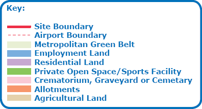
Based on the above analyisis a composite land use plan of the JAAP area is presented in Figure 2.6. It clearly shows the context of the area and the land use contrast between the southern part and northern part of the JAAP. This prevailing context will be important in shaping the nature of change and development in the area.
Questions
(54) Q2.1 Are the assets of the JAAP area fully reported and understood?
(46) Q2.2 Are there any important assets or issues missing from the assessment?
Figure 2.5 - JAAP Habitat Plan
This map is reproduced from Ordnance Survey® material by Halcrow on behalf of Rochford District Council of Council Offices South Street Rochford SS4 1BW with the permission of the Controller of Her Majesty’s Stationery Office, ©Crown copyright. Unauthorised reproduction infringes Crown copyright and may lead to prosecution or civil proceedings. Licence Number: 1000018109, 2007.
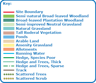
Figure 2.6 - Summary Land Use Plan
This map is reproduced from Ordnance Survey® material by Halcrow on behalf of Rochford District Council of Council Offices South Street Rochford SS4 1BW with the permission of the Controller of Her Majesty’s Stationery Office, ©Crown copyright. Unauthorised reproduction infringes Crown copyright and may lead to prosecution or civil proceedings. Licence Number: 1000018109, 2007.
6Source: CAA Annual Airport Statistics 2006