Battlesbridge Conservation Area Appraisal and Management Plan
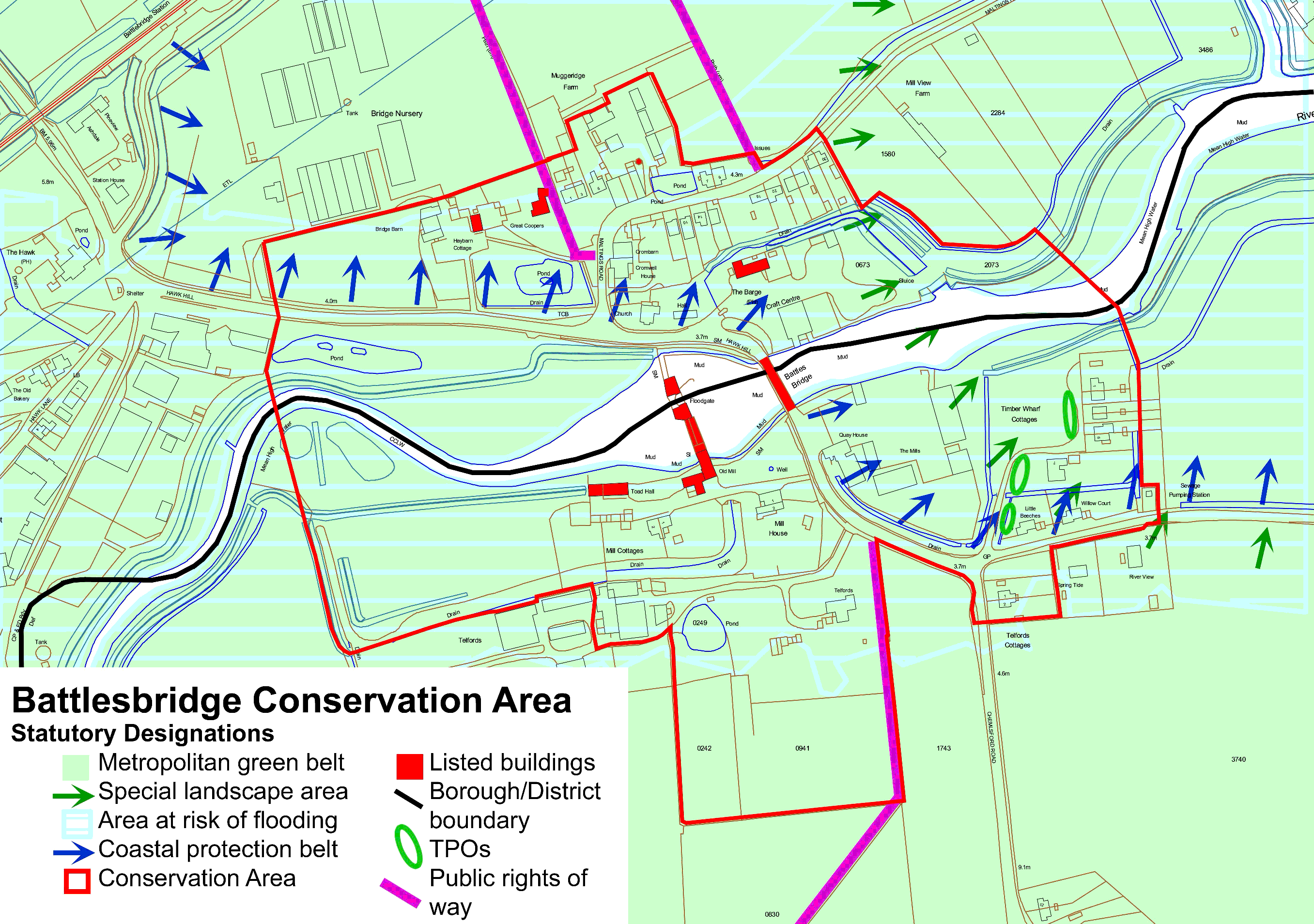
3. Statutory Protection within the Conservation Area (figure 2)
3.1 The conservation area was jointly designated by Chelmsford Borough Council (north side of the river) and Rochford District Council (south side of the river) in February 1992 and March 1992 respectively.
3.2 There are seven listed buildings in the conservation area. These are the old tide mill and attached dam wall, the old granary and drying kiln, the Hay Barn Antique Centre, the Barge Inn, the dovecote at Muggeridge's Farm, Great Coopers farmhouse, and the road bridge. All of these are Grade II listed. Appendix 1 contains list descriptions for these buildings.
3.3 There are three public rights of way in the conservation area marked on the Definitive Map of footpaths in Essex. Two paths head north from Maltings Road on either side of Muggeridge Farm, and one runs south from Chelmsford Road past Telfords heading towards Rawreth.
3.4 There is one Tree Preservation Order in the conservation area, within the Rochford District area, covering three groups of willow trees off Beeches Road (ROC/30/92). However trees within the conservation area enjoy protection in as much as anyone within a conservation area carrying out works to a tree must give written notification to the local planning department at least six weeks beforehand.
3.5 The rural character of Battlesbridge and its wider setting is recognised by a number of statutory designations. The settlement lies within Metropolitan Green Belt, where there is a general presumption against inappropriate development. Parts of the conservation area fall within the Essex Coastal Protection Belt which recognises the special and undeveloped character of parts of the Essex coastline. In addition the eastern part of the conservation area is set within a Special Landscape Area (SLA), designated as being of great landscape value, the conservation of which is considered to be important to the county's natural heritage as well as at a local level. There is a presumption against development in an SLA unless it accords with the character of the area.
3.6 With its low-lying setting Battlesbridge is situated within an area that has been designated as at risk of flooding. New developments must take into account the level of risk posed and must include appropriate flood mitigation and management measures.
Figure 2: Battlesbridge conservation area showing statutory designations.