Canewdon Church Conservation Area Appraisal and Management Plan
6. Character Appraisal
(1) Spatial Analysis
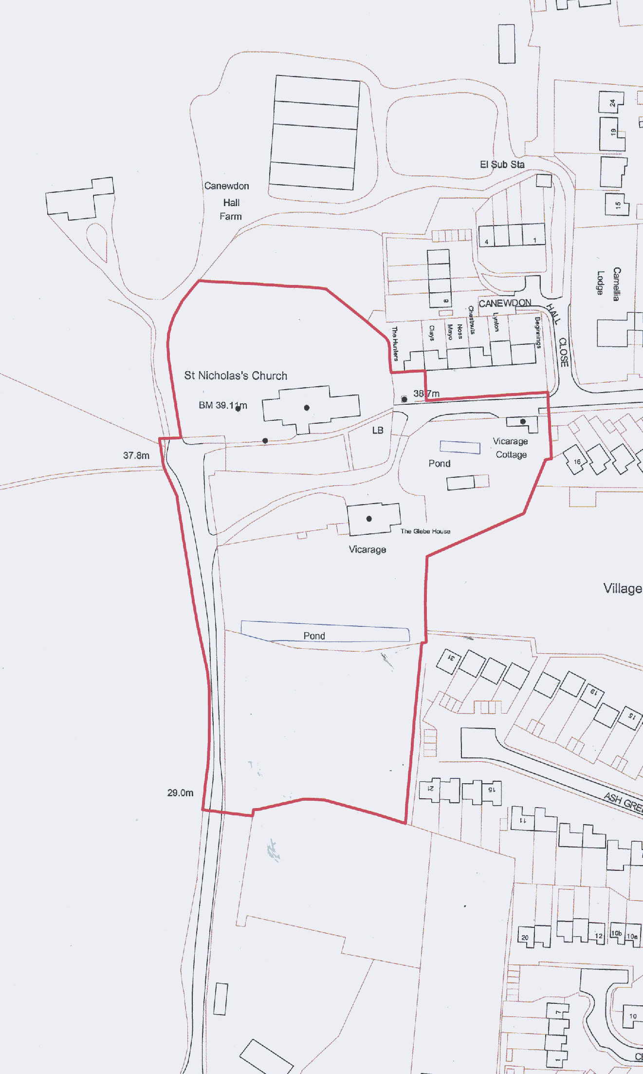
6.1 The Canewdon Church conservation area focuses on the parish church and churchyard and the vicarage and grounds, including the lane to the west as far as the boundary of the vicarage grounds. It also encompasses the western end of the High Street, taking in Vicarage Cottage and the village lock-up.
6.2 The conservation area can be approached either from the east along the High Street or from the south via a small lane off Lark Hill Road.
Fig. 9 Aerial photograph of conservation area
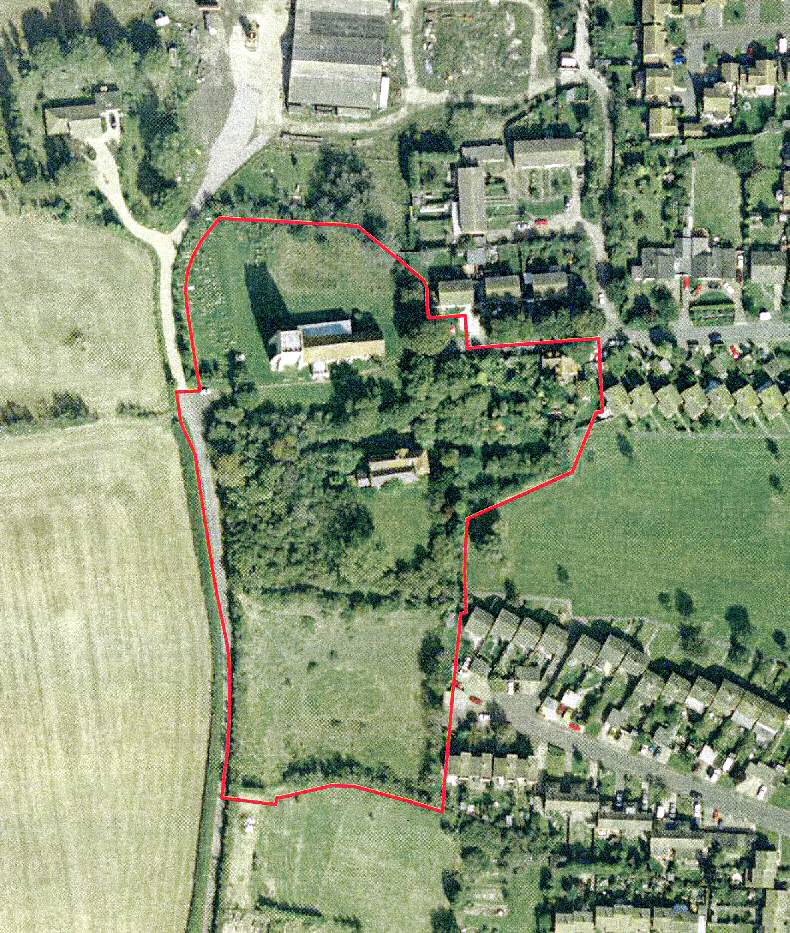
©UK Perspectives
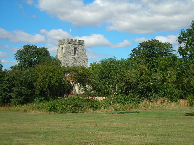
6.3 From the village green there are views into the conservation area, which has a hedge boundary with trees and scrub. The church tower rises above the trees with glimpses of the red brick vicarage through gaps in the hedge. Vicarage Cottage and its gardens are also visible from the green. Despite the modern housing around the green, the rural quality of the adjoining conservation area creates an impression of a traditional village setting overlooked by the parish church (Fig. 10).
Fig. 10 The church viewed from the village green
6.4 Approached from the High Street the conservation area lies beyond the transitional zone of modern housing development that separates it from the High Street conservation area. This is a quiet stretch of the High Street that carries no through traffic. The view towards the conservation area narrows towards the end of the street with mature trees obscuring the view of the church and churchyard beyond (Fig. 11). An old iron side gate with a heart-shaped detail and adjacent wooden gate terminate the street, inviting further investigation and progression to the end (Fig. 12).
Fig. 11 High Street
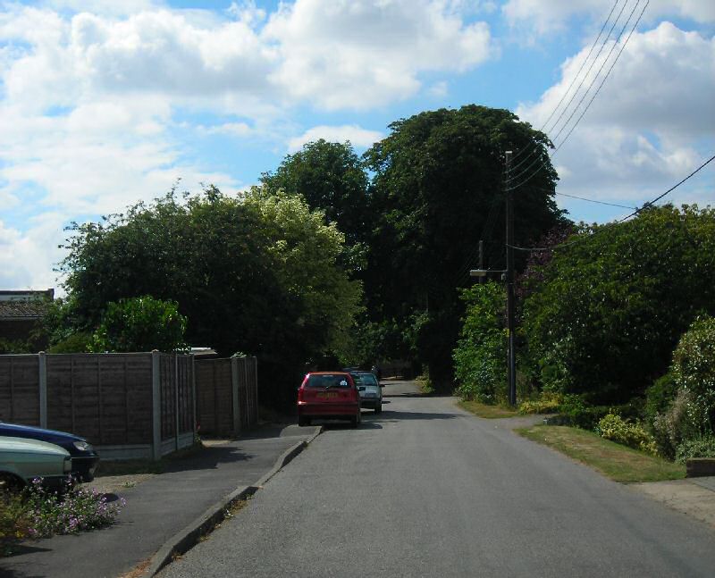
Fig. 12 High Street
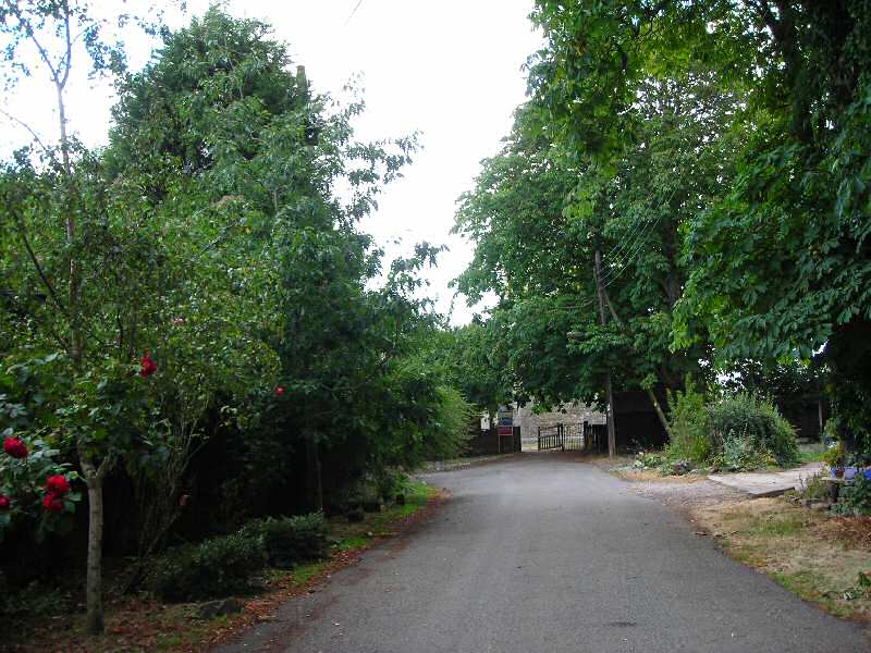
6.5 Vicarage Cottage, a white rendered cottage, marks the start of the conservation area, at which point the kerbed pavement ends and the High Street becomes less formal. Opposite the cottage, a row of mature horse chestnut trees in the open front gardens of modern houses set well back from the road enclose the northern edge of the street.
6.6 Just before reaching the gate into the churchyard, a driveway branches round to the left, and here the view opens out across a field gate to the red brick vicarage, a two storey building with a crow-stepped gable and off-centre porch (Fig. 13).
Fig. 13 View from the High Street to The Vicarage

6.7 From within the churchyard, the view opens out, and the elevated position of the site is immediately apparent with exceptional views to the distant landscape beyond the boundaries (Fig. 14). If it is possible to climb the church tower, yet more expansive views can be obtained. From the east gate of the churchyard, a footpath passes south of the church, drawing the visitor through to another gate on the west side (Fig. 15). From this path the wide front elevation of the vicarage is clearly visible over the boundary wall with views across its grounds emphasising the open rural setting. The boundary between the churchyard and the vicarage grounds is defined partly by an old red brick wall that has collapsed in places, and by a newly planted laurel hedge planted within the vicarage boundary.
Fig. 14 Churchyard looking south-west
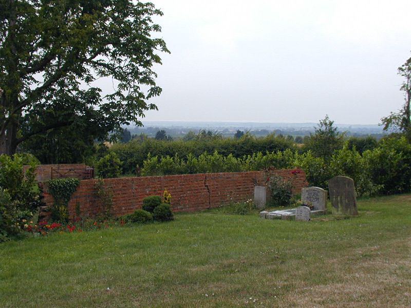
Fig. 15 Churchyard, east side
6.8 The space is generally more open and sparse on the north side, except in the north-west corner where the majority of the graves are clustered (Fig 16).
Fig. 16 North side of the churchyard looking north-west

6.9 The boundary around the northern edge of the churchyard is defined by a low wooden post and rail fence with a thin hedgerow and occasional mature trees that allow frequent views out. The buildings of Canewdon Hall Farm are visible to the north through gaps in the hedge. Modern housing adjoins the churchyard to the north east.
6.10 The lane running off Lark Hill Road is a historic route leading to Canewdon Hall. It climbs the hill to the church tower in a gentle curve that draws the eye upwards, providing visual drama as the massive tower reveals itself above the surrounding trees and hedgerow (Fig. 17). The lane is edged with hedgerow contributing to the rural character, and the modern housing developments of Canewdon village are visible across paddocks to the east. Field gates provide access to the vicarage grounds from the lane. At the top of the hill the lane opens up to provide a parking area by the west gate to the churchyard, and a field gate leads through to Canewdon Hall Farm. Gaps in the hedge at the top of the lane allow expansive views north towards the Crouch estuary and west across arable fields towards Ashingdon.
Fig. 17 Lane leading up to the church
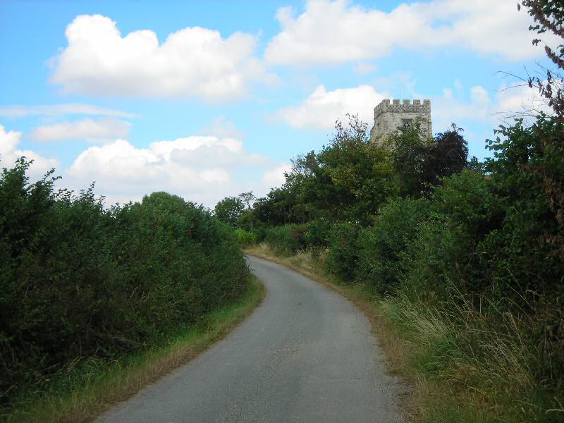
Fig. 18 Important views in, out and through the conservation area
Reproduced by permission of Ordnance Survey® on behalf of the Controller of Her Majesty's Staionery Office. ©Crown Copyright. Licence number LA10001962
(2) Character Analysis
6.11 The main focus of the conservation area is provided by the churchyard and vicarage grounds, which are characterised by their open and rural setting. However the western end of the High Street is also included which is of a more enclosed and intimate in character, and has been treated as a sub-area of the main conservation area.
Churchyard and Vicarage Grounds
6.12 The churchyard and vicarage grounds follow the historic layout as they appear in the 1788 map of Vicarage Lands at Canewdon (Fig. 3). The churchyard is dominated by the grey Ragstone church which is unusually large for a rural parish church and separates the more enclosed and varied south side of the churchyard from the extensive and open north side. The south side of the churchyard is overlooked by the red brick façade of The Vicarage, and views of the vicarage grounds fall away over the churchyard wall.
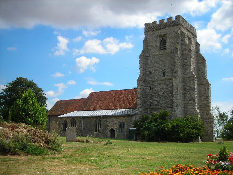
6.13 The large parish church provides the focus for the conservation area (Fig. 19). It is mainly constructed of Kentish Ragstone with some septaria and flint and limestone dressings. The building is about 38.5 metres in length, and 14 metres wide (excluding the south porch). The roof is mainly red plain tile, with lead over the north aisle. The dominant feature of the church is the early 15th century tower, which is an important local landmark clearly visible on the skyline, and provides an exceptional viewing point to the surrounding landscape. It is about 23 metres in height, and is constructed of ashlared Ragstone, and is heavily buttressed with crenellations with flint chequerwork. The tower was restored in 1998. Great difficulty was experienced in obtaining new Kentish Ragstone to match the original. New stone from the Nicholls quarries at Folkestone was used which although geologically similar to the original proved to be an unsatisfactory match. It is not now considered suitable for repairing historical Ragstone buildings. In view of the prominence of the tower, it is important that any future repairs use matching Ragstone. This can be obtained provided there is sufficient early planning and allowance is made for long delivery times. Although the building is generally in good condition, at the time of visiting the door to the west tower had been removed for repair following damage during an attempted break-in, and some windows were broken as a result of vandalism. Some windows are protected by grilles and more are to be installed in the future. Building work is underway to introduce new facilities into the church including toilets, with the intention that the building will be used for a wider range of community activities. The church is Grade II* listed.
Fig. 19 The north side of the church
6.14 The vicarage stands close to the churchyard boundary on the south east and is a fine brick building with an elegant façade that is clearly visible over the low boundary wall, providing architectural contrast with the church (Fig. 20). A memorial in the church records that the vicarage was built by George Walker M.A. in 1758. There have been extensive 19th century alterations since this date. It is constructed of warm red brick laid in Flemish bond with some burnt black headers, with a plain clay tile roof to the front range and vertical sliding sash windows. The off-centre 19th century crow stepped gable and gabled porch add interest to the elevation. Other elevational details include a brick string course running at first floor level across the east end and the gable and an eaves cornice. The Vicarage and its grounds are currently undergoing extensive sympathetic repairs and restoration. The grounds had become overgrown but are being tidied and a red brick garden wall which is a significant feature visible from the churchyard is being repaired. A new laurel hedge has been planted along the boundary with the churchyard, where perhaps a more mixed hedge of native species would have been more appropriate to the rural character of the area.
Fig. 20 The Vicarage viewed over the churchyard boundary wall
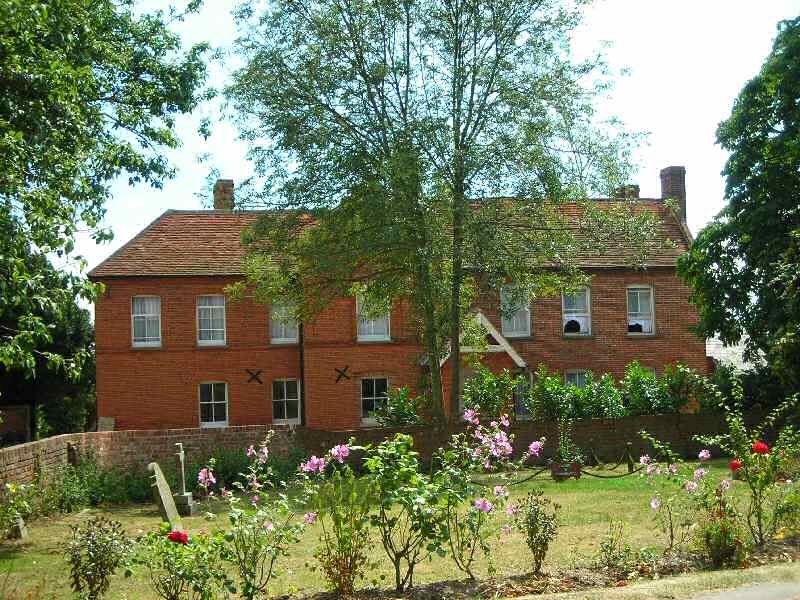
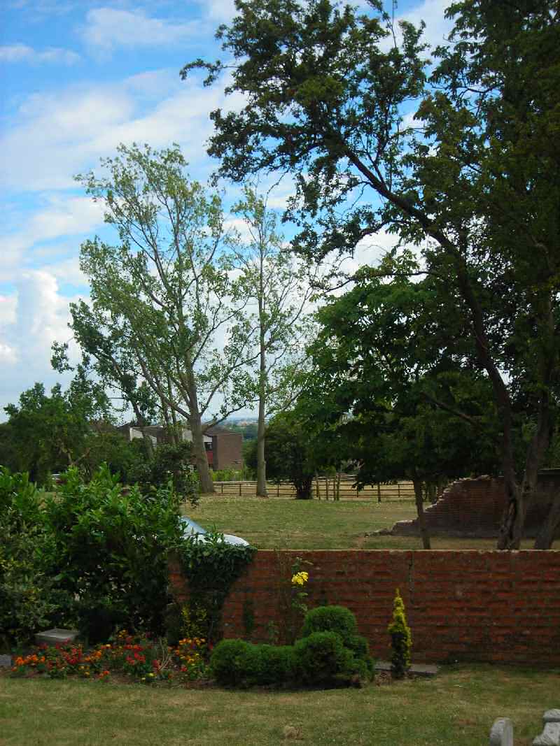
Fig. 21 The vicarage grounds
6.15 In the churchyard the low red brick boundary wall around the southern perimeter is an important feature. Although there have been recent repairs to the wall, much of it is in a very poor state of repair, collapsed in places, or exhibiting serious structural cracks. Cement pointing in some sections has resulted in decay of the soft brick and further deterioration. Hedgerow around the perimeter contributes to the rural character of the area, and allows frequent views out to take in broad vistas of the surrounding countryside. There is evidence that encroaching scrub has been cleared from the boundary recently, but there is still a degree of encroachment which if left unchecked will alter the form of the churchyard.
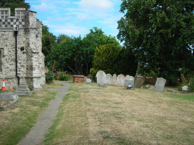
6.16 The churchyard south of the church is of different character to the north, and is more enclosed with much visual interest, texture and detail. It is overlooked by The Vicarage, emphasising the important historic relationship with the church. There are tombstones of varying design in an irregular arrangement, including upright headstones and flat body tombs. A small Garden of Remembrance is defined by a low rope barrier. The brick boundary wall adds colour and texture, with planting, shrubs and scrub around the boundary. A tarmac footpath passes round the south side of the church, past the attractive south porch with its flint chequerwork crenellations (Fig. 23). Another path, now grassed over but visible as a shallow ditch, leads from a blocked 14th century door in the south wall of the church to a small gate in the boundary wall heading towards The Vicarage, reinforcing the historic link between the two. There is one Grade II listed headstone adjacent to the path, dated 1691, next to which is a table tomb with a red brick plinth (Fig. 22). With the exception of the boundary wall which is in urgent need of repair, this part of the churchyard is generally well maintained, and there has been some recent clearance of scrub. A few gravestones however have become rather overgrown or have suffered collapse.
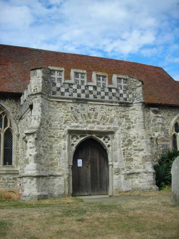
Fig. 22 Listed headstone adjacent to a tabletomb
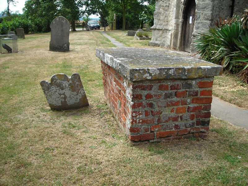
Fig. 23 The south porch
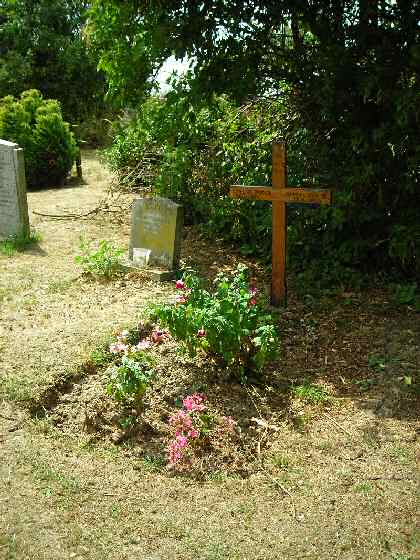
6.16 The north side of the churchyard is more open, with the majority of the graves clustered in the north-west corner, including the most recent. The churchyard is clearly in active use with well tended graves and colourful plantings of flowers. The graves are of varying design, and mostly arranged in neat rows. There are few grand monuments in the churchyard, but there is a fine Grade II listed table tomb west of the church tower dated 1795, with a moulded top slab, bulbous corner pilasters with moulded capitals and bases (Fig. 24). This tomb has undergone repairs in recent years following vandalism, and the iron railings around it have been reinstated. There are a high number of post-war wooden crosses, probably reflecting a past decline in economic prosperity. Some are now 40 years old or more, and they have become a characteristic feature of the churchyard (Fig. 25). Several memorial trees have been planted in the open area to the north of the church, adding visual interest particularly in the otherwise sparse open area. The buildings of Canewdon Hall Farm are visible through gaps in the hedge, and these do not unduly detract from the character and setting of the churchyard. To the north and north east the churchyard is generally of less visual interest, with fewer views out to the surrounding countryside and modern housing in close proximity. There is a heap of cleared scrub and flowers tidied from graves, together with a water trough and some containers evidently for use by families tending graves. This heap includes discarded plastic bottles, polystyrene and other rubbish, and is unsightly in the otherwise well maintained churchyard.
Fig. 24 Listed table tomb.
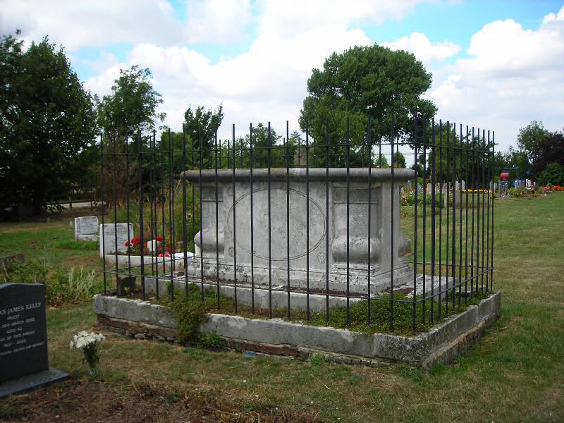
Fig. 25 Wooden cross
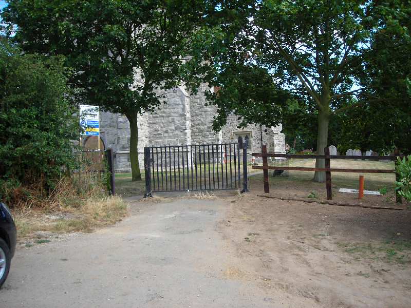
6.17 The west entrance of the churchyard has a metal gate with a wooden post and rail fence, and leads to a small parking area (Fig. 26). There is an iron side gate with a heart detail matching that at the east end which has been incorporated into the fence. At the time of visiting this presented a rather unattractive entrance to the churchyard, but as building work was underway at the time this is likely to improve. A new cess pit has recently been dug in the south west corner adjacent to the gate to provide toilet facilities in the church. The northern end of the lane leading to the church with rough grass edging and hedgerow on each side contributes to the attractive rural character and low level management of this lane is important to retaining this quality.
Fig. 26 The west gate
High Street
6.18 The High Street east of the churchyard is quiet and informal, contrasting with the rest of the High Street. This part of the street carries no through traffic, although it is used for car parking. The detached rural quality follows the historic settlement pattern, providing a degree of separation from the more developed stretch of the High Street. The enclosed, intimate scale of the street provides an experience in marked contrast to the grandeur of the church and the sweeping views from within the churchyard.
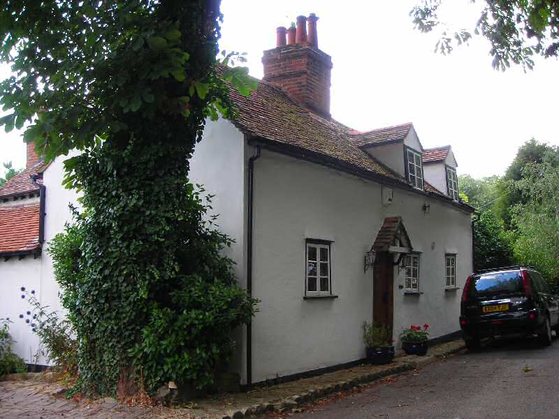
6.19 Vicarage Cottage stands on the street edge on the south side, and was built in 1799 on charitable property known as Poors Land to serve as the village school and schoolmaster's house3 (Fig. 27). It is a white rendered timber framed cottage with black and white painted joinery and a plain clay tile roof. It is one storey with two gabled dormers and19th century small paned casement windows. The off-centre door has a small clay tiled gabled hood. An early 20th century photograph of the cottage shows that it was once fully weatherboarded, a material that was historically more prevalent in the vernacular architecture of the village than it is now. The cottage is Grade II listed.
Fig. 27 Vicarage Cottage
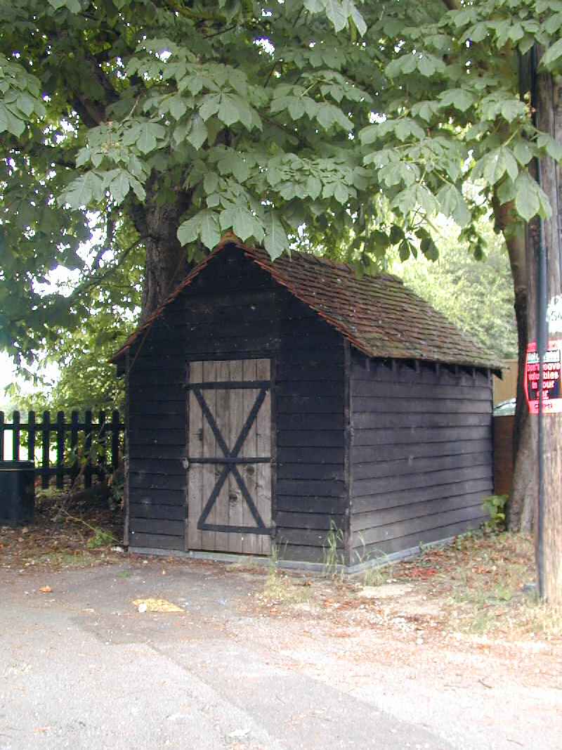
6.20 The village lock-up sits just outside the east gate of the churchyard, and is a curious shed-like building, timber framed with black weatherboard and a clay tiled roof, positioned gable-end to the road (Fig. 28). It has a vertically boarded door with two strap hinges and crossed metal straps. The door is sometimes left open to reveal the village stocks on the floor inside. The structure is in good condition, having undergone significant restoration in 1983. However until recently a board hung over the door identifying the building, along with a round plaque presented to the village for the 900th anniversary of the Domesday Book. Both these were recently stolen. This little structure is a good survival of a building type that has been lost from many villages, and is a fascinating nugget of social history4. The stocks and cage are Grade II listed.
Fig. 28 The village lock-up
6.21 The northern edge of the street opposite Vicarage Cottage is bordered by a row of mature horse chestnuts trees. A row of trees is shown here in the 3rd edition OS map of 1924 (Fig. 8). These trees are protected by TPOs but are outside the conservation area boundary, although they are essential to the green and rural character of this part of the High Street. They provide screening from modern housing that might otherwise detract from the undeveloped quality of this part of the street, and help to soften the negative effect of hard landscaping of front gardens that might otherwise intrude on the street scene.
Problems and pressures
6.22 Canewdon Churchyard has in recent years become the focus for anti-social behaviour which has resulted in some damage to the historic fabric and undermines attempts to make repairs and improvements. A recent attempted break-in at the church caused damage to the ancient west door, and church windows have been broken by stones. Gravestones have also been damaged. Rails from a new wooden fence that is being built by the west gate have been stolen. The sign and plaque over the door of the Grade II listed village lock-up have been forcibly removed. The threat of vandalism has necessitated the introduction of protective measures, including grilles over church windows and cages around the church floodlights (previously the floodlights were stolen). These essentially urban interventions undermine the tranquil rural character of the conservation area.
6.23 The churchyard boundary wall is in a serious state of disrepair, despite some repairs having been made. This has partly been caused by previous cementitious repairs, but structural problems have also resulted due to the instability of the ground, the site being located on slumping London clay, and from damage caused by encroaching scrub. Localised rebuilding and repairs are planned, including building a new gate pier by the vicarage gate leading to the now blocked south door, and some stitching in of brickwork with stainless steel ties. Sections of the wall have been lost, and a new laurel hedge has been planted within the vicarage grounds to provide a continuous boundary. The wall has undergone extensive repair and replacement of original fabric in the past, but it is an important historic boundary and a valuable feature of the churchyard.
3 More information on the charities of Canewdon can be found in Crowe (2002).
4 More information on village lock ups is available from the Village Lock-Up Association which is carrying out a national survey of surviving structures. Further information and contact details are available through the Historic Environment Information Resources Portal (Heirport) on the Archaeology Data Service website at http://ads.ahds.ac.uk.