Canewdon Church Conservation Area Appraisal and Management Plan
1. Introduction
1.1 Canewdon is a large parish, which extends for several miles along the southern side of the Crouch estuary. The area has important historical associations, with old entrenchments that once existed between the village and the river believed to mark the site of Canute's camp before his victorious battle over Edmund Ironside in 10161. The church lies at the western end of the village. Set high on a hill its massive tower is a conspicuous local landmark, and is widely thought to be the site of Canute's Minster.
1.2 There are two conservation areas in Canewdon village, one taking in most of the High Street, the other centred on the church. Canewdon Church conservation area (Fig. 1) comprises St Nicholas church and churchyard and The Vicarage and grounds, and covers the western end of the High Street where it meets the churchyard, taking in the village lock-up and stocks and Vicarage Cottage.
1.3 Conservation areas are 'Areas of Special Architectural or Historic Interest, the character or appearance of which it is desirable to preserve or enhance' (Planning (Listed Buildings and Conservation Areas) Act 1990). Government Planning Policy Guidance 15, Planning and the Historic Environment, emphasises that our experience of historic areas depends on more than the quality of individual buildings. Other significant elements might include the historic layout of property boundaries and thoroughfares, characteristic materials, street furniture and hard and soft surfaces or vistas along streets and between buildings.
1.4 Designation of a conservation area extends planning controls over certain types of development, including extensions, boundary treatments, the demolition of unlisted buildings and works to trees. However it does not prevent any change and the area may be subject to pressures (good and bad) that will affect its character and appearance. Although Canewdon is a relatively remote village, it still faces pressure for change including housing development, and in recent years the churchyard and its environs have become the focus of antisocial behaviour which threatens its special character.
1.5 Rochford District Council commissioned Essex County Council to prepare this conservation area appraisal and the research and fieldwork were carried out in July 2006.
1.6 The appraisal provides a brief development history of the current settlement, followed by a description and assessment of character. The contribution of different elements to the character is identified. Any issues which may affect the protection of character will be highlighted and opportunities for enhancement identified.
Fig. 1 Canewdon showing the two designated conservation areas and listed buildings (dotted)
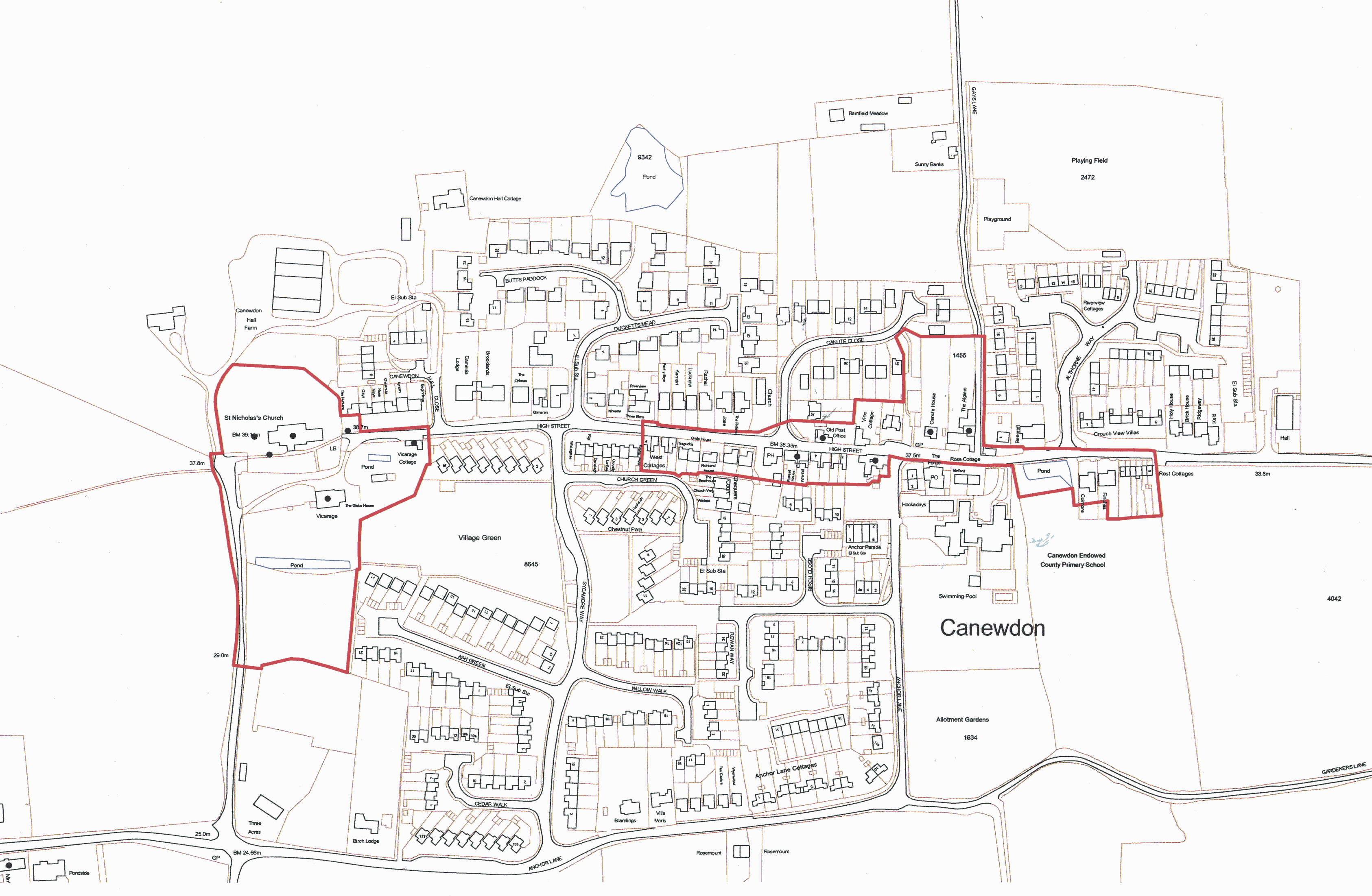
Reproduced by permission of Ordnance Survey® on behalf of the Controller of Her Majesty's Stationery Office. ©Crown copyright. Licence number LA100019602
1 The Victoria County History (Vol. 1 1903) records a large oblong enclosure to the north of the church at Canewdon, which is identified on early OS maps as the supposed site of Canute's Camp. No above ground evidence of this survives.