Great Wakering Conservation Area Appraisal & Management Plan
7 Character Appraisal
Spatial Analysis
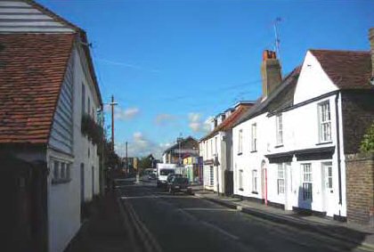
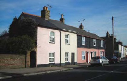
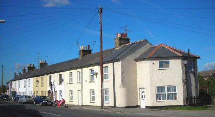
7.1 The conservation area is generally continuously built up along the High Street creating a sense of enclosure which is occasionally diminished by late 20th century development (Figs 7,8). The High Street comprises a mixture of shops, pubs, houses and community buildings which, with the exception of some more recent developments, mostly front directly onto the street. Occasional roads and narrow tracks, some unmade, head off to the north and south leading to further residential developments, with other openings in the building line leading to back areas and car parks. Until reaching the churchyard, few green spaces or trees provide relief from the built-up street and there are no opportunities to view out to the surrounding landscape. Despite Pevsner's observation that the street 'just avoids being absolutely straight'10, the gentle curves soften the streetscape, and are sufficient to create changing vistas with movement along the road. Rows and terraces hug the street edge creating serial vision in long views. The ancient church is a landmark building that terminates the view at the eastern end.
Fig. 6 High Street looking east, with over-dominant gables of late 20thcentury and 21st century development interrupting the grain of the street.
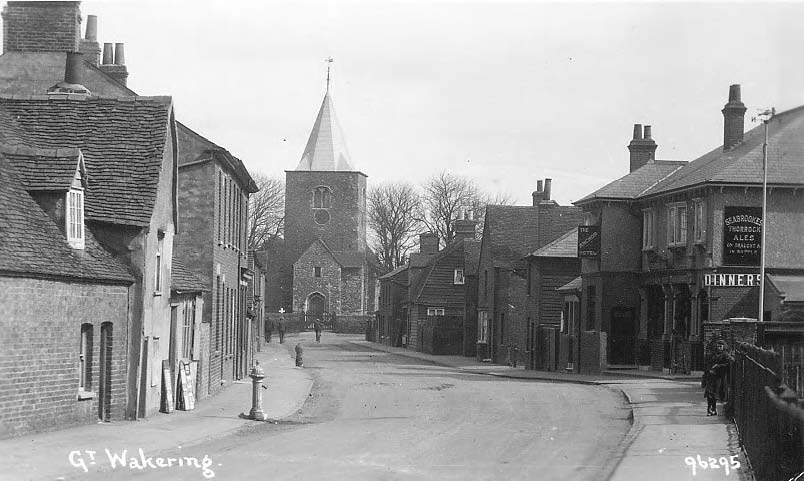
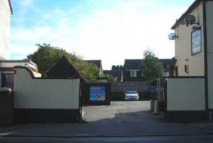
Fig. 7 East end of High Street from west.
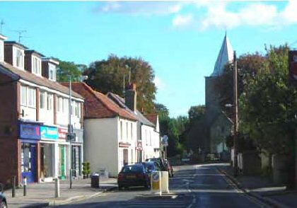
Fig. 8 East end of High Street from east.
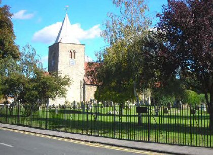
7.2 The enclosure of the High Street is in marked contrast to the view that opens up beyond the eastern end of the street, with the wide road junction in front of the church and large open churchyard (Fig. 9). New Road follows the edge of the churchyard south, the iron railings that define the boundary allowing the trees and greensward to contribute to the scene. An iron plaque on the railings indicates that the actual boundary to the churchyard now lies beneath the road. Properties opposite the churchyard are set back from the road edge sometimes with garden planting contributing greenery to the scene.
Fig. 9 Parish church of St Nicholas.
7.3 From within the churchyard looking out beyond its eastern boundary, the slightly elevated position provides the only opportunity to take in broad views of the flat arable landscape stretching away from the village, and is a reminder of what was once a remote rural location (Fig. 10).
Fig. 10 View east from the churchyard looking over neat hedges that separate the churchyard from the parish burial ground, with a further hedge boundary at the eastern edge bordering agricultural land.
7.4 Common Road curves away north from the church leading to modern housing, with mature trees framing the view (Fig. 11). The road edge is defined for part of its length on the left by the traditional yellow stock brick boundary wall of properties in The Cedars, with garden planting contributing greenery to the scene. With the exception of Cottawight the modern houses in Common Road are set back from the road with open grassed areas and hard standing to the front, and there is little sense of enclosure. A pond with hard and soft landscaping contributes to a more open character. The road curves away out of the conservation area to follow a historic route to the Common, continuing on towards Potton Island which once formed part of the dispersed parish lands of Great Wakering. In the 19th century, the road also provided access to brickfields.
Fig. 11 Looking into the Common Road.
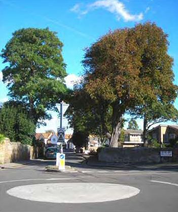
Fig. 12 Common Road.
7.5 New Road, built for military use in 1922, continues east from the churchyard towards Landwick and the security checkpoint for access to Foulness Island, following the route of an older track called Tinker's Lane that provided access to dispersed farmsteads and grazing marsh. The conservation area terminates at the churchyard boundary, and the road ahead is developed only along its southern edge with mostly late 19th and early 20th century semi-detached cottages. The north side remains undeveloped and is defined by a tall hedge that creates a rural quality to the street and contributes to the setting of the churchyard (Fig. 14).
Fig. 13 New Road.
Fig. 14 Shoebury Road.
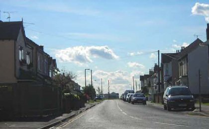
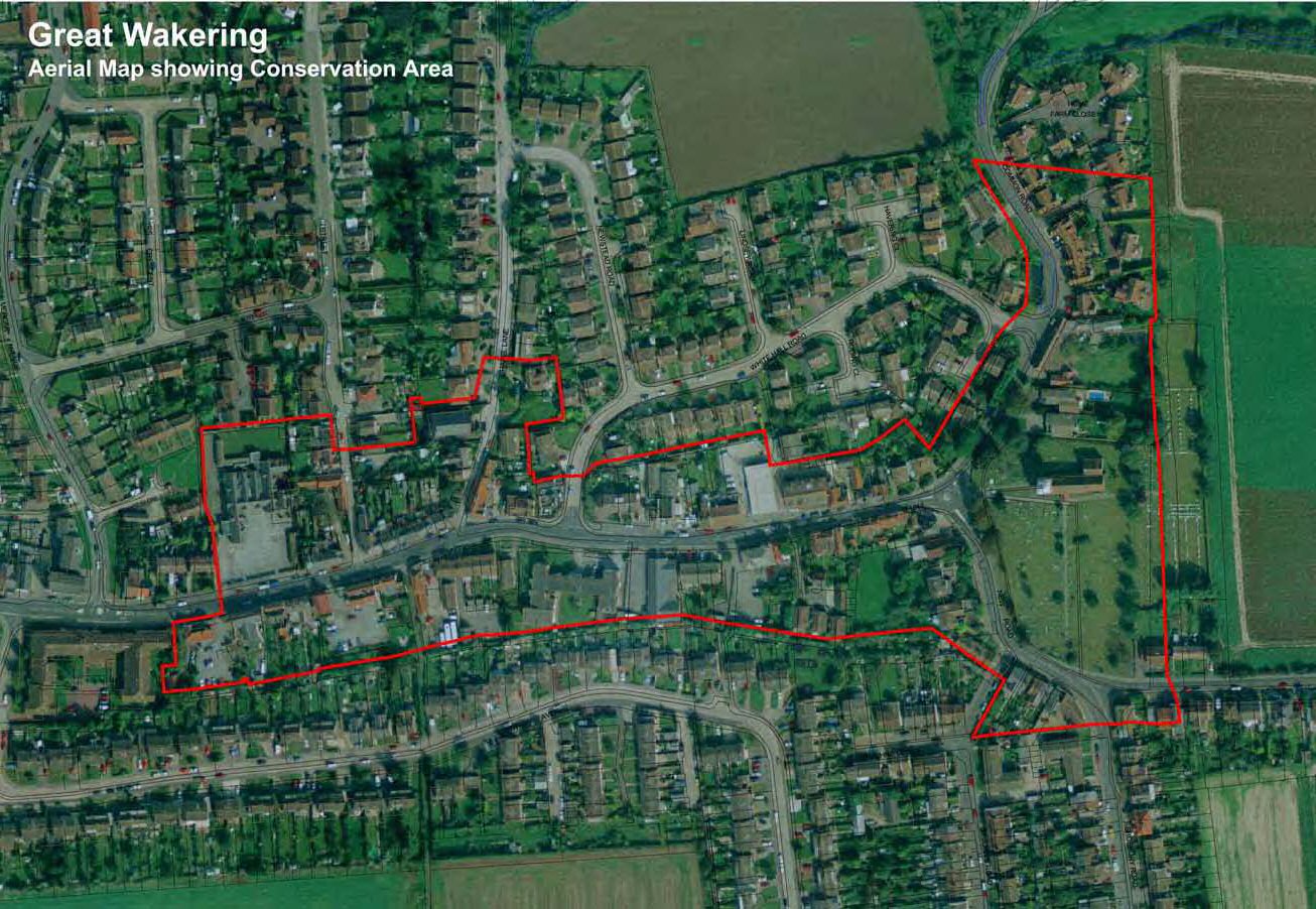
Fig. 15 Aerial photograph showing conservation area.
©UK Perspectives
Fig. 16 Townscape map of conservation area.

Reproduced by permission of Ordnance Survey® on behalf of the Controller of Her majesty's Stationery Office. ©Crown Copyright. Licence number LA100019602
Character Analysis
7.6 Great Wakering has evolved over many centuries whilst retaining possible elements of an ancient planned settlement in its layout. The 12th century parish church of St Nicholas at the eastern end of the conservation area marks the site of an earlier minster church which provided the focus for early settlement that developed along the north and south sides of the High Street. Evidence of this Saxon or medieval planned settlement can still be seen in settlement edges and boundaries of the present village with some narrow plots surviving in the High Street, although there is now a good deal of variety in the horizontal scale and plot sizes of properties. The historic boundaries are a precious element in the special historic character of the area and should be protected11.
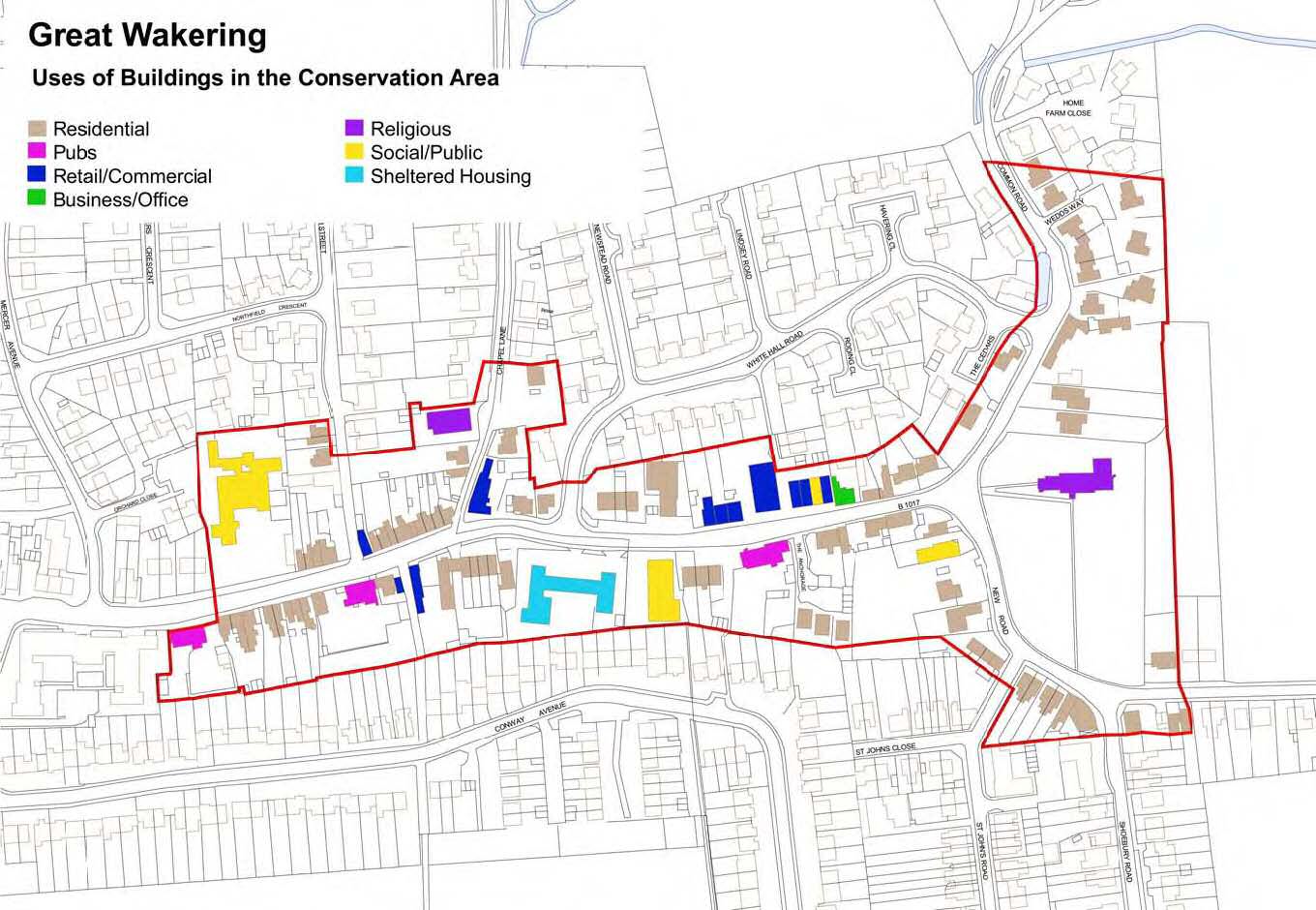
7.7 Today, the linear development along the High Street is a rich mix of properties of different periods, exhibiting a variety of uses as would be expected of a modern High Street (Fig. 18)
7.8 The High Street is characterised by two storey commercial and domestic buildings, with a vertical rhythm emphasised by vertically proportioned windows. There is a lively and varied roofscape with an irregular eaves line, the roofs enlivened by brick chimneystacks but with only occasional dormers. Roofs are generally pitched or gambrel, sometimes with gables facing the street, and rows and terraces are a common form. Properties are generally closely built up to the street edge, with an irregular building line which is frequently broken by roads and tracks leading off, with back-access arches and other openings to back areas. The curve of the road affords changing views of varied facades and side elevations, the broken and irregular building line creating shadow lines.
7.9 The conservation area also takes in short stretches of roads to the north and south of the church which are more suburban and residential in character than the commercial High Street. Within the conservation area boundary New Road and Shoebury Road are characterised mainly by a variety of two storey semidetached and detached houses of the late 19th and 20th centuries, along with a couple of terraces that echo the common building form of the High Street. In Common Road, properties are mainly late 20th century detached and semi detached houses, including a development of the late 1980s occupying the site of the former Home Farm. This development comprises large traditionally-styled detached and semi-detached properties built in an Essex Design Guide style, with gables to the front and set back from the footway with hard standing and front lawns.
Fig. 17 Uses of buildings in the conservation area.
Reproduced by permission of Ordnance Survey® on behalf of the Controller of Her majesty's Stationery Office. ©Crown Copyright. Licence number LA100019602
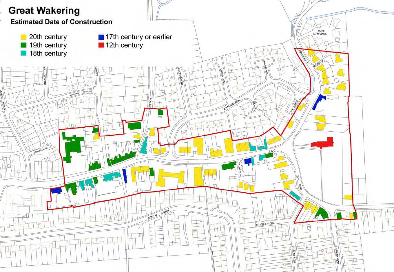
Fig. 18 Estimated date of construction of buildings in the conservation area.
Reproduced by permission of Ordnance Survey® on behalf of the Controller of Her majesty's Stationery Office. ©Crown Copyright. Licence number LA100019602
Materials and detailing
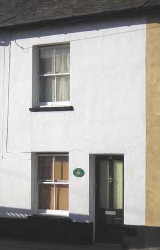
7.10 The variety of architectural styles exhibited in the conservation area is given a degree of cohesion by the use of a range of traditional materials. These have been used to varying degrees of success in more recent developments. The architecture is generally modest and restrained, with little decorative embellishment. The oldest buildings in the conservation area are typically timber framed and smooth rendered or pebbledashed. Later properties are also often rendered, and some more recent residential developments have incorporated either fully or partially rendered facades in keeping with this architectural tradition. Featheredge weatherboard is also traditional, and may be painted white or black, or tarred, and is sometimes seen on side returns only. Again this traditional material has been used on some more recent developments, and historically would have been more prevalent in the streetscape than is seen now, as can be seen in early photographs of the village. On some buildings it has survived beneath pebbledash render.
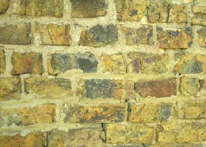
7.11 Yellow stock brick was commonly used from the 19th century onwards. This was a cheap building material, but the inclusion of ash and other waste products in the fabric creates an attractive vari-coloured appearance (Fig. 19). Occasionally local soft red brick is also seen. Brick was used to reface older timber framed buildings. Brick walls are often rendered or painted, and finished in a light colour. In the past exposed brick would have been more evident in the built environment. Chimney stacks are generally left unrendered. Brick is sometimes used decoratively on Victorian gothic buildings such as the old school and the polychrome United Reformed chapel. Recent developments have introduced a wide variety of modern brick into the streetscape. These bricks lack the character and texture of the historic materials.
Fig. 19 Yellow Bricks.
7.12 Traditional roofing materials are plain clay handmade tiles, making an important contribution to the textural character of the roofscape, with natural slate used on later properties with slacker pitch roofs. Clay pantiles are also traditional.
7.13 Traditional fenestration consists of vertically-proportioned small paned sash windows, with simpler glazing bar patterns in later sash windows. Glazing bars are generally fine, and windows are often recessed, as are doors, creating shadow lines on façades. In brick façades windows have slightly cambered or flat arches, sometimes with keystones on later buildings, rendered or painted over. Some timber framed properties have simple architraves around the windows. A variety of traditional doors are seen in the conservation area, including boarded, panelled and painted part-glazed. Simple flat hoods on brackets are a common treatment of entrances.
Fig. 20 Weatherboard and simple architraves, No. 67 High Street.
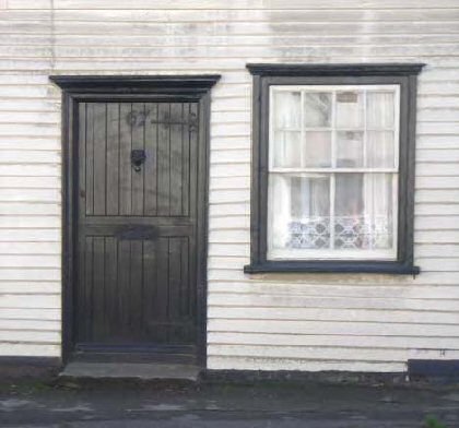
Fig. 21 Recessed doorway, no. 6 High Street, within a Victorian brick arch.
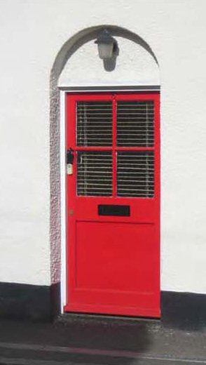
Fig. 22 Simple Victorian terrace façade, no. 76 High Street.
7.14 The majority of the older buildings front directly onto the street, but traditional boundary treatments where they exist are characteristically brick walls of stock brick capped by soldier bricks (Fig. 23 Stock brick boundary wall, 2a High Street.
Fig. 23 Stock brick boundary wall, 2a High Street.
7.15 Evidence of former commercial use is common in the traditional architecture in the village. This might include timber shop window fascia boards, pilasters, bay windows and carriage arches leading through to back areas (Figs. 24,25).
Fig. 24 Former shop window, no. 73 High Street.
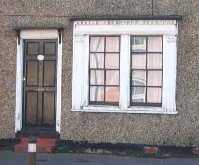
Fig. 25 Carriage arch, Prospect Cottages.
Individual contribution to character
High Street, south side, west to east
7.16 The conservation area boundary encompasses the Grade II listed White Hart public house and rear plot at its western edge (Fig.26). This was originally a medieval hall house with a cross-wing to the right, but with various alterations and additions including a later cross-wing to the left. It is timber-framed and rendered with applied false framing on the first floor. The otherwise attractive building is spoilt by the number of extraneous items on its surfaces including satellite dishes, lighting, and advertising. The view through to the car park, which incorporates a historic weatherboarded outbuilding, would benefit from improved landscaping (Fig.27).
Fig. 26 The White Hart pub.
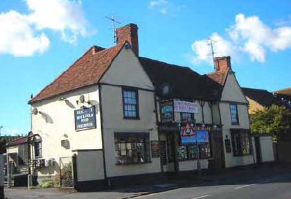
Fig. 27 View through to the car park.
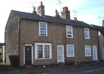
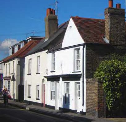
7.17 East of the White Hart attractive rows of cottages, some listed, are typical of the modest historic houses and former shops of the street and reinforce its particular character. Nos 83, 85 and 87 form a Victorian property formerly a shop that has been converted in the last five years for residential use (Fig. 28). This has been carried out fairly sympathetically but lacking some attention to detail. The retention of the carriage arch is a valuable reminder of the former commercial use, and a console bracket from the shop front has also survived. Nos. 79 and 81 are a Grade II listed pair of cottages dating from around 1700 with a 19th century rear range (Fig. 29). They are timber framed and pebbledashed with rendered side returns and rusticated quoins over weatherboarding. The doors have simple surrounds and pentice boards on brackets that are typical of the area, with a traditional vertically boarded door on no. 81. Nos 73, 75 and 77 High Street are another attractive row of 18th or 19th century cottages, pebbledashed with weatherboarded side returns (Fig. 30). No. 73 retains a historic shop window with side pilasters, fascia and dentilled cornice, as well as a traditional six panelled door. These Grade II listed cottages have suffered some unauthorised alteration since the list description was prepared in 1983, including replacement of a six-panelled door in the centre and replacement windows to the right.
Fig. 28 Nos 83, 85,High Street.
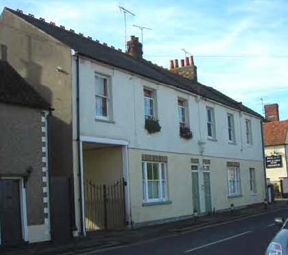
Fig. 29 Nos 79 and 81 High Street.
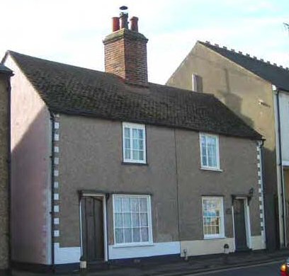
Fig.30 Nos 73, 75 and 77 High Street.
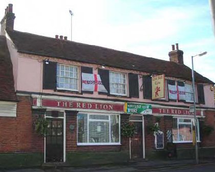
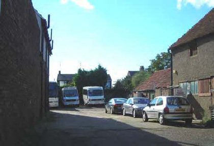
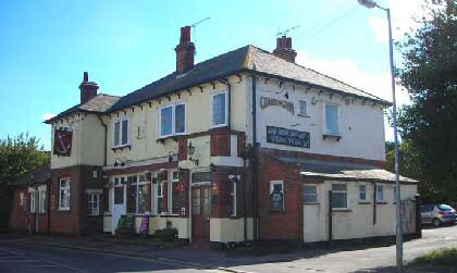
7.18 No 71 High Street is a barn conversion, formerly the Red Lion Barn, with a mono-pitch front extension to the street that was formerly a lean-to workshop (Fig. 31). Although the building incorporates vernacular elements such as weatherboard but has an awkward residential character, and some of the detailing is poor such as overly chunky glazing bars on windows. This building borders directly onto the car park of the Red Lion pub (Fig. 32). This pub is timber framed with a double range pitched roof, rendered to the first floor with small paned eight over eight sashes and a dentilled eaves course. The ground floor has a late Victorian appearance with red brick and green glazed bricks below, but unsympathetic replacement false leaded windows and a 20th century replacement door which detract from the appearance of the building. The car park, although it has an attractive green boundary contributed by the gardens of properties to the rear, requires resurfacing and landscaping and currently presents an untidy view from the High Street. The pub was formerly on the Rochford District Council Local List of Buildings of Architectural, Historic and Townscape Importance, but the practice of local listing has been discontinued.
Fig. 31 No. 71 High Street, formerly Red Lion Bar.
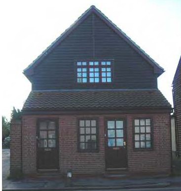
Fig. 32 The Red Lion pub.
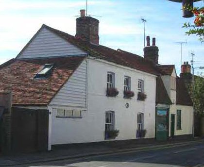
7.19 Nos. 63, 65 and 67 High Street are a row of 18th or 19th century cottages that make an attractive vernacular contribution to the streetscape (Fig. 33). These cottages are timber framed and weatherboarded, with the exception of the ground floor of no. 67 which is partially of red brick and now forms part of the adjacent Red Lion pub. No. 65 has a bay shop window with a moulded surround, a reminder of its former commercial use. The cottages retain two traditional boarded doors. They have clay tiled gambrel roofs, with three small segmental head dormers. Their weatherboarded left side elevations contribute to the street scene, made visible by the adjacent gap in the building line where a footpath passes through. No. 63 is now used a bakery. The cottages are Grade II listed.
Fig. 33 Nos 63, 65 and 67 High Street.
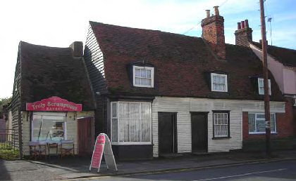
Fig. 34 Footpath between 61 and 63 High Street.
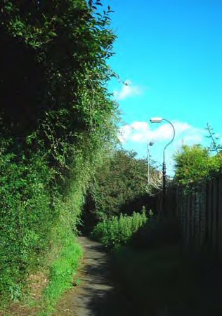
7.20 A green edged public footpath leading off the High Street at this point follows an old, possibly medieval boundary, and passes between attractive vernacular buildings creating a pleasing rural character to the street scene at this point (Fig. 34). The track, known as Lion Fields, provided access to historic settlements at Crouchmans, and an old street light has survived indicative of a time in recent history when this was a more significant route. Utilitarian railings at the entrance are not sympathetic to the historic context.
7.21 Beyond the footpath is one of the most characterful of buildings on the High Street, no. 61, a butcher's shop and store which remains in use today (Fig. 35). It is of early 17th century and 19th century construction. The long timber framed rear range is pebbledashed, probably over weatherboarding, with wooden mullioned windows, and is a significant feature in the streetscape visible from the adjoining yard and from the footpath running along the side. The front range comprises the single storey butcher's shop which is weatherboarded, and has a clay tiled canopy supported on wrought iron brackets with meat hooks. The shop is Grade II listed.
Fig. 35 No. 61 High Street.
7.22 The yard adjacent to the butcher's shop creates an untidy and unattractive setting to the listed building, and an unappealing view from the street (Fig. 36). Whilst over-management of this space would not be a fitting for the setting of this humble utilitarian building, some improvement such as resurfacing and modest landscaping is desirable.
Fig. 36 The yard adjacent to 61 High St.
7.23 The stretch of High Street between 57 High Street and the Anchor pub retains little historic integrity, consisting of late 20th century and 21st century development representing infill and replacement of historic properties. These developments do not always reinforce local character.
7.24 Southgate Mews at 47-57 High Street is a 1980s two storey development with a vertical rhythm and an irregular building line (Fig. 37). Parking is hidden through a carriage arch. The slack roof pitch, poor use of materials, and lack of local detailing mean that they sit uncomfortably in the street scene, and they have a sombre quality which is out of step with the lightness of many of the more traditional cottages. Adjacent to this a new detached house is in the process of construction incorporating the mission hall (and former site of the chapel of the Peculiar People) to the rear. This is of a more sympathetic design, if rather large and lacking some attention to local detail (Fig. 38).
Fig. 37 Southgate Mews.
Fig. 38 New property adjacent 47 High St.
7.25 Beyond this Goodmans is a late 20th century development now used as sheltered housing with bold mono-pitched ranges (Fig. 39). The appearance is softened by front gardens and planting, but the development breaks the historic grain of the settlement, undermining the sense of enclosure. The large picture windows and rendered panels create lightness of character, and although this development makes little concession to local context it is honest architecture of its time. East of Goodmans is the Memorial Hall, 1992, a neat and unobtrusive single storey hall that would benefit from some planting to soften the setting. Beyond these nos 25, 27 and 29 are a row of late 20th century houses set back from the street edge, of appropriate general form, but with poor materials including plastic windows, inappropriate detailing such as classical style pedimented door cases, and front hardstanding for cars.
Fig. 39 Goodmans.
7.26 The Anchor is one of the four pubs in the High Street, and is an attractively detailed brick and rendered building with a turn-of-the-century appearance, with leaded windows and first floor oriels (Fig. 40). The pub certainly pre-dates this however, and is recorded as a timber framed and clay tiled building in 182312. Like the other pubs mentioned, the car park and its entrance could be improved to provide a more attractive view from the High Street. The Anchor was formerly on the District's Local List.
Fig.40 The Anchor pub.
7.27 East of the Anchor is an attractively presented private road, The Anchorage, leading to a late 20th century backland development of three residential chaletstyle properties (Fig. 41). Although these properties do not respect the historic grain and character of the settlement, the well treated access with garden planting and a stock brick boundary wall do not detract from the street scene.
Fig. 41 The Anchorage.
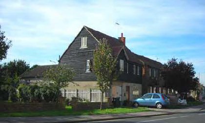
7.28 At the east end of the High Street, older shops and houses together create an attractive approach to the church. No.17 is Grade II listed and was originally a medieval house possibly of 16th century date but almost completely rebuilt in the 19th century (Fig. 42). It is timber framed with a restored jettied cross wing creating a characteristic medieval form, faced in brick which is now rendered over. Gardens to the right side bounded by a stock brick wall contribute greenery to the street scene. The adjoining no.9 is a tiny cottage, gable to the street, with exposed timbers to the first floor and small paned sash windows. No.7 is a Grade II listed timber framed house and shop of 18th century date with later alterations and additions. This is a distinctive building in the streetscape, with a bulky gambrel roof and a tall central gabled dormer, with a single storey 19th century lean-to shop extension (Fig. 43). The shop extension incorporates a butcher's shop window, making an important contribution to the historic commercial character of the conservation area. No. 3, Laurel Cottage, perhaps 19th century in date, has a white painted brick exterior and recessed sash windows, with a partially weatherboarded side extension and side elevation (Fig. 44). Nos 3 and 9 were both previously on the Rochford District Local List.
Fig. 42 Anchor Cottage, 17 High Street.
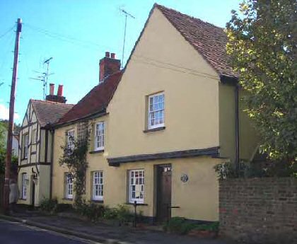
Fig. 43 No.7 High Street.
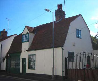
Fig. 44 Laurel Cottage, 3 High Street.
7.29 Opposite the church, 1 High Street occupies an important position on the road junction, and was also formerly on the Local List (Fig. 45). This pebbledashed early 20th century detached villa currently has a poor appearance which detracts from the street scene. The property has patchy pebbledash render and poor replacement plastic windows, and an untidyhard landscaped frontage opening onto the footway in New Road, although a brick wall provides a boundary to the High Street side. Improvements to the appearance of the building and plot could make a significant contribution to the enhancement of the conservation area at this prominent point.
Fig. 45 No.1 High Street, New Road elevation.
High Street, north side, west to east, North Street, Chapel Lane
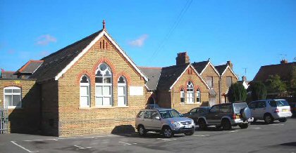
7.30 At its west boundary, the conservation is marked by the old school, built in a Victorian gothic style in 1876, and now a well used community centre (Fig. 46). The building is generally in good condition, retaining its original boundary wall to the street of yellow stock brick with red brick string courses. However part of the building is now disused and boarded up. The school was formerly on the Local List.
Fig. 46 Community Centre, former school.
7.31 Nos 84 to 92 High Street are an attractive row of slate roofed cottages, possibly 19th century in date (Fig. 47). Nos 90 and 92 are rendered, whilst nos 84, 86 and 88 are rendered to the ground floor and weatherboard above, with white painted weatherboard to the side elevation. The latter three have been fairly sympathetically restored, with simple flat hoods on brackets over traditional panelled doors and small pentice boards over the ground floor windows. No. 84 has been converted to residential use from a shop in recent years. The row suffers from replacement windows that do not respect the traditional glazing pattern. To the right, rear access to a large rear plot is provided along an unmade driveway set back from the footway by a grass verge, and there is a traditional stock brick boundary wall along the North Street edge.
Fig. 47 Nos 84-92 High Street.
7.32 North Street is an un-made Victorian road following an older track north (Fig. 48). A pair of red-brick semi-detached houses have recently been built to the rear of no. 84 High Street on a large back plot that formerly accommodated workshop buildings. The double gabled front elevation is uncharacteristic of the area and the dark framing to the windows is inappropriate. Opposite is a pair of new semidetached brick cottages of a more suitable design. Beyond No. 1 North Street is a pair of much-altered late 19th century semi-detached cottages that were one of the first developments when the new road was laid out (Fig. 49). They are now suffering from replacement windows that detract from their appearance. Beyond these an old street lamp adds historic character to the streetscape.
Fig. 48 North Street.
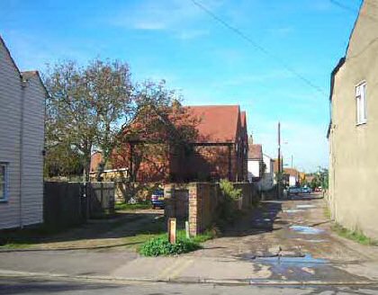
Fig. 49 Nos 3, 5 North Street.
7.33 Nos 66-82 High Street are a continuous row of late Victorian painted or rendered brick cottages and shops. They are a prominent feature of the High Street and an important element in its special character, built up to the pavement edge between North Street and Chapel Lane (Figs. 50,51). Incorporating Prospect Cottages of 1878, this row was formerly on the Local List. These cottages have been greatly abused by unsympathetic alteration, particularly replacement plastic windows and doors. The shop at No. 82 appears to be unused at present.
Fig. 50 Nos 66-82 High Street.
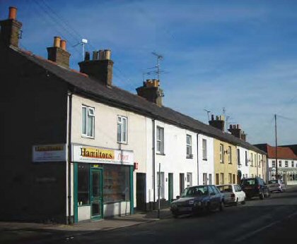
Fig. 51 Nos 66-82 High Street.
7.34 Chapel Lane is another narrow un-made road, following an old route north (Fig. 52). The conservation area encompasses an attractive Edwardian detached villa adjacent to a late 19th century detached cottage. Homeleigh retains many original features and is well presented (Fig. 53).
Fig. 52 Chapel Lane.
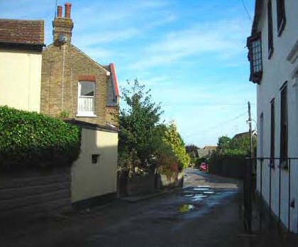
Fig. 53 Homeleigh.
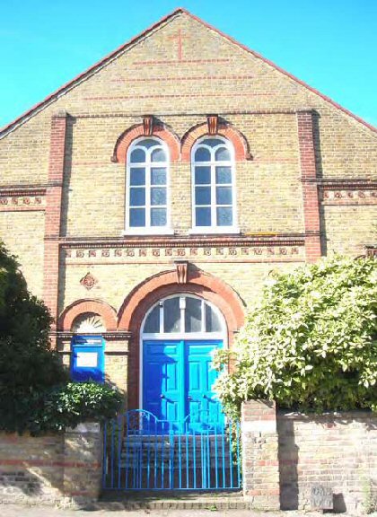
7.35 Beyond Homeleigh, creating an attractive pairing with it, is the United Reform Church. This is a handsome Victorian building, constructed in 1889, prior to which a Congregational Chapel existed from around 180013 (Fig. 54). Opposite this is The Manse, a much altered large detached stock brick building of uncertain date but possibly 19th century, its name a reference to former use as accommodation for the chapel minister. This property is distinctive in the conservation area for having retained a large historic plot with grounds. Adjacent to it is a late 20th century pitched roofed detached house, Pennyrile, set back from the street on a slightly elevatedplot. It is constructed of modern materials but does not overly intrude on the streetscape.
Fig. 54 United Reform Church.
7.36 Occupying an important corner site, 62 High Street and the adjoining property known as Roundabout are Grade II listed and dominate the junction between the High Street and Chapel Lane, given prominence in the streetscape by the curve of the road (Fig. 55). The main building is early 18th century or possibly earlier with later alterations and additions, and is timber framed and rendered, with a clay tiled double range roof. The High Street elevation has a traditionallystyled 20th century ground floor shop front with round headed windows, added around 1983, but with a plastic fascia. The Chapel Lane elevation contrasts with the High Street appearance and is more residential in character, with moulded eaves cornice, black painted joinery and a 19th century door case with a moulded canopy and fluted surround (Fig. 56). There is a sympathetically restored rear weatherboarded range with catslide dormers. Roundabout is a heavily restored mono-pitched structure to the right of no. 62, with a door to the side. The current appearance with weatherboard cladding dates primarily from restoration work carried out around 1986.
Fig. 55 No. 62 High Street and Roundabout.
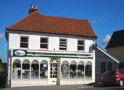
Fig. 56 Chapel Lane elevation.
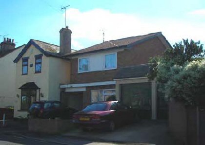
7.37 East of this the High Street is again dominated by late 20th and 21st century development of varying quality representing infill and replacement. No. 60 is a substantial detached property constructed in the 1980s in a traditional style with two cross-wing ranges with gables to the street. It is rather large in scale and lacks attention to local details (for example with horizontally proportioned windows), but makes good varied use of materials (Fig. 57). Occupying an important position on the corner of Whitehall Road a new detached property is under construction. This property makes a rather catholic use of traditional materials and details, but its gabled front elevation creates an attractive shadowed building line with those of its neighbour along the curve of the street, and the whimsical dragon-hugged chimney pot is a nice detail (Fig. 58). It is however a large property for the size of the plot, and the close boarded boundary fence only draws attention to this. A low boundary wall or more open treatment would be more attractive and appropriate to the conservation area, and give the building more breathing space. Beyond the junction with Whitehall Road nos 36-42 High Street are a row of late 20th century houses. These are a modern interpretation of the traditional building form, constructed of modern materials with a varied brick and render front elevation, but with plastic windows of strong horizontal emphasis.
Fig. 57 No. 60 High Street.
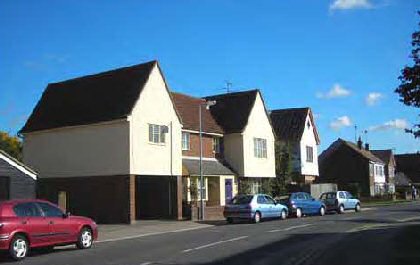
Fig. 58 New property adjacent 60 High Street.
7.38 Adjacent to the public conveniences, the old fire station is a striking and memorable building in the streetscape, partly due to its distinctive art deco geometric architecture and bold brickwork, but also for its unorthodox decorative windows, albeit with very poor frames (Fig. 59). Formerly used as a boat building works and now in residential use, the building has red doors and other elevational details that are a reminder of its original use. However the building is badly let down by its poor plot. Whilst an overly residential treatment would not be suitable for the setting of this building, the poor surface finishing, clutter and unattractive modern garage make a negative contribution to the street scene.
7.39 Nos 28 to 32 are a row of Edwardian stock brick shops, one marked 'Coronation Villa, 1902' (Fig. 60). No. 28 has a traditional form of shop front with a recessed doorway and old detailing, including canopy brackets and moulded monogrammed panels, now painted over, on the stall risers. It has traditional small paned sash windows to the first floor, with fine glazing bars, but otherwise the row suffers from unsympathetic replacement windows and doors, including poor shop windows.
Fig. 59 The Old Fire Station.
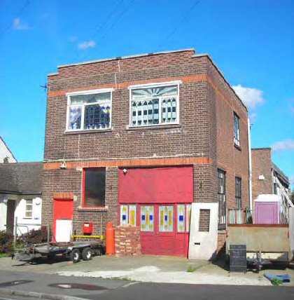
Fig. 60 Nos 28-32 High Street.
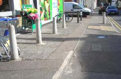
7.40 The Co-op supermarket at 22-26 High Street is a particularly unsympathetic design for the conservation area. Its low rectangular form has overwhelming horizontal emphasis that is completely at odds with the historic grain of the settlement, and a garish plastic fascia and window advertisements (Fig. 61). The forecourt area is also poor, with badly maintained patchy surfacing and concrete bollards (Fig. 62). Back access at either side creates unattractive views from the street, with high metal security gates to the car park and CCTV cameras creating a harsh character.
Fig. 61 Nos 22-26 High Street.
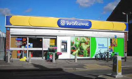
Fig. 62 Forecourt, 22-26 High Street.
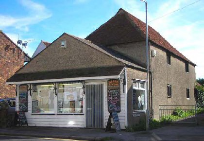
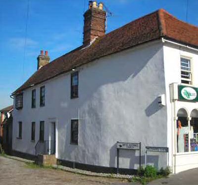
7.41 Nos 14-20 are a row of late 20th century shops and the village library, with flats above, constructed of modern materials and of two storeys but with large flat roofed dormers. The shop fronts here are modern in appearance, and could have been more sympathetically designed for the conservation area drawing on the District Council's design guidance (LPSPD6). Beyond these more traditional vernacular shops and cottages contribute to a pleasing approach to the church. Nos 10-12 are offices and residential (Fig. 63). The main building is timber framed and rendered with a plain clay tile hipped roof and deeply recessed vertical sliding sash windows. It retains a former shop front including the wooden fascia, and has some nice detailing such as corner pilasters, as well as a dentilled eaves course and lining out on the side elevation. The view through to the rear yard reveals converted outbuildings that are generally sympathetic to the setting. Nos 4-6 are rough rendered painted cottages with traditional doors recessed in round headed arches and recessed windows. No. 4 has recently been sympathetically converted from a shop, retaining wooden fascias, pilasters and tethering rings (Fig. 64). Nos 2 and 2a are late 20th century detached properties, set well back behind traditional stock brick boundary walls, with garden planting contributing to an attractive setting. Nos 2-12 were formerly on the Local List.
Fig .63 Nos 10-12 High Street.
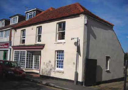
Fig. 64 Nos 4-8 High Street.
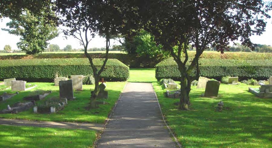
The parish church and churchyard
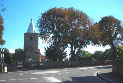
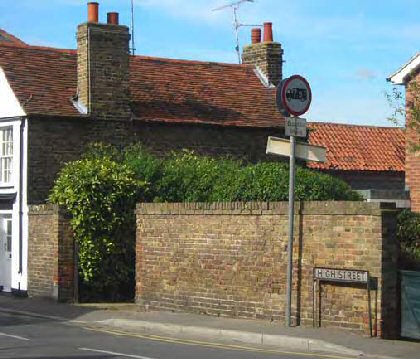
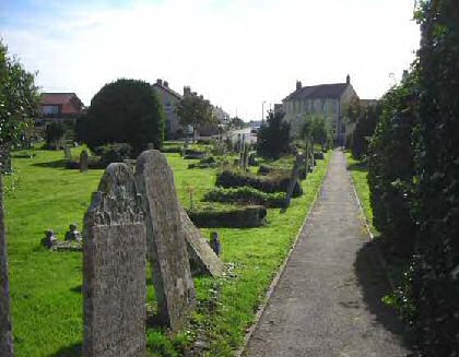
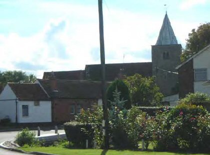
7.42 The 12th century parish church of St Nicholas is a landmark building that dominates the streetscape at the east end of the High Street, given prominence by the slightly elevated position (Fig. 65). It is constructed of roughly coursed ragstone flint and septaria rubble with limestone dressings and plain clay tiled roofs. The west tower has an octagonal weatherboarded spire, and possibly incorporates 'long and short work' at its corners suggesting earlier Saxon origins. The church is Grade II* listed, and there are four Grade II listed headstones in the churchyard. The churchyard is closed and is well maintained by the parish council, with well spaced mature trees, some protected by TPOs, along its boundary and scattered trees and shrubs within the space (Fig. 66). The parish burial ground lies behind the churchyard and comprises well kept lawn with neat avenues of graves. Low, tidy hedges form the eastern boundary allowing views out. The low north western boundary wall is constructed of rubble stone, soft red brick and yellow stock brick, and now incorporates a brick built bus shelter (spoilt by graffiti). The southern boundary is formed of iron railings. The churchyard contributes valuable green space and trees to the conservation area.
Fig. 65 Parish church.
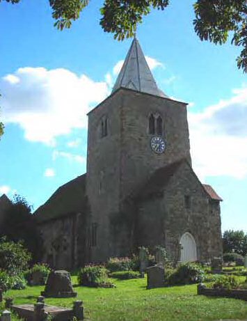
Fig. 66 Churchyard looking into Shoebury Road.
Common Road
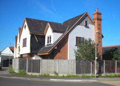
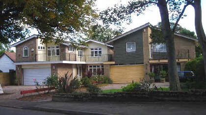
7.43 To the north of the church are two distinctive late 20th century properties, Banjo Lodge and Chestnut Lodge (Fig. 67). These are large detached properties constructed of modern materials and set well back from the road with mature trees to the front, including a horse chestnut protected by a TPO. Although they are attractive modern dwellings, their scale and uncompromising modern design makes no concession to their historic setting between two listed buildings, the church and Cottawight.
Fig. 67 Chestnut Lodge and Banjo Lodge.
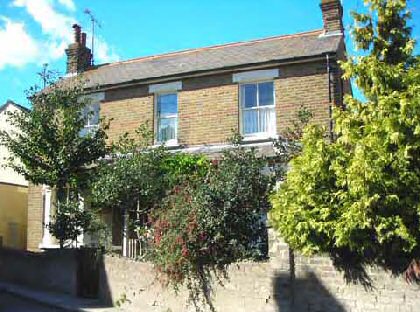
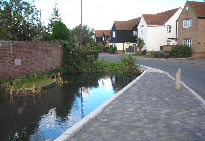
7.44 Beyond Chestnut Lodge is Cottawight, a Grade II listed single storey house which is of 17th century date with later additions. It may originally have been associated with Home Farm (once known as Rectory Farm) which lay to the north. It is L shaped in plan, and is part timber framed and plastered or weatherboarded, and partly of soft red brick. A walnut tree in the grounds is protected by a TPO. Cottawight contributes to a distinctly rural and picturesque scene looking towards the church across the pond (Fig. 68).
Fig. 68 Cottawight, church and pond in foreground.
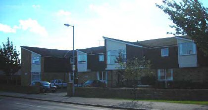
7.45 On the west side of Common Road a late 20th century residential development in The Cedars comprises two storey brick and render properties discretely set in gardens behind a traditional brick boundary wall, with garden greenery contributing to the scene including some trees protected by TPOs. Beyond Cottawight the conservation area consists entirely of late 20th century residential development, built on the site of Home Farm which was demolished in the late 1980s. The old farm duck pond has survived here, although it now features elaborate hard and soft landscaping to fit with the modern development around it (Fig. 69)). Although the properties here are attractively designed in a traditional Essex Design Guide style, there is little opportunity for further preservation or enhancement of local character.
Fig. 69 Duck pond, Common Road.
New Road
7.46 Heading south New Road is dominated by the churchyard where the iron railings allow the green space to contribute directly to the streetscape (Fig. 71). On the west side of the road, no. 1 High Street has already been mentioned as having a poor appearance, and between this and the row of cottages at 4-8 New Road there is 20th century infill consisting of the church hall and two large detached properties. The church hall has a rather unattractive plot that would benefit from some soft landscaping, but behind it is a large green plot preserving historic boundaries which has remarkably survived infill development (Fig. 70). Nos 2 and 2a are set in large plots with garden planting obscuring the buildings and contributing to the more green and suburban character of the street.
Fig. 70 Church Hall.
Fig. 71 Church and churchyard from New Road.
7.47 Nos 4-8 New Road are an attractive row of cottages set at an oblique angle to the road with attractive open front gardens (Fig. 72). They are of uncertain date, possibly 18th century. Buildings are shown on this site on the Chapman and André map of Essex of 1777 standing isolated on the edge of a large open plot at a time when the village was more rural in character. They have suffered from replacement plastic windows and other unsympathetic alterations, but they are still a picturesque group of great value to the street scene.
Fig. 72 Nos 4-8 New Road.
7.48 Nos 10-16 New Road are two pairs of semi-detached Edwardian cottages that are characteristic of suburban development in these peripheral roads (Fig. 73). No. 16 is a fine example of a well preserved cottage, with original sash windows, canted bay window and slate roof, recessed door and decorative ridge tiles. The other cottages have been much altered, including replacement windows and flush doors, although some original brick front boundary walls have survived. The yellow stock brick flanking wall to the rear garden of no.10 extends along St Johns Road, and is a good survival of a traditional local boundary.
Fig. 73 Nos 10-16 New Road (16 to the left).
7.49 New Road continues east towards Foulness. On the north side beyond the churchyard boundary Moss House, a late 20th century detached brick house, is included in the conservation area (Fig. 75). Although the house itself has little reference to traditional local character, its large green plot and front hedge boundary contributeto a transitional rural quality as the edge of the village is reached. Adjacent to Moss House nos 5 and 7 New Road are currently excluded from the conservation area, and beyond these the hedge bordering the street edge is a valuable green element in the scene looking out of the conservation area. On the south side no.16a is a two storey late 20th century detached house of modern materials with a slack roof pitch, its relatively small scale and recessed position rendering it unobtrusive in the street scene. No.18 New Road, Alexandra Villa dated 1897, is a small detached house that is more characteristic of the suburban turn of the century development at the east of the conservation area, and is smartly kept but with unsympathetic replacement windows (Fig. 74).
Fig. 74 Alexandra Villa and 16a New Rd.
Fig. 75 Moss House, New Road.
Shoebury Road
7.50 No.1 Shoebury Road is a large detached late 19th century property known as Wakering House (Fig. 76). It occupies a prominent corner position, and has suffered from some unsympathetic alteration including poor replacementwindows although there are some sashes to the ground floor. Opposite this at nos 2-4 is the old bakehouse, Bakery Court, a prominent Victorian terrace with a later single storey pitched roof range to the right occupying an important position on the curve of the road (Fig. 77). This was converted to flats in the 1980s, and has again suffered from alterations that have eroded its Victorian character. These include flush mounted replacement windows and doors, and re-roofing in machine-made interlocking tiles, although the carriage arch has survived providing back access to parking.
Fig. 76 No.1 Shoebury Road.

Fig. 77 Nos 2-4 Shoebury Road.

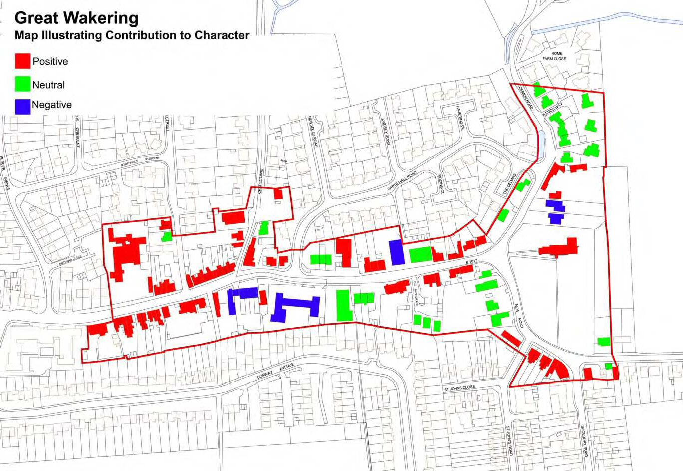
Fig. 78 Map to illustrate the contribution of individual buildings to the conservation area.
Reproduced by permission of Ordnance Survey® on behalf of the Controller of Her majesty's Stationery Office. ©Crown Copyright. Licence number LA100019602
Problems and Pressures
Unsympathetic alterations
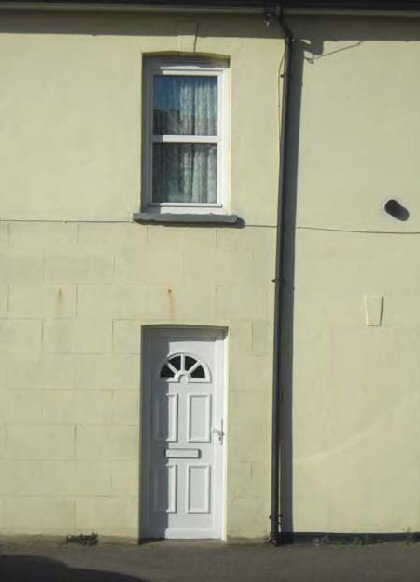
7.51 The conservation area encompasses several good listed vernacular shops and cottages, and comparison with photos from the mid-1970s and 1980s show that many of these have benefited from significant repair and improvement over the past few decades. However unlisted historic buildings also make an important contribution to the character of the area. Many of these are Victorian or early 20th century in date, and whilst not of sufficient merit for listing are of sufficient local interest to have formerly been included in the District's Local List of Buildings of Architectural, Historic and Townscape Importance. Many unlisted properties in the conservation area have suffered greatly from unsympathetic and uncontrolled alteration as a result of permitted development, including replacement plastic windows and modern roof tiles, as well as some unauthorised alterations (Fig. 79). The effect is overwhelmingly negative. Replacement plastic windows and doors are frequently flush mounted, creating blank facades that lack the attractive shadowing effect of recessed features. Incremental inappropriate alterations can cause irreparable damage to the rhythm and cohesion of the terraces that are an important element in the special character of the area. Overall, the extent of alteration to older properties in the conservation area has done great damage to its fragile historic character.
Fig. 79 Plastic replacement window and door, Prospect Cottages.
Public Realm
7.52 The public realm of the High Street is generally poor with a down-at-heel appearance in parts, and makes little concession to the special historic character of the settlement. The pavement surfacing is often patchy and poorly maintained. The un-made up roads, whilst being a distinctive feature of the streetscape, have become potholed and neglected. There is a wide pavement area to the front of the public conveniences and the old fire station which is confused between private and public space, and which is untidy and poorly maintained. The design of the street lighting makes no concession to the historic context, and there are excessive overhead wires. There are places where CCTV cameras are mounted prominently on poles, for example by the memorial hall and on the side of the Co-op. On-street parking also detracts from the scene. Hard standing to the front of residential properties impinges on the character of the street, and there is generally an excess of hard landscaping at the expense of greenery and soft landscaping.
7.53 Views through to backland areas are often poor from the highway. These areas tend to be used for car parking, as in the case of pubs for example, and they would benefit from tidying and landscaping.
Development
7.54 The conservation area is characterised by a variety of architectural styles, and includes a good deal of late 20th century development of varying quality often representing both infill of open space and replacement of older properties. The extent of this modern development threatens to swamp the distinctive historic character of the conservation area. Often, it is the more ordinary and unassuming brick and render two-storey houses of the late 20th century that sit most unobtrusively in street scene. Some properties are in an Essex Design Guide style which take references from traditional materials and building forms but are often too large in scale for the village and lacking attention to local details and materials such as fenestration patterns and traditional brickwork. Others such as Goodmans and Banjo Lodge make bold and honest architectural statements of their time but do nothing to reinforce the traditional character of the area. New infill tends not to respect the historic building line and frontages, due in part to resistance from Highways authorities with regard to development hard on to the pavement edge. This undermines the sense of enclosure and serial vision that is an important element in the character of the conservation area. New properties are continuing to appear in the conservation area, and there will be ongoing pressure for infilling and backland development.
7.55 The extent of 20th century development has resulted in significant loss of open green space over the past half century. Where once the historic High Street was surrounded by open fields and orchards, it is now almost entirely encapsulated in 20th century development. The loss of green space and of views out to the surrounding countryside has created a harsh, at times almost urban character in parts of the historic centre of the village.
Shops
7.56 Many older shops have been converted to residential use, and the number of shops in the High Street is diminishing. Traditional shop fronts now survive mostly as redundant vestigial features, and existing shop front design and advertisements are often of a poor, modern quality which does not respect the historic context. The Co-op has already been mentioned in this regard. Poor shop design seen in the conservation area includes metal framed plate glass windows, internally illuminated box fascias, plastic fascias and other use of inappropriate shiny reflective materials.
7.57 The closure of many shops over the past few decades has created pressure of change of use of buildings in the historic centre, and there are a growing proportion of residential properties within the conservation area boundary. The decline in mixed use is damaging to the special character of the conservation area, as well as requiring alterations to the fabric of existing buildings.
10 See Pevsner, N. The Buildings of England: Essex (London: Penguin, 1954), 193
11 Further research using survey maps in the ERO (ERO D/DBm P5A) could provide additional information on historic boundaries surviving in the existing settlement layout.
12 See ERO D/DBm P5A
13 See Quarrell, Johnie, Portrait of Great Wakering, Romford, Essex: Ian Henry Publications. 1996, 62