Great Wakering Conservation Area Appraisal & Management Plan
6 Historical development
6.1 Great Wakering has been the subject of an historic settlement assessment report produced by Maria Medlycott for Rochford District Council and Essex County Council in 2003. This report describes a range of archaeological sites and deposits and historic landscape features in the area3.
6.2 Many prehistoric and Roman remains have been found in the extensive Great and Little Wakering brickfields, although few have been precisely recorded. There are known to have been at least three Late Bronze Age settlements in the Great Wakering area. There is also evidence for Iron Age and Roman settlement in the area, suggesting that the site of the later village was already a focal point for settlement by the Roman period. Excavations in advance of a churchyard extension provided evidence of settlement during the Roman period including a number of drainage/boundary ditches, an oven/kiln and a human cremation4.
6.3 In the early Saxon period Great Wakering became the site of a minster church. The presence of a minster indicates there was a religious community there living within the minster enclosure. The minster was supported by agricultural production and perhaps other forms of industrial production and trade. It is likely that as well as the religious community there would also have been a lay community working for the minster supporting the economic activities associated with it. Saxon finds and features have been found in the brickfields to the north and south of the village, and the excavation to the east of the church revealed features probably relating to the minster, including possibly the minster boundary ditch. It is thought that the 12th century church is built on the site of the minster church itself. The place-name Wakering derives from the Old English Wœceringas meaning 'the settlement of the sons or people of Wacor or Wécer'5. Wacor may have been one of the founding members of the minster. The present church was built around 1100, and a rector was in place by 1283. The location of the medieval rectory is not known, although Rectory Farm was located to the north of the church. The post-medieval vicarage was located to the west of the village at the junction between the High Street and Little Wakering Hall Lane.
6.4 Great Wakering is recorded in the Domesday Book in 1086, with one manor with 20 households held by Swein of Essex. The village originally had its own manor house, but Morant notes that this had been demolished by the time of his writing in 1768, and its functions, including the holding of courts, passed to Little Wakering Hall. The exact location of the manor house is not known, but Morant records that it 'stood by Pales Pitt at the coming of the street', which may refer to Paton's Pit identified on the 1st edition OS map on the main road into the village6.
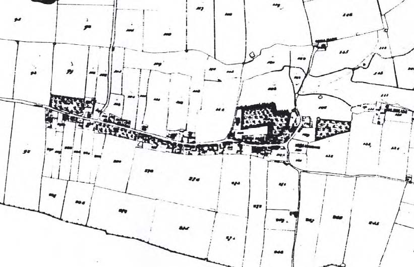
6.5 Historic maps of the village show that the High Street follows a historic east-west route with co-axial boundaries running off it. The 1841 tithe map and the first edition OS map of 1880 show a system of narrow strip fields running back from the properties facing on to the High Street, and these are strongly suggestive of an early planned settlement which may have its origins in either the middle to late Saxon period or in the late 11th to mid 12th centuries when the area was controlled by Swein and his family (Figs 3, 4). The plots on the north side of the street ran back to the creek which could have brought access to the sea right to the edge of the settlement.
6.6 The extent of the village in the late medieval period can be surmised from the 1777 Chapman and André map of Essex which shows the settlement extending along both sides of the High Street (Fig. 2). Isolated farms existed to the east of the village along the marsh edge. The demesne holdings included fields, pastures, farms, houses, fresh and salt marshes and woods, with marshland comprising a large portion of the parish.
Fig. 2 Great Wakering from the Chapman and André map of Essex, 1777.
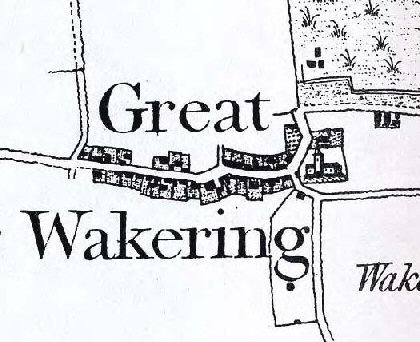
Fig. 3 Tithe map of Great Wakering, 1841.
6.7 By the time of the tithe map of 1841 the settlement had expanded further west along the High Street, and much of the marshland had been drained and turned into fields. Until the late 19th century agriculture and fishing formed the basis of the local economy. A survey of the copyhold lands, tenements and demesne lands of 1823 shows the extent of orchards, gardens, pastures and fields that surrounded the High Street at that time7. Writing in 1867, the historian Philip Benton noted the local tradition that the High Street was ploughed until the latter part of the 18th century, and was one of the last places where the road harrow was used8. From the second half of the 19th century brick-fields became a significant form of employment in the area. In 1851, the population of the parish was 905, and by 1891 this had risen to 1,652. A wide variety of commercial services were available in the parish, including grocers, bakers, butchers, hairdressers, drapers, china and glass dealers, boot and shoe makers and fishmongers9. A National School was built in the village in 1826, replaced by a Board school in 1876. There was also a Congregational Chapel, a Primitive Methodist Chapel, and a chapel of the Peculiar People, a sect that originated in the village in the 1850s as a revivalist movement established by James Banyard of Rochford.
Fig. 4 First edition OS map of Great Wakering, 1880.
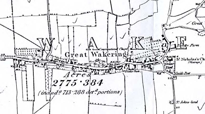
Fig. 5 East end of the High Street, c.1910.
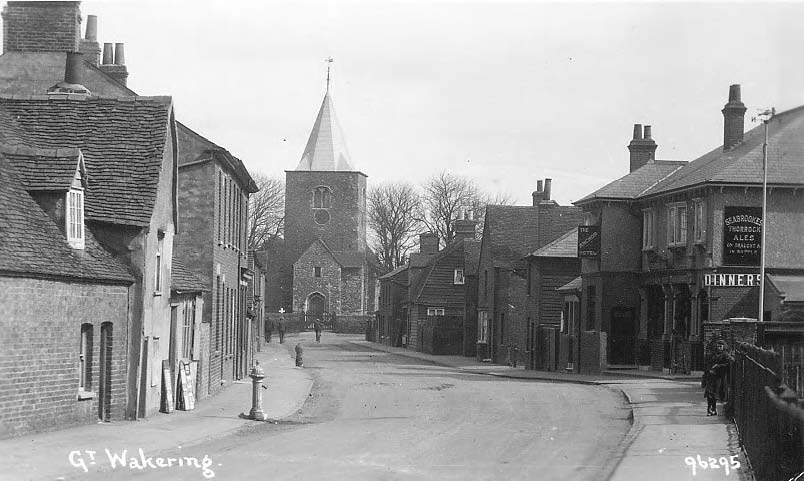
6.8 During the 20th century a number of factors influenced the expansion of Great Wakering. In 1915 the War Department acquired Foulness Island for weapons testing. A new road was constructed from the village to the island, and housing was provided for workers at the military establishment. In 1932 the Star Lane Brickworks opened and became a major local employer. The brickworks were operated by The Milton Hall (Southend) Brick Company Limited until 1984 when it was taken over by the London Brick Company. The brickworks closed in 2005. Since the 1960s the village has become an expanding residential area taking overspill from Southend, with infill along the High Street and housing estates built along new roads off the main streets, some of which follow historic routes leading to marshland grazing pastures. Ribbon development has linked Great Wakering to neighbouring settlements at Little Wakering and Barling, threatening the unique identity of the village. Today the population of the parish is around 5,500 with around 2,200 households, and it is an active community with a busy High Street. The village is provided with a range of local shops, pubs, a school and community facilities.
3 This document includes a summary of EHER records for the settlement.
4 ECC Field Archaeology Unit (FAU) Project no. 457, Land Adjacent to St Nicholas Church Burial Ground, Great Wakering, Essex, November 1998.
5 See Reaney 1935, The Place names of Essex.
6 Morant, P. 1768 The History and Antiquities of Essex, Vol. 1, 614
7 See ERO D/DBm P5A
8 See ERO D/DQs/183, Philip Benton's unpublished notes on the history of Great Wakering, c.1867
9 Kelly's Directory of Essex, Hertfordshire, Middlesex, Kelly & Co. Ltd, 1894