Great Wakering Conservation Area Appraisal & Management Plan
5 Location and Landscape Setting
5.1 Great Wakering is a large village in the south-east of Rochford district located on the road from Southend to Shoeburyness and the Ministry of Defence-owned Foulness Island. It is a civil and ecclesiastical parish within the jurisdiction of Rochford District Council.
5.2 The village is located on a low-lying brickearth-covered gravel terrace, less than 10m above sea level. It lies close to creeks and marshes to the north and east. The proximity to the estuarine marshes was critical to the early importance of the settlement at Great Wakering, and Potton Island once formed part of its detached parish lands. The marshes provided valuable sheep pasture as well as a source of wildfowl, shellfish and fish. In the past the marshland would have been subject to tidal influence and there may well have been access to the sea via the tidal creek to the north of the village. The present reclaimed marshland was created through piecemeal embankment and drainage throughout the medieval and early post-medieval period, with final enclosure in 1774, which produced fertile land for cultivation. Periodic flooding has continued to occur, and six people lost their lives in Great Wakering during the terrible floods of 1953. With rising sea levels the coastal marshes are again under threat, and it is possible that Great Wakering may once more become a settlement bordered by tidal marshes.
5.3 Wakering Common lies to the north east of the village and may be of medieval or earlier origin. Now consisting of grassland and wetland, this may originally have been a tidal creek prior to the building of the sea wall. Villagers had the right to graze their animals on the common until the 20th century. The Common is now designated in the District's Local Plan as a public open space and a wildlife site.
5.4 The economic value of the brickearth deposits, as well as local sand and gravel deposits, resulted in quarrying out in the surrounding fields from the mid-19th century, with subsequent restoration of the land. The Star Lane Brickworks, now closed, is located to the south west of the village, and was a significant employer for the local population from the 1930s.
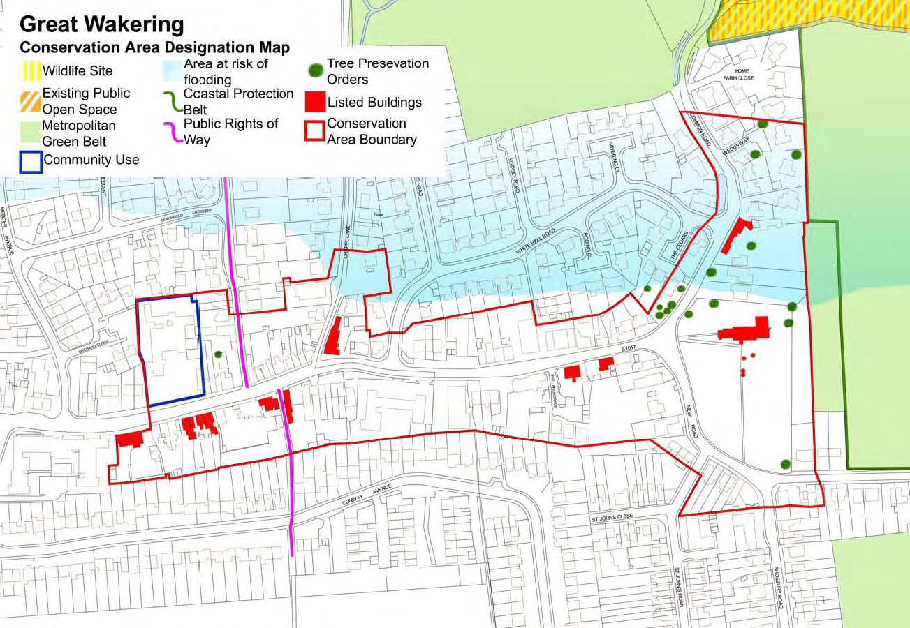
Fig. 1 Map showing statutory designations within conservation area.
5.5 Today the landscape around the village consists of a patchwork of arable fields. Although there has been some hedgerow loss resulting in erosion of the historic field pattern, comparison with the tithe map of 1841 shows some survival of coaxial field boundaries which are likely to be medieval or earlier in origin. This field pattern is part of a wider area of early planned landscapes that can be identified in the district, and Great Wakering is a valuable element in this context1. Historic boundaries at Great Wakering relate to what is believed to be a planned settlement originating in either the 8th-9th centuries or the 11th-12th centuries, with long narrow plots of crofts and tofts extending off the High Street2.
1 See Rippon, S. 1991 Early Planned Landscapes in South-East Essex, Essex Archaeology and History 22, 46-60
2 See Rochford District Historic Environment Characterisation Report, Rochford District Council and Essex County Council, 2005, 68-69, and Medlycott, M. 2003 Historic Settlement Assessment of Great Wakering, Essex County Council/Rochford District Council