Rayleigh Town Centre Area Action Plan - Issues and Options
04 The Options
(1) 4.1 Introduction
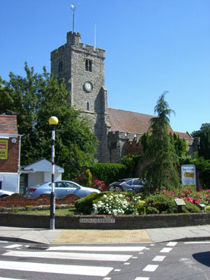
Figure 37: Holy Trinity Church, at the top of the High Street
4.1.1 In responding to the issues and the established objectives a range of options have been developed. These are presented in Table 2 and then discussed in more detail in following sections. These options directly relate back to the set of issues identified and summarised in section 2.8 of this report.
4.1.2 There are a range of opportunity areas within the town centre and variety of options relating to these, including lower levels of intervention such as cosmetic improvements to shopfronts, through to larger more strategic interventions, such as redevelopment of existing buildings. These are outlined in section 4.2: The Component Options. These have implications for transport and movement in the town, which is then discussed in more detail in section 4.3: Circulation Options.
4.1.3 We also present four spatial options, relating to the level of intervention, change and improvement that may be possible. These are presented in section 4.4: The Spatial Options. It must be recognised that these are not masterplans between which a preferred approach must be selected. They are not mutually exclusive and the preferred option that is taken forward during the next stage is likely to combine elements from each. That is, the preferred option may incorporate a combination of low, medium and higher level interventions. We are seeking your views on the component options and the circulation options to help shape the preferred option.
4.1.4 In section 4.5 we discuss the delivery implications and considerations associated with the different options. This section focuses on the primary development opportunities and the options presented relating to public realm and highways improvements.
Table 2: Summary options table.
| Issues | Options (by level of change and improvement) | |||
|---|---|---|---|---|
| Low | Medium | High | Higher | |
|
1. Quality and setting of conservation area / listed buildings undermined by unsympathetic development and ‘street clutter’ |
|
|
|
|
|
2. Need to introduce a greater range of leisure service providers, further comparison goods, floorspace and office floorspace |
|
|
|
|
|
3. Cluster of leisure and cultural uses around Rayleigh Mount are poorly integrated with the town centre core |
|
|
|
|
|
4. Traffic dominated, service access nature of Websters Way represents a poor quality environment and arrival to the town centre |
|
|
|
|
|
5. Pedestrian movement hindered or uncatered for in some locations through a combination of vehicle-dominated junction forms, street clutter and guardrailing, narrow or missing pavements, or poorly defined routes |
|
|
|
|
|
6. Congestion along Websters Way and approaches into the town centre |
|
|
|
|
Question 4
(15) Which of the options outlined above do you prefer?
(10) Are there any other options that should be considered?
(3) 4.2 The Component Options
 Figure 38: Potential for recladding
and refurbishment of old
Figure 38: Potential for recladding
and refurbishment of oldbuildings, as at King's Road, London
4.2.1 The following sections expand on the options summarised in the table above. They are presented in the same order and presented thus: Enhance the appearance of the town centre; Introducing new / mixed uses in the town centre; Improving connections between the High Street, Rayleigh Mount and the Mill; Improving the quality and appearance of Websters Way; Walking and public realm improvements; and Improving public transport attractiveness (as one measure to reduce traffic movement and congestion).
4.2.2 There are however overlaps between some of the options. We have therefore sought to avoid repetition and only present options once. This will help us to identify a set of preferred options to take forward It should also be noted that the options presented in this section with regard to transport, movement and public realm are explored in more detail in section 4.3: Circulation Options.
Enhance Appearance
 Figure 39: Potential for shop front
improvements and
Figure 39: Potential for shop front
improvements andpublic realm improvements, encouraging outdoor dining
(1) 4.2.3 Options to improve the appearance of the town centre include cosmetic improvements to shop fronts and facades, streetscape and public realm schemes, and the redevelopment of unsympathetic, under-used or unsightly buildings. Cosmetic improvements, including painting and planting would represent a potential low intervention. Shop front improvement schemes and associated policy guidance could be prepared to guide this, supporting and strengthening existing policy SAT8 in the Conservation Area SPD (2007). Areas of particular sensitivity which would benefit from such treatments include the top of the High Street (between the junctions with Bellingham Lane and Church Street) and the rear of properties along Bellingham Lane. This location would also benefit from a general ‘tidying-up’ of servicing arrangements. The potential for green walls, including the use of climbers (Figure 41), could be promoted to hide blank walls fronting onto streets, such as along Websters Way, although this would require regular maintenance.
4.2.4 There are also a number of buildings in the town centre which have been identified as having a negative impact on the quality and setting of the conservation area, such as the Police Station and former Tesco store. These could be refurbished and enhanced through recladding (Figure 38). Equally, potential for redevelopment may exist, as explored in sections below. Current planning policy may need to be revised to allow for improvements to buildings, ensuring they respond sensitively to the High Street and maximise the qualities of the conservation area.
QUESTION 5:
(14) Should we promote a shop front improvement scheme and encourage facade treatments, or should redevelopment be promoted?
 Figure 40: Potential for landscaping
and public realm treatments
Figure 40: Potential for landscaping
and public realm treatments
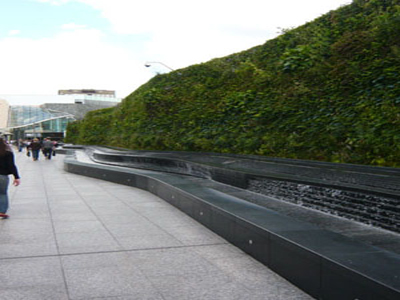 Figure 41: Climbers and green walls
could be used to enhance
Figure 41: Climbers and green walls
could be used to enhancethe appearance of buildings and blank walls,
as at Westfield in London
 Figure 42: As a temporary, short-term
measure, the blank facades of buildings along Websters Way
could be screened, as in this example from Berlin
Figure 42: As a temporary, short-term
measure, the blank facades of buildings along Websters Way
could be screened, as in this example from Berlin
Introduce new/mixed uses in the town centre:
(2) 4.2.5 Potential may exist to either reuse or redevelop some existing uses, backland or infill sites to provide for new retail, leisure, employment and residential floorspace within the town centre. Any new development that does take place should be flexible and adaptable so that it can respond to future circumstances. This is an important design consideration and is even more so given the current economic circumstances (and policy changes set out in PPS4). The development opportunities are set out below, and discussed in more detail in following sections of the report:
- Creation of new active development frontage along Websters Way, with enhanced links through to the High Street;
- Potential redevelopment between the High Street and Websters Way, providing new premises and enhancing the quality of the built form, particularly within the conservation area;
- Creation of new courtyard retail area providing links from the High Street through to the Mount;
- Restructuring and redevelopment around the Police Station and Somerfield store to the south of the High Street.
(1) 4.2.6 Other opportunities to increase the mix and diversity of uses could be explored through proactive policy measures. At present, non-retail uses are restricted from locating within the primary retail area, i.e.: between Eastwood Road and Holy Trinity Church. This however means there are few uses within this area that contribute to an evening economy. The Councils Retail and Leisure Study (2008) identified a need for restaurants and cafes in the town centre. Relaxing controls on primary and secondary retail areas could allow for a greater mix of uses within the High Street and thus contribute to its vibrancy throughout the day.
4.2.7 A proactive approach could also be taken towards the reuse of vacant buildings, potentially encouraging temporary reuse of space during the economic downturn. The Communities and Local Government (CLG ) document ‘Looking After our Town Centres’ (2009) provides guidance. Temporary uses could include arts and gallery space or community uses such as further education, training, performance or meeting space. This will have overall benefits for the visual appearance of the town and use of the town, creating activity throughout the day and having spin-off benefits for other businesses. Local Development Orders can be used to allow for change of use in a flexible and efficient manner.
(3) 4.2.8 Associated with the creation of a vibrant and diverse High Street is the operation and location of the town market. The license for the market was extended for a period of seven years in 2003 and thus expires in March 2010. This could be relocated to a more centrally located position, potentially along the High Street, increasing the intensity of uses and activities in the centre of the town. This may require the rationalisation or permanent relocation of the taxi rank (potentially to Websters Way, the Railway Station or elsewhere) or a temporary closure/relocation of this on market days to provide the space for erection of market stalls. The existing market could then be fully utilised as a car park or as an opportunity site for development.
(1) 4.2.9 Relocating the market to the High Street may be contingent upon resolving traffic management impacts, in particular the impacts on bus routing and access to all important town centre car parks during weekend retail peaks. It is however likely that the market could be accommodated within the High Street with only minimum impact on traffic flows as the street width is relatively generous.
QUESTION 6:
(15) Should new development be encouraged in the town centre to provide opportunities for new retail, leisure and other uses?
QUESTION 7:
(11) Should the Council review its planning policies and use of Local Development Orders to encourage a greater mix of uses, even if only on a temporary basis?
QUESTION 8:
(12) Should the Market be relocated into a more centrally accessible location, such as the high Street?
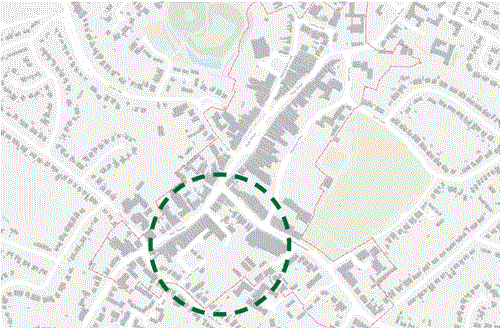 Figure 43: Location Plan: Police
Station area development opportunity
Figure 43: Location Plan: Police
Station area development opportunity
4.2.10 To the south of the High Street a major opportunity for redevelopment and restructuring exists, focused on the Police Station and adjacent buildings, including the shops, offices and flats fronting the High Street, the Council car park to the rear and the Somerfield store on Eastwood Road (Figure 43).
4.2.11 The Police Station is temporarily being used as a jail and many of the adjacent retail and commercial units are vacant (Figure 45). These could be improved through facade treatments, refurbishment or redevelopment.
4.2.12 If redevelopment was considered to be the preferred option, it would allow scope to reconsider the location of the foodstore. Relocation of this from Eastwood Road to the High Street would strengthen the High Street frontage and pedestrian footfall between the top and bottom of the High Street.
4.2.13 Any redevelopment scheme would need to consider the appropriate mix of uses, including residential, to create an active and viable development scheme. The location and provision of car parking would also need careful consideration.
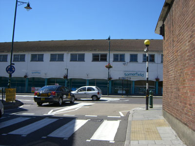 Figure 44: Somerfield store, viewed
from Websters Way
Figure 44: Somerfield store, viewed
from Websters Way
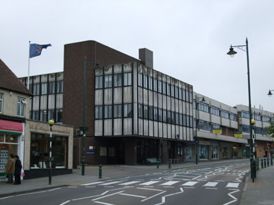 Figure 45: Police Station and
adjacent buildings
Figure 45: Police Station and
adjacent buildings
4.2.14 Our options for this area are presented on the facing page: these are indicative ideas and need to be considered in more detail before progressing.
QUESTION 9:
(13) Which of the options illustrated below do you prefer?
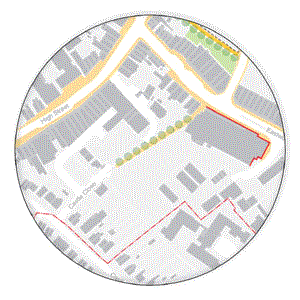 Figure 46: Option 1
Option 1 - Key Aspects:
- Cosmetic improvements to the facade of the existing Somerfield foodstore to improve the quality of the street frontage along Eastwood Road
- Paving, lighting and tree planting to improve walking conditions between the Council car park and Eastwood Road
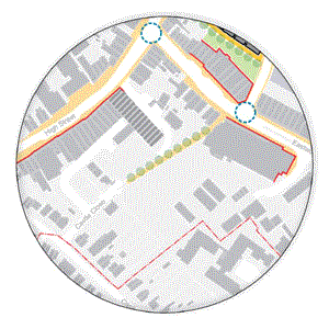 Figure 47: Option 2
Option 2 - Key Aspects:
- As with option 1 but also including:
- Recladding and refurbishment of the former Police Station for re-use as a new community hub acting as an attractor and anchor for the southern end of the High Street. This could include a new or relocated health centre, library, education and training facilities
- Shop front improvement schemes and encouragement of temporary uses in vacant units alongside police station
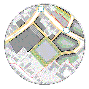 Figure 48: Option 3
Option 3 - Key Aspects:
- Refurbishment of former Police station as in option 2
- Relocation of library into new community hub and redevelopment of current library site for retail and residential purposes
- New town centre foodstore with High Street frontage and other modern retail units. Existing foodstore redeveloped for mixed use, including commercial and residential (Figure 49)
- Infill development to create safe, active and well defined streets and spaces
- Landscaping of car park. Development may also require additional car parking to be provided in the town centre
 Key to
all plans in section 4.2 of this report
Key to
all plans in section 4.2 of this report
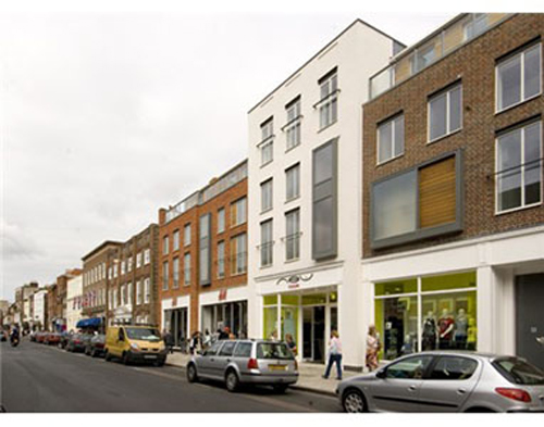 Figure 49: Potential for new retail-led mixed use development
on
Figure 49: Potential for new retail-led mixed use development
onthe police station site, reflecting the grain and rhythm of the historic built form,
as at Chichester
The High Street taxi rank (‘Boots Lagoon’)
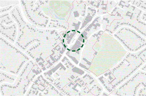 Figure 50: Location Plan: The High Street taxi rank
(1) 4.2.15 The town centre taxi rank (‘Boots lagoon’) comprises a large area of parking (Figure 50). It is visually intrusive and takes space away from the pedestrian, reducing the quality and enjoyment of the town centre retail offer (Figures 51-52). It was considered during the consultation exercise as an opportunity for rationalisation or relocation. Two options are presented here, both of which include public realm improvements and new public spaces. Transport and wider public realm issues are discussed in more detail in section 4.3.
4.2.16 Our options for this area are presented on the facing page. Please note these are indicative ideas and would need to be considered in more detail before they could be progressed.
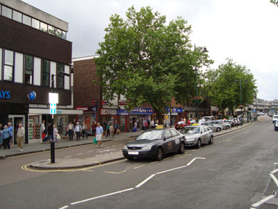 Figure 51: ‘Boots Lagoon’ taxi rank as
existing
Figure 51: ‘Boots Lagoon’ taxi rank as
existing
 Figure 52: ‘Boots Lagoon’ taxi rank as
existing
Figure 52: ‘Boots Lagoon’ taxi rank as
existing
QUESTION 10:
(14) Which of the options illustrated below do you prefer?
 Figure 53: Option 1
Option 1 - Key Aspects:
- Reduced number of taxi waiting spaces within the ‘Boots Lagoon’ area
- Restrictions on taxi waiting within the actual High Street carriageway
- Landscaping and public realm improvements, including creation of increased area of public space
 Figure 54: Option 2
Option 2 - Key Aspects:
- Removal of all taxi waiting spaces, requiring relocation to alternative locations, potentially including the railway station
- Public realm and landscaping of area, creating a new central public space in the town centre (Figure 55)
- Potential use of public space for market stalls, including relocation of current market and introduction of additional markets, such as continental and farmers markets (Figure 56).
 Figure 55: Potential exists to create
new outdoor space
Figure 55: Potential exists to create
new outdoor space
 Figure 56: Potential exists to
relocate the market to
Figure 56: Potential exists to
relocate the market tothe heart of the town centre
 Figure 57: Current route to the Mount
along Bellingham Lane
Figure 57: Current route to the Mount
along Bellingham Lane
Improve connections to Rayleigh Mount and Mill:
(2) 4.2.17 The Leisure and Cultural uses on Bellingham Lane are a great asset for the town, although they are poorly connected back to the High Street. The exposed ‘backs’ along Bellingham Lane also undermine the setting of these uses. Opportunities to improve theses connections involve:
Enhancing signage, lighting and public realm treatments to increase awareness and setting of these uses. The public space at the junction of the High Street and Bellingham Lane could be the focus for such interventions.
Maximise existing routes as access points, such as the link through Berrys Arcade. Creating new access arrangements through potential development opportunities, which could allow for improved linkages, enhancement to the quality of the townscape (where existing buildings are considered as detrimental to the quality of the conservation area) and provision of new floorspace providing for needs set out in the employment, retail & leisure studies.
 Figure 58: The Mill arts and leisure
centre
Figure 58: The Mill arts and leisure
centre
(1) 4.2.18 These connections are focussed on the links between the Mount and the High Street. Equally, there are potential improvements to be made between the Mount and the railway station. This is the most direct link between the station and High Street and although it may not be the main movement corridor for residents it does provide an important connection, particularly for visitors. Whilst there may be concerns at increasing footflow along this route (particular given the potential impact on residential uses along Castle Drive) opportunities may exist to formalise this, which could include signage and/ or improved lighting.
 Figure 59: The Mount
 Figure 60: The current entrance
to the Mount
Figure 60: The current entrance
to the Mount
Opportunities between the High Street and Mount
 Figure 61: Location Plan: Development
opportunities between
Figure 61: Location Plan: Development
opportunities betweenthe High Street, Mount and Mill
(1) 4.2.19 To the rear of properties on the High Street an opportunity exists to create attractive and intimate new retail courtyard spaces, providing space for new shops, restaurants and cafes, as well as residential. This could take place on the existing area of hard standing but could potentially be extended to include redevelopment of buildings on the High Street frontage, which the Conservation Area Appraisal (2007) rates as having a negative impact on the quality and setting of the conservation area (Figure 61). Coupled with landscaping to car parking areas and a formalised entrance to the Mount, this could provide attractive new connections between the High Street and cluster of cultural uses in the town centre.
4.2.20 Any development here would be subject to a range of delivery considerations (see section 4.5). At the lower end of the scale, measures such as facade treatments, public realm improvements, landscaping, lighting and signage might be employed as a means to improve connections.
4.2.21 Our options for this area are presented on the facing page. Please note these are indicative ideas and would need to be considered in more detail before they could be progressed.
 Figure 62: Bellingham Lane street
frontage
Figure 62: Bellingham Lane street
frontage
 Figure 63: Area behind
Bellingham Lane (source: bing.com)
Figure 63: Area behind
Bellingham Lane (source: bing.com)
QUESTION 11:
(14) Which of the options illustrated below do you prefer?
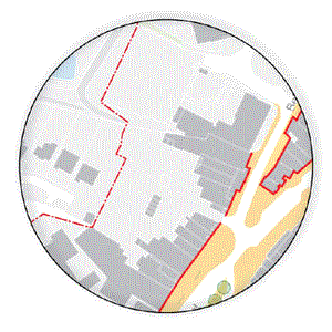 Figure 64: Option 1
Option 1 - Key Aspects:
- Cosmetic facade treatments and shop front improvements to properties along the High Street and Bellingham Lane
- Improvements to paving, lighting, tree planting and signage along the High Street and Bellingham Lane
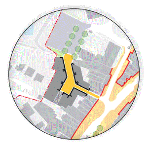 Figure 65: Option 2
Option 2 - Key Aspects:
- As with option 1 but also including:
- Small scale retail and residential courtyard development on current backland site to rear of properties on High Street (Figure 69)
- Landscaping of the Mount car park, with formalised pedestrian routes, lighting and improved entrances to the Mount
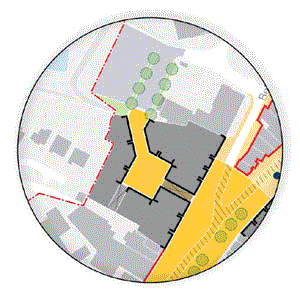 Figure 66: Option 3
Option 3 - Key Aspects:
- As with option 2, but incorporating:
- Larger retail, residential and commercial redevelopment of properties on High Street and area of hard standing behind, creating larger retail footprints and a larger central public space (figure 67)
- Creation of legible and continuous street frontage along the High Street, sensitively responding to the quality of the conservation area
- Wider public realm improvements to the High Street (as discussed in section 4.3)
 Figure 67: Potential for intimate,
mixed use courtyard space,
Figure 67: Potential for intimate,
mixed use courtyard space,as at Pied Bull Yard, London
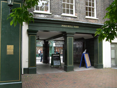 Figure 68: Entrance to Pied Bull Yard,
London
Figure 68: Entrance to Pied Bull Yard,
London
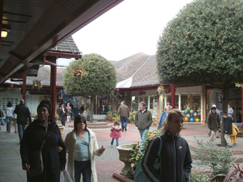 Figure 69: Smaller scale courtyard
retail environments, as at The Spires, High Barnet, which
provides
Figure 69: Smaller scale courtyard
retail environments, as at The Spires, High Barnet, which
providesan attractive and seamless retail connection between the High Street, Library and town centre car park
Improving the quality and appearance of Websters Way:
 Figure 70: Rear service areas,
Websters Way
Figure 70: Rear service areas,
Websters Way
(2) 4.2.22 Websters Way suffers from ‘exposed backs’, lack of footway width (and in cases footways altogether), large areas of parking and few connections with the High Street. It is one of the main arrival points into the centre yet also acts as its servicing and parking ‘back door’. A range of opportunities potentially exist:
- Landscaping and streetscape i mprovements, including tree planting, lighting and new footways and paving. This would also involve enhancing existing access routes between the High Street and Websters Way, and potentially formalising some of the small lanes where the public realm is poorly defined (such as through pub gardens and rear yards)
- Strategic interventions to create new links between the High Street and Websters Way, including redevelopment of some unsympathetic development on the High Street (which currently undermines the historic assets within the town and also undermines the Websters Way frontage).
- Creation of new active frontage along Websters Way, which again may require some strategic interventions.
- Rationalisation of Websters Way car park to create active development frontage, although this would also need to respond positively to the King George Playing Fields.
- Improve gateways into Websters Way at Eastwood Road junction, particularly paving widths, which may though require remodelling of the junction or potential redevelopment of adjacent buildings.
 Figure 71: Websters Way
4.2.23 Any improvements to walking facilities on Websters Way will need to consider impacts on the highways network for the town as a whole and, in particular impacts on bus journey times and for traffic movement through the town generally.
Development opportunities along Websters Way
 Figure 72: Location Plan: Development opportunities along
Websters Way
Figure 72: Location Plan: Development opportunities along
Websters Way
4.2.24 A primary area of opportunity for new development in the town centre is focused on the former Tesco Store (Figures 72-74). This is rated within the Conservation Area Appraisal (2007) as having a very negative impact on the quality and setting of the conservation area. This could be improved through facade treatments and screening, though opportunities also exist for a range of development interventions, providing new retail floorspace, an attractive new street environment and improved connections between Websters Way, the car park and the High Street. The delivery implications of these options need to be considered (see section 4.5).
4.2.25 Our options for this area are presented on the facing page. Please note these are indicative ideas and would need to be considered in more detail before they could be progressed.
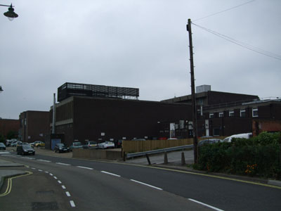 Figure 73: Rear of the former Tesco
store on Websters Way
Figure 73: Rear of the former Tesco
store on Websters Way
 Figure 74: Front of the former Tesco
store on the High Street
Figure 74: Front of the former Tesco
store on the High Street
QUESTION 12:
(13) Which of the options illustrated below do you prefer?
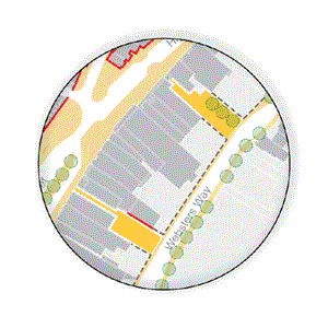 Figure 75: Option 1
Option 1 - Key Aspects:
- Screening of access and servicing through gating and fencing areas and associated creation of new footpath along northern side of Websters Way Public realm, lighting and landscaping along routes between Websters Way and the High Street
- Cosmetic facade treatments and opening up of building frontages on pedestrian routes between the High Street and Websters Way, creating safe and attractive spaces
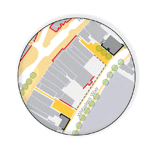 Figure 76: Option 2
Option 2 - Key Aspects:
As with option 1 but including:
- Facade improvements to exposed blank walls of properties on Websters Way and unattractive buildings on the High Street. Could include new cladding, painting or planting of green walls
- Small infill development on parking and servicing areas, formalising pedestrian routes between Websters Way and the High Street and creating new building fronts onto Websters Way
- Shops may require timed / regulated servicing along Websters Way or the High Street resulting from the loss of servicing areas. Compensatory car parking may also need to be provided elsewhere (potentially along Websters Way)
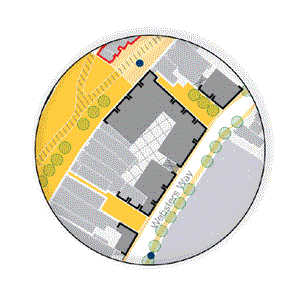 Figure 77: Option 3
Option 3 - Key Aspects:
- Redevelopment of former Tesco store with new, appropriately sized retail floorplates, creating new development on the High Street and Websters Way. Would need to be sensitively designed to respond to the conservation area
- Potential for incorporating a mix of uses, including commercial and residential
- Strengthens pedestrian links between Websters Way and High Street by formalising routes between the two (Figure 79)
- Provides for internal, screened servicing, but would require compensatory car parking elsewhere (potentially along Websters Way)
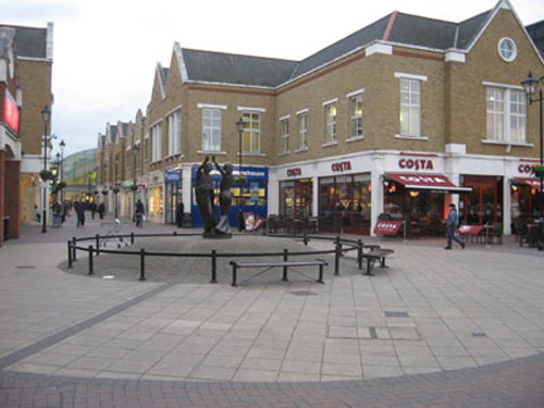 Figure 78: Potential for new
retail-led mixed use development, complementing the scale and
form of the High Street, as in this example from Staines
Figure 78: Potential for new
retail-led mixed use development, complementing the scale and
form of the High Street, as in this example from Staines
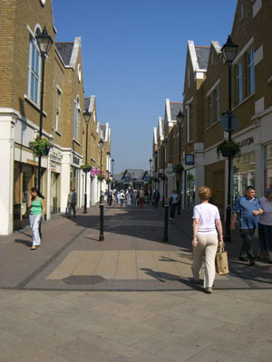 Figure 79: Potential for retail lined
pedestrian routes,
Figure 79: Potential for retail lined
pedestrian routes,linking the High Street and Websters Way, as in Staines
 Figure 80: Mixed use retail and
residential development reflecting
Figure 80: Mixed use retail and
residential development reflectinghistoric character of the town, Lion & Lamb Yard, Farnham
Development opportunities at Rayleigh Lanes
 Figure 81: Location Plan: Development
opportunities at Rayleigh Lanes
Figure 81: Location Plan: Development
opportunities at Rayleigh Lanes
(1) 4.2.26 As outlined in section 2.6, permission has recently been granted on the Rayleigh Lanes site, converting the Snooker Hall into residential use. The adjacent site also benefits from a permission for residential use, though this is due to expire soon.
Should this expire, then the opportunity exists to re-examine the potential of this site and its surroundings, providing wider public realm improvements relating primarily to pedestrian links between Websters Way and the High Street at this point (Figures 81-83). As with the options presented above, lower interventions include the screening of servicing and access areas to minimise the visual impact of these.
4.2.27 Our options for this area are presented on the facing page. Please note these are indicative ideas and would need to be considered in more detail before they could be progressed.
 Figure 82: Rayleigh Lanes and adjacent
site
Figure 82: Rayleigh Lanes and adjacent
site
 Figure 83: Pedestrian route alongside
Rayleigh Lanes
Figure 83: Pedestrian route alongside
Rayleigh Lanes
QUESTION 13:
(11) Which of the options illustrated below do you prefer?
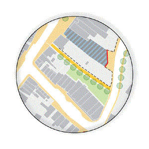 Figure 84: Option 1
Option 1 - Key Aspects:
- Screening of access and servicing areas (through fencing and gating) and associated creation of footpath along northern side of Websters Way
- Recently permitted development of Rayleigh lanes takes place, with associated facade improvements to Websters Way entrance
- Landscaping, lighting and paving improvements, formalising pedestrian connection between Websters Way and the High Street
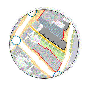 Figure 85: Option 2
Option 2 - Key Aspects:
- Redevelopment of Rayleigh Lanes building as per option 1 but also including: Redevelopment of adjacent site for a mix of retail, commercial and residential uses (Figures 86-87)
- Landscaping of servicing and parking area to rear of properties on Eastwood Road, including removal of brick wall alongside pedestrian link, improving safety and quality of this space.
- Facade treatments to properties on Eastwood Road Will require compensatory car parking to be provided
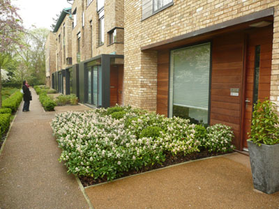 Figure 86: Attractive mews style
development, Cambridge
Figure 86: Attractive mews style
development, Cambridge
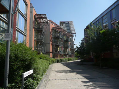 Figure 87: Safe, residential lined
pedestrian routes, Greenwich
Figure 87: Safe, residential lined
pedestrian routes, Greenwich
Car parking provision on Websters Way
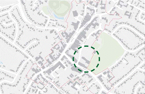 Figure 88: Location Plan: Car parking
provision on Websters Way
Figure 88: Location Plan: Car parking
provision on Websters Way
4.2.28 The options presented above are likely to result in the need for compensatory car parking to be provided in the town centre. Websters Way is the main town centre car park and, given both the current highways network and the opportunities presented to improve pedestrian connections between Websters Way and the High Street, it is considered the most logical place in the town centre to provide replacement parking spaces (Figure 88). We explore the provision of additional surface parking and a new multi-storey car park. Both have associated delivery considerations and are discussed in section 4.5.
4.2.29 Our options for this area are presented on the facing page. Please note these are indicative ideas and would need to be considered in more detail before they could be progressed.
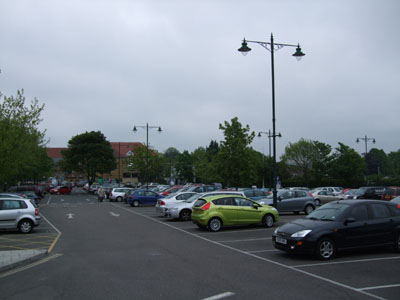 Figure 89: Websters Way car park
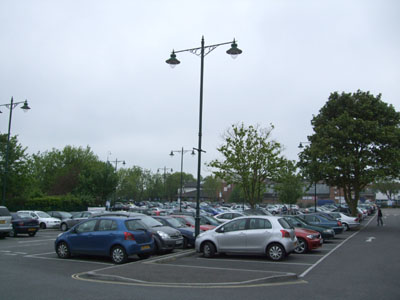 Figure 90: Websters Way car park
QUESTION 14:
(15) Which of the options illustrated below do you prefer?
 Figure 91: Option 1
Option 1 - Key Aspects:
- Redevelopment of existing businesses and health centre immediately south of existing car park to provide for an enlarged car park area
- Relocation of health centre into potential new community hub within refurbished Police Station (see earlier options)
- Improvements to pedestrian crossing conditions at junction of Eastwood Road and Websters Way
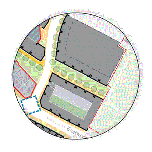 Figure 92: Option 2
Option 2 - Key Aspects:
- Redevelopment of existing businesses and health centre immediately south of existing car park to provide for an enlarged car park area, comprising a new multi-storey car park.
- Multi-storey car park wrapped with commercial activities to create an active street front and screen car parking from view (Figure 93)
- Refurbishment and redevelopment of properties on Eastwood Road, including new links to and development addressing King Georges Fields (Figure 94), connecting to wider pedestrian route to the High Street
- Signal controlled junction improvements at junction of Eastwood Road and Websters Way
 Figure 93: Sensitively designed
multi-storey car park,
Figure 93: Sensitively designed
multi-storey car park,hidden behind shops and housing, Norwich
 Figure 94: New development wrapping
the car park could also
Figure 94: New development wrapping
the car park could alsoprovide a positive frontage to King Georges Field
Walking and public realm improvements:
4.2.30 Walking facilities are generally well provided for across the town, although in response to traffic engineered junction designs, pedestrian crossing points are set back from the junction and result in some convoluted movements for pedestrians. Public realm interventions should focus on small-scale improvements to the efficiency and quality of walking facilities. It is likely this will involve the reconfiguration of roundabout junctions to the west of the town core so as to re-provide direct pedestrian crossing facilities and give pedestrians a higher level of priority, without having undue impacts on bus movements or traffic flow.
(1) 4.2.31 There are also number of exposed ‘backs’ to properties in the town, particularly along Websters Way and Bellingham Lane. As a short-term measure these areas could be properly defined, clearly separating the public from the private/semi-public realms. Generally streetscape improvements could be implemented, including landscaping and façade treatments. Ad-hoc parking and servicing arrangements could also be formalised, including the use of measures to limit servicing to particular times of the day.
(1) 4.2.32 The High Street has benefited from public realm investment relatively recently. This has created relatively wide and comfortable shopping environments for pedestrians. However, there are locations where pedestrian guardrailing hinders pedestrian movement (such as at the Crown Hill / High Street junction) and also where the proliferation of disorganised street furniture (bollards, traffic signage, lighting columns and bins) undermines the quality of the public realm and surrounding townscape (such as at the junction of the High Street and Church Street outside Holy Trinity Church). Opportunities may exist to rationalise the amount of ‘street clutter’ in the town. The consultation undertaken also drew attention to the opportunity to pedestrianise, or part pedestrianise the High Street area, though this may have wider implications for traffic movement, servicing and activity throughout the day.
4.2.33 Further there are also opportunities to improve development frontages and the relationship of buildings with the street.
4.2.34 Options are presented in more detail in section 4.3, where we also ask questions relating to public realm, movement and circulation.
Improve public transport attractiveness:
(1) 4.2.35 Given the arrangement of traffic flows through the town centre bus routes use the High Street, Websters Way and Eastwood Road. The condition of the public realm around the main bus stop on Websters Way is satisfactory, however the overall lack of active frontage (exposed backs) and associated levels of passive surveillance significantly detract from the quality and safety of this setting. Equally, although outside the immediate study area, consideration should also be given to the setting the quality of the interchange between the railway station and adjacent bus stop facilities. Improvements here that encourage public transport use should be encouraged and could include a mix of new walking facilities and vehicle speed management, public realm ‘gateway’ improvements, and wayfinding/legibility signage.
4.2.36 Options are presented in more detail in section 4.3, where we also ask questions relating to public realm, movement and circulation.
(2) 4.3 Circulation Options
4.3.1 This section presents options for change and improvement relating to movement and the public realm. The options are predicated on the understanding that transport and development are not only linked, but that transport must serve development envisaged in the town, not dominate it. Transport also has a vital contribution to make to the achievement of broader sustainability objectives, such as the achievement of carbon emission targets and greater social inclusion.
4.3.2 Rayleigh is located at the convergence of a number of strategic routes that bring people to and through the town, and support it as the districts primary town centre. The future success of the town is therefore intrinsically linked to the ability to maintain and enhance town centre access by all modes of travel in support of the town centre vision.
4.3.3 New development has a vital role to play in encouraging more sustainable patterns of growth and change. Development should be designed and laid out in a way that facilitates and emphasises movement by less polluting and healthier modes, so that people will more readily choose walking, cycling and public transport over private car trips. To minimise the impact of new development on the public realm and pedestrian environment, changes in the number and locations of long and short stay parking in the town may need to be considered, as well as the manner in which buildings are serviced and deliveries made.
(1) 4.3.4 In addition to the manner in which the town is to evolve and grow, there are a number of public realm interventions that can support the vision. By rationalising and removing excess items of street furniture, and by placing items in the correct place, it will be possible to greatly improve movement along and across streets and access around the town, particularly for pedestrians. It will also markedly improve people’s perception of the town as an attractive place to be and encourage people to inhabit the public realm more often, for longer periods of time, and for a greater range of necessary, social and spontaneous activities. Similarly, the removal of guardrail will remove feelings of severance and vastly improve the directness, legibility, efficiency and quality of walking journeys and improve the effectiveness of the town’s retail circuit.
4.3.5 There are four transport circulation options that have been considered for the town. These are:
- Working with the existing network;
- Partial Pedestrianisation of the High Street;
- Full Pedestrianisation of the High Street; and
- Two way working on the High Street.
These are illustrated (Figure 97) and discussed in turn below.
Working with the existing network
(1) 4.3.6 As noted in section 2.7 above, a modified one-way system along the High Street was introduced as part of a Department for Transport (DfT) pilot project ten years ago. Websters Way forms an important distributor route around the town core. Traffic throughout the town is controlled via a series of mini roundabouts to the east on the High Street, and a signalised junction is in place to the west. The arrangement of junctions and form of control is appropriate to the volume and nature of traffic using the towns streets in the context of the constraints imposed by the layout of the town itself. Without pursuing changes to traffic circulation, it is possible to institute a wide variety of tangible and achievable transport improvements.
‘Shared Space’ transformation for the High Street
(1) 4.3.7 There is an opportunity to build upon the success of the DfT pilot project and to transform the High Street into a new and improved landmark ‘shared space’ (Figure 97, image 1, and example Figures 100 & 104). This could involve widening footways, possible reductions in kerb heights (or even their removal), installation of new seating, trees, public art and lighting elements (Figure 101). This would not involve any reductions in traffic or buses through the street, but rather would manage the speeds and behaviour of vehicles to levels that would create a much safer and higher amenity street environment for all users. These improvements would also result in higher footfalls past retail premises due to an increase in the number and duration of stay of pedestrians attracted to a higher quality and much more usable space.
4.3.8 As part of this transformation, the ‘Boots Lagoon’ taxi rank can also be transformed into a functioning urban space that could possibly provide for relocated market stalls on certain days of the week. This would involve the rationalisation of the under utilised taxi ranks and the possible re-provision of spaces in nearby locations.
Pedestrian crossing improvements to the town’s roundabouts
 Figure 95: Existing pedestrian routes
between Websters Way
Figure 95: Existing pedestrian routes
between Websters Wayand the High Street
(1) 4.3.9 The existing design of the towns roundabouts has favoured the fast and efficient movement of vehicles over that of pedestrians. This has impacted on the desirability of walking as the primary mode of movement within the town, and may constrain pedestrian footfall to particular areas. In order to increase the number of walking trips, and to support the towns continued economic and social development, it is critical that the directness, efficiency and attractiveness of walking journeys be improved.
4.3.10 The towns roundabouts are a particular issue for pedestrians, and one option is that pedestrian crossing facilities on junction approaches be moved closer to the junction so as to line up with logical and direct pedestrian walking routes. These roundabouts can also be designed as critical gateways to the town core and important landmarks in their own right (Figures 102 & 103).
Junction capacity improvements at either end of Websters Way
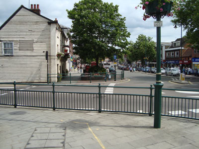 Figure 96: Guardrail at the Crown Hill
/ High Street junction
Figure 96: Guardrail at the Crown Hill
/ High Street junction
(1) 4.3.11 Websters Way is a critical traffic route around the town and main access point to the town centre car park. Junctions at either end are under considerable pressure and small scale improvements would markedly improve traffic circulation (Figure 97, point c). The Church Street and High Street junction has been identified as a particular issue. This is a priority controlled Junction and the High Street and Hockley Road is signalised. A study undertaken by Mouchel Ltd has clearly proven that by adding a right turn lane from the High Street into Bull Lane (Websters Way), and by bringing the Church Street and Bull Lane (Websters Way) junctions with the High Street under signal control, that existing congestion at this junction can be relieved. There is sufficient width between buildings to provide for this improvement without materially impacting upon the pedestrian environment.
4.3.12 Websters Way and Eastwood Road roundabout is also very congested at peak times. Improving capacity at this junction would improve circulation. Physical constraints at this point may however mean that signalisation is the only option to pursue.
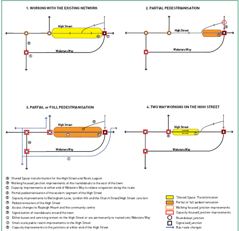 Figure 97: Town centre circulation and public realm options
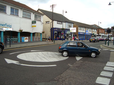 Figure 98: Junction of Eastwood Road
and Websters Way
Figure 98: Junction of Eastwood Road
and Websters Way
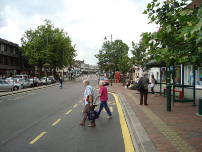 Figure 99: High Street bus stop
Partial pedestrianisation of the High Street from Bellingham Lane to Church Street
Public realm
(2) 4.3.13 A n option exists to pedestrianise the eastern arm of the High Street from Bellingham Lane to Church Street (Figure 97, image 2). This section of the street could be transformed into a new public space for the town, and could potentially accommodate the relocation of market stalls on particular days of the week. This treatment would allow for the substantial improvement of the quality of the space and would attract higher footfall that would drive improvements to retail premises offer over time.
Transport
(2) 4.3.14 While this would have marked benefits to the quality of this section of the High Street, it would require the diversion of traffic onto Bellingham Lane, London Hill and Church Street and significant capacity improvements / modifications would be required to the junction of Church Street and the High Street for this to occur. Critically, buses will not be able to use this route given the narrowness of these streets. Bus journey times would also be significantly impacted upon if this route were to be used, and it is unlikely this would be acceptable to Council or bus operators. This means that buses will still be required to use the High Street under this option.
Partial or full pedestrianisation of the High Street
Public realm
(1) 4.3.15 The High Street could be transformed into a central pedestrian retail spine and a civic focal point for town centre social and economic activity (Figure 97, image 3). A series of unique yet unified public spaces could be designed accommodating a range of activities along its length. This would markedly boast the attractiveness of this space for residents and visitors, and would therefore translate into an increase in footfall past retail premises. Given the space made available, it is also possible under this option to relocate the market from outside the Town Hall to the High Street for certain days of the week.
4.3.16 H owever, there are also many well documented problems associated with pedestrianisation. Critically when shops are not open – i.e. in the evenings - there is little reason for people to use this space and therefore the area becomes deserted. The absence of natural surveillance provided by either foot or vehicular traffic can become a place for antisocial activities and behaviour, making the area both an undesirable and unsafe place to be at night.
Transport
(1) 4.3.17 As with most pedestrianisation schemes, the banning of cars from one street limits permeability through the town and concentrates vehicles to a limited number of alternative routes. The highways response is to re-provide vehicular capacity on the route that vehicles will be diverted onto. Under this scenario there are two options for busses. The first and easiest option is for busses to remain in operation along the high Street, although that would restrict the potential to relocate the Market here. The second option is to permanently divert busses away from the High Street to Websters Way (Figure 97, Image 3, point i). It is likely that in order to offset increased delay for vehicles, that signalisation of town centre junctions will be required, which will come at a substantial cost.
(1) 4.3.18 Access to Rayleigh Mount and the Community Centre would also be severely restricted under this option given that Bellingham Lane would need to be turned into a two-way cul-de-sac, accessed via London Hill. Disabled parking would also need to be relocated to Websters Way car park or to the Market Car park, greatly increasing distances to be travelled and obstacles to be overcome for disabled persons needing to access town centre goods, services and facilities. Buses would also be subjected to unacceptable levels of delay on this route – with little opportunity to provide priority measures – that would impose greater costs to the bus operator, which may in turn trigger the possible retraction of commercial services from operation
Two way traffic on the High Street
Public realm
(1) 4.3.19 The majority of the High Street is wide enough to accommodate two-way traffic while leaving substantial room for pedestrian movement along the footways (Figure 97, image 4). The exception is the eastern section of the High Street between Bellingham Lane and Church Street where parking would be lost. Under this option all footways would need to remain largely as they are now, and in places be reduced in width. The ‘Boots Lagoon’ are would also need to accomodate a new westbound double length bus bay and associated stop facilities, as provided on the opposite side of the road.
4.3.20 The critical issue with this option is that it would double the amount of traffic that currently uses the High Street. This would have significant environmental and amenity impacts on other street users and may, without proper treatment, lead to the decline in footfall and retail quality and viability. Under this option, footways will need to remain at their current widths, whereas for the other options, significant improvements to widths and the quality of this space are possible. Instead of moving to a less regulated and informal crossing situation as is possible under a shared space scenario, crossings would need to be regulated at controlled crossing points given volumes of traffic and buses using the street.
Transport
(2) 4.3.21 Two waying the High Street would greatly improve the legibility of this route through the town and would remove the need for traffic to divert along Websters Way. It would effectively relieve congestion through the town by adding a second lane for eastbound traffic. It would also allow for the provision of two-way buses on the High Street, vastly improving the legibility and efficiency of the bus network, and position stops where people want to be. Junction improvements would be required at Church Street, High Street and Bull Lane (Websters Way), as well as the High Street and Crown Hill. This would most likely involve some form of widening and or signalisation.
Conclusions
4.3.22 In considering the options presented above, due consideration has been given to the both public realm and transport benefits and costs of each.
4.3.23 Although pedestrianisation of part or whole of the High Street would provide a new retail focused civic space, the dis-benefits to the town need to be fully considered. Pedestrianisation effectively moves the issue of traffic routing and congestion to somewhere else in the town, and in turn triggers the need for capacity improvements on alternative routes, that in themselves create a new vehicular barrier to movement to and from the town (albeit away from the main retail circuit) and a constraint on longer term expansion.
4.3.24 Another critical issue with pedestrianisation is that when shops are closed in the evenings there is little reason for people to use this space and therefore the area becomes deserted. The absence of natural surveillance or ‘eyes on the street’ provided by either foot or vehicular traffic is likely to encourage antisocial activities to relocate to this area, making it both an undesirable and unsafe place to be at night.
 Figure 100: Shared space scheme, New
Road, Brighton
Figure 100: Shared space scheme, New
Road, Brighton
(1) 4.3.25 The costs of upgrading alternative routes such as Bellingham Lane or Websters Way to accommodate increases in traffic would be substantial, and the quality of these streets would become degraded. Also, the increases in delay to buses would be so dramatic as to discourage people from using them, and impact upon commercial viability of services. In this context, it is considered that the negative impacts of either pedestrianisation scheme would far outweigh the benefits, and neither option is considered viable.
(1) 4.3.26 The final option to be considered is that of the potential to two-way the High Street. This option has significant transport benefits to be considered. By adding an additional eastbound traffic lane through the town, congestion on Websters Way would be relieved Bus movement through the town would also be vastly improved in terms of the legibility and efficiency of the service provided. There are however major public realm disbenefits. The volume of traffic using the High Street would effectively double and bring with it associated environmental, amenity and retail related impacts. The High Street would also become much more difficult for people to cross on foot due to the need to restrict crossing to formal crossing points. It is therefore considered that this option, although beneficial in transport terms, would deliver outcomes that work against the achievement of the vision of the town.
 Figure 101: Public realm
improvements, New Road, Brighton
Figure 101: Public realm
improvements, New Road, Brighton
(1) 4.3.27 It is considered that the existing layout of streets and method of traffic control is entirely appropriate for a town of the size of Rayleigh, and that seeking to deliver transport improvements to this network – as presented in option one - is the most desirable and feasible option to pursue. Transformation of the High Street and ‘Boots Lagoon’ will deliver similar benefit to the performance of retail premises as pedestrianisation schemes, and will create a new civic space for the town – without the loss of town centre access, without the impacts on bus services, and without the need for substantial mitigation works.
(1) 4.3.28 Critically, option one allows for incremental transport and public realm improvements to be delivered as development comes forward, responding to changes in the property market and the availability of material and financial resources. This means that it is a much more feasible and deliverable option to pursue, as achieving the towns overall vision is not dependent upon a major costly intervention (such as pedestrianisation or two-waying the High Street) that may take 5-10 years to deliver, at substantial cost and with the potential for major consultation issues. Maintaining the existing network will also allow maximum flexibility for the town to respond to changes in the property market, movement demands, and community needs, long into the future.
QUESTION 15:
(12) Which of the circulation options do you prefer?
(5) We believe there is merit in maintaining the movement network but improving the quality of this, providing a more attractive series of spaces in the heart of the town. Do you agree?
Figure 102: Junction treatments, Shoe
Lane, London
 Figure 103: Junction treatments, New
Malden
Figure 103: Junction treatments, New
Malden
 Figure 104: Potential exists to
create a shared space scheme on the High Street, as at
Patrick Street, Cork
Figure 104: Potential exists to
create a shared space scheme on the High Street, as at
Patrick Street, Cork
(1) 4.4 Spatial Options
4.4.1 In this section we present four potential combined masterplan approaches for the town centre, each relating to the level of change and improvement that might be taken forward. They show the options discussed above in their wider, town centre scale context.
4.4.2 Please note that we are not asking for your comments on which of these masterplan options you prefer: the preferred option is likely to comprise a mix of elements relating to different degrees of change and improvement (at low, medium and high levels) and it is thus likely that a composite approach will be progressed. Your comments on and response to the questions presented earlier in the report will be used to help identify the best way forward.
Change Level 1: Low
(1) 4.4.3 A low level change and improvement, comprising potential early wins, enhancing and improving existing built form / streetscape (Figure 105):
- Screening of service yards on Websters Way to reduce visual intrusion and define areas of public and private realm, through use of fences and tree planting
- New pavement along north side of Websters Way, associated with definition of service areas
- Hard landscaping, tree planting and street lighting to define pedestrian routes from Websters Way through to the High Street
- Co-ordinated public realm improvements along High Street, including rationalisation of street clutter and improved wayfinding strategy, particularly between the High Street and Mount and between the High Street and Market.
- Reduce size of taxi-rank on High Street, with potential relocations of waiting areas to the railway station and Websters Way
- New public realm treatment to define routes from the Castle Road car park via the Somerfield store to Eastwood Road
- Review of planning policies to allow for greater mix of uses within the High Street
- Proactive approach to reusing empty and vacant units on the High Street for temporary alternative uses, such as art space or education.
 Figure 105: Spatial option one: Low change / improvement
Change Level 2: Medium
(1) 4.4.4 Further develops level 1, but with introduction of some new development (Figure 106):
- Façade treatments to rear of exposed properties along Websters Way and Bellingham Lane. Also to unsympathetic properties along High Street and Eastwood Road
- Backland / infill development along Websters Way creating new active street fronts and also opening out onto pedestrian routes between Websters Way and the High Street, potentially acting as new ‘shopping lanes’. Also involves timed / restricted servicing arrangements along the High Street.
- New mixed use courtyard development on land to rear of High Street (north side) providing a new direct connection to the Mount. Landscaping of this route, including surface car park at the Mount, to enhance quality of connections
- Extension of Websters Way car park to south west, offsetting car parking space lost through development of backland sites. Would also potentially involve relocation of health centre to new development within the town centre.
- Relocation of market to the High Street and promotion of different types of market on alternative days
- Improvements to junctions in and around the town centre, enhancing crossing facilities for pedestrians
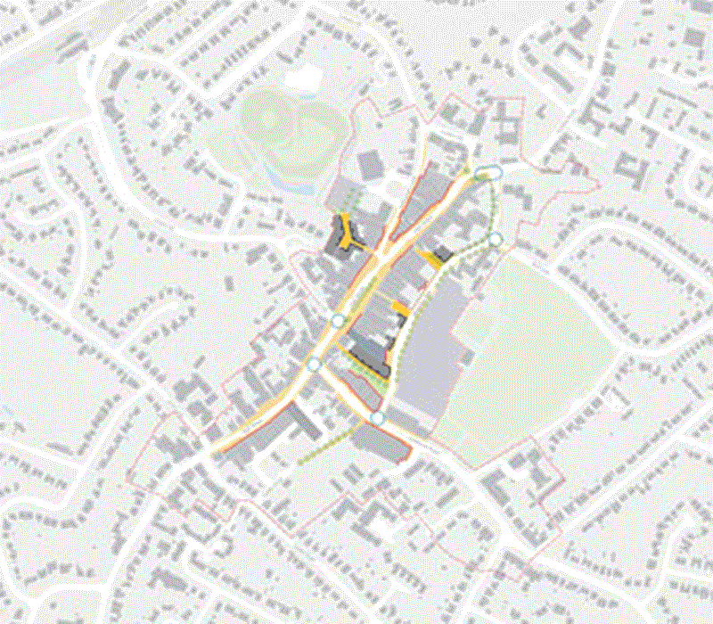 Figure 106: Spatial option two: Medium change / improvement
Change Level 3: High
(2) 4.4.5 Further development of change and improvement level 2, with additional new development within the core High Street area and the introduction of new traffic management measures (Figure 107):
- Redevelopment of former Tesco store and adjacent units on High Street, providing new retail, commercial and leisure space with active development frontages on the High Street, Websters Way and routes between these. Includes enclosed servicing area.
- Expansion of courtyard retail development between High Street and the Mount, including redevelopment of the high Street frontage and refurbishement of adjacent buildings current considered as contributing negatively to the conservation area
- Refurbishment of units located along main pedestrian route between Websters Way and High Street to provide active frontages
- Introduce shared surface treatment along High Street and Bellingham Lane
- Potential signalisation of road junctions at gateway entry points into the town centre
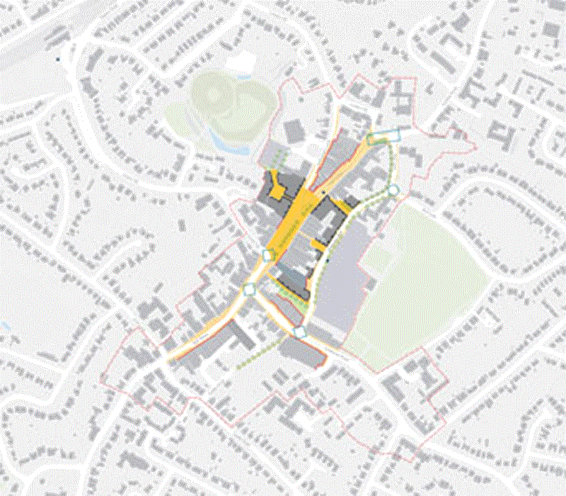 Figure 107: Spatial option three: High change / improvement
Change Level 4: Higher
4.4.6 This level of change looks at a wider area, considering potential for change and development along Eastwood Road and the southern end of the High Street (in the vicinity of the Police Station and Somerfield foodstore) (Figure 108):
- Refurbishment of Police Station as a new community hub, including relocated health centre and library facilities. Also allows for redevelopment of existing library on the High Street for new mixed use development
- Redevelopment of retail units, offices and flats adjacent to Police Station to include new town centre foodstore, acting as a southern anchor to the High Street.
- Current surface car park accessed via Castle Road transferred to foodstore, with replacement town centre parking provided by way of new multi-storey car park on Websters Way, with active development uses around this fronting onto Websters Way
- Mixed-use redevelopment on Eastwood Road on site of current Somerfield store and opposite this at junction of Eastwood Road and Websters Way, including space for town centre residential units.
- Shared surface treatments and new development fronting onto routes between the High Street, new footsore car parking and Eastwood Road frontage.
- Potential pedestrianisation of High Street and diversion of all through traffic to alternative routes Relocation of all taxi waiting facilities from the High Street to alternative locations around the town centre
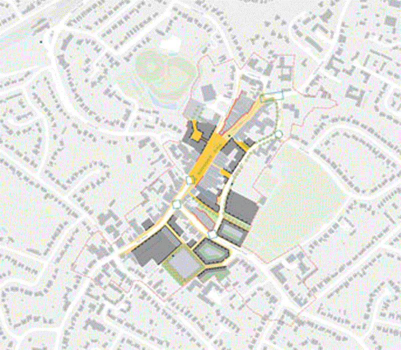 Figure 108: Spatial option four: Higher change / improvement
(1) 4.5 Delivery Considerations
4.5.1 This section looks into the delivery implications of the potential public realm and highways improvements, as well as the major development opportunities identified in section 4.2 above and including:
1 land around the Police Station (see 4.2.10 - 4.2.14)2 land between the High Street and the Mount (see 4.2.19 - 4.2.21)
3 land between the High Street and Websters Way (see 4.2.24 - 4.2.29)
Public Realm and Highways
(1) 4.5.2 The options relating to the public realm and transport network vary according to the level of change. The lower change options essentially involve improvements to the public realm while the higher change options also include modifications to highways. Depending upon the anticipated level of new development within the town centre and the financial viability of the development uses, improvements to the public realm could be funded from planning obligations (s.106 receipts/ Community Infrastructure Levy - see Box 1) obtained as part of the grant of planning permission for development within the town centre. However, unless significant and financially viable development was forthcoming in the short-term, the public sector would need to either fund the improvements itself or forward-fund the improvements and claw the costs back from future developments).
Box 1: Infrastructure Tariff
Infrastructure Tariff
- As an alternative to securing planning obligations through the traditional s.106 means, the Council could consider establishing a tariff, such as a Community Infrastructure Levy (CIL ). The overall purpose of the CIL is to ensure that development contributes fairly to the mitigation of the impact it creates: to ensure that development is delivered, and in a more sustainable way. The CIL is a standard charge which could be levied as a certain amount per dwelling or per square metre of development and is decided by designated charging authorities and levied by them on new development.
- The advantage of a tariff is that the Public Sector could potentially deliver improvements to the Study area (e.g. public realm) in the short term to stimulate development and investment and secure the receipts from developers over the longer term as and when phases of development are constructed. However, the Public Sector would need to secure the necessary funding to achieve this and if development is slow in coming forward, it could take a long time to recover the expenditure.
- If the Council has to prudentially borrow, it needs to identify a secure revenue stream and may have to carry holding costs until tariff receipts arise. The alternative approach might be to use its assets to lever in such funds from the private sector.
- If the public sector wishes to explore the implications of a tariff/ CIL , it will need further advice and guidance to assess the structure and operation of such an option.
Box 2: Tax Increment Funding
Tax Increment Funding
Sometimes the remediation and infrastructure related costs of brownfield sites can be so large that property developers are reluctant to get involved. In these circumstances, the only way to proceed may be for the public sector to help prepare land for development through up-front investments. In the US, Tax Increment Financing (TIF) is the mechanism by which this is usually funded.
- TIF is a mechanism for using anticipated future increases in tax revenues to finance the current improvements (such as new or improved infrastructure) that are expected to generate those increased revenues. It enables a local authority to trade anticipated future tax income for a present benefit. Typically, those who invest in municipal debt which is funded using TIF are incentivized to do so by a tax exemption for interest they receive.
- TIF works on the principle that the supply of new or improved infrastructure usually leads both to new development and to an increase in the value of surrounding property, both of which serve to increase the level of property taxation in the area. Within a designated TIF district, this anticipated increased taxation (the ‘tax increment’) is captured and used to fund the infrastructure that has been provided.
- Following designation of a TIF district, property taxes within that district are divided into two streams. The first tax stream is based on the original assessed value of the property before any redevelopment, with the city or other taxing body receiving that money. The second stream is the additional tax money generated after development takes place and, as a result, property values have risen. Typically that revenue is used to pay off bonds that raise money for infrastructure improvements in the TIF district, for land acquisition through compulsory purchase or for direct payments to a private developer for site preparation and construction.
- TIFs generally capture the increase in value within the
district, including increases attributable to:
- new development;
- overall inflation in property values unrelated to development;
- market effects that are attributable to the TIF development (proximity to a new development, in many cases, will increase the value of surrounding properties); and
- market effects that are unrelated to the TIF development (market values may increase through shifts in locational values, or for other reasons unrelated to the TIF development).
4.5.3 The public realm and transport improvements proposed for the town centre should help to improve the attractiveness of the street to shoppers and retailers, which should have a positive impact upon rental values and the financial viability of retail development. However, because of the current economic climate, development in the town centre may not be forthcoming and even if it is, financial constraints may mean that it cannot support contributions towards the public realm and transport infrastructure improvements.
4.5.4 However, if the public sector is able to ‘forward fund’ the improvements, it may help to stimulate development and it may be possible to claw back some of those costs if the uplifts in value generated are significant enough.
4.5.5 The forward funding of public realm improvements by the public sector may be achieved through Tax Incremental Financing (TI F), which the Government is currently debating whether to introduce (Box 2). TI F is a scheme that is common in the United States and that would enable the public sector to raise funds to forward-fund infrastructure improvements. If the Government does introduce TI F’s, the Council should consider its suitability for the town centre.
4.5.6 The Council may also wish to consider the feasibility of establishing a Business Improvement District (BI D) for the town centre (Box 3). This would need to have the support of a majority of businesses within the BI D area but if successful, could help to raise the funds to carry out improvements which would not otherwise by undertaken by the Council.
Box 3: Business Improvement District
Business Improvement District
A BID is a flexible funding mechanism to improve and manage a clearly defined commercial area. It is based on the principle of an additional levy on all defined ratepayers following a majority vote. Once the vote is successful, which must achieve both a majority in terms of number of ratepayers and the proportion of their rateable value, the levy becomes mandatory on all defined ratepayers and is treated in the same way as the Business Rate, becoming a statutory debt.
- The public sector has an important role in assisting the development of a BID. It is vital that the proposed BID has the support of the public sector and necessary that a strong partnership is formed between the public sector and the BID proposer at an early stage. A BID can help the public sector to establish relationships with businesses where none may have existed before, or develop existing ones, and this will help in balancing business needs with those of residents.
- The public sector can work with businesses through the BID mechanism to improve the safety, cleanliness and marketing of an area. This will benefit not only the businesses but all those who live in, work in and visit the area. In this way BID’s can also help local authorities to achieve their statutory aim of improving the economic, social and environmental well-being of their communities.
- Most BID’s will offer at least one service, such as an extra street cleaning team, which complements and adds to those already provided by the council. Therefore a BID is also likely to have an impact on service delivery for local authorities. If this is the case, a detailed baseline agreement will need to be drawn up that will set out the council’s responsibility for each service that the BID will be complementing. The council will have to adhere to this agreement to ensure that businesses can see that the BID is adding to council services as opposed to replacing them. One of the key issues for businesses in deciding to support a BID is that they must feel assured that the council will not reduce or remove existing services that it provides.
Land around the Police Station
4.5.7 The quality of the retail offer on the southern side of the High Street, immediately to the west of Eastwood Road, is significantly weaker than to the east of Eastwood Road. This is because of its peripheral location away from the core area and lack of a strong anchor at the western end of the High Street.
4.5.8 The options presented explore the opportunity to develop a new anchor store along the High Street, immediately to the west of the former police station (Figure 48). The former police station could also be converted or redeveloped, potentially to create a new civic hub which could include a library and health services. These proposals would help to draw people to this end of the high street which would improve the footfall and could attract other retailers.
4.5.9 The most likely anchor at this end of the High Street would be Somerfield, assuming that it wished to relocate from its existing premises on Eastwood Road. The advantage of the proposed new store to Somerfield would be the High Street prominence, the maintenance and operational advantages of a new store, the improved car parking and the opportunity to develop or sell its existing store site for residential purposes. The financial viability of developing a new building fronting the High Street could also be improved if residential, civic or commercial accommodation could be developed above the ground floor retail.
4.5.10 If a tenant cannot be found for the proposed new anchor store, an alternative form of development for the site fronting the High Street may be required. If the former police station could be refurbished/ redeveloped for a new civic hub, it may prove sufficient in itself to draw smaller retailers to the west of the former police station. This could make development of the site for smaller ground floor retail units with residential, civic or commercial above financially viable. However, if the former police station is not refurbished/ redeveloped or if it does not prove a sufficient anchor in itself, development of retail accommodation to the west of it may not be financially viable. Alternative uses, such as town houses, could therefore be more appropriate.
Land between the High Street and Mount
4.5.11 The sites at the junction of the High Street and Bellingham Lane have been identified as an area for improvement (Figure 61). This could vary anywhere between a cosmetic refurbishment of the exterior and a more significant redevelopment of the existing units and the creation of a courtyard parade of shops to the rear, creating a new access to the Mount.
4.5.12 Although the land to the rear is predominantly car parking, development of the parade of shops may be marginal if a significant footfall through cannot be created. This will depend in part on the quality of entrance to the parade from the High Street and Bellingham Lane. Redevelopment of any part of the High Street and Bellingham Lane area will not only depend upon the value that can be generated on land to the rear, but also the value that can be generated on the sites fronting the street compared to the value of the existing premises.
4.5.13 To create a suitable entrance to the rear courtyard and to achieve noticeable change to the built environment along the High Street/ Bellingham Lane, it may be necessary for a number of landowners to work together, or for one landowner/ developer to assemble a number of sites. Unless much of the land is already in single ownership, redevelopment in the short to medium term may not be possible without public sector intervention.
4.5.14 Development of residential units above retail, both fronting the High Street/ Bellingham Lane and a parade of shops, could help to improve financial viability. The AA P for Rayleigh town centre will have a 15 to 20 year lifespan. Property values may fluctuate significantly over this period and developers will have to choose an appropriate time to develop. Although the residential development market in Rayleigh has suffered, like elsewhere, as a result of the ‘credit crunch’, we would expect demand to pick up as the economy recovers. What may not be viable today, may be in the future and it is therefore important that the current economic downturn does not unduly influence the long term objectives for the town centre.
4.5.15 The Council should work with the landowners to explore the potential redevelopment opportunities for their sites and to assess whether it may be able to offer assistance, such as through using its compulsory purchase powers to assemble developable sites or to secure vacant possession; by helping to relocate existing occupiers; or by reviewing whether financial viability could be improved through requiring, say, a lower level of affordable housing.
Land between the High Street and Websters Way
4.5.16 The financial viability of redeveloping retail units on the High Street will depend upon whether the residual land value exceeds the current value of the existing units (Figure 77). Demand for retail units is driven by footfall and this in turn drives rents. Simply improving the architecture of a unit may not improve the footfall. Although the exteriors of some units on the High Street are unattractive, if the space is leased on market terms to retailers with strong covenants and for a reasonable length of time, it may not be financially prudent to redevelop the units.
4.5.17 However, the Council could seek to stimulate development through means such as:
- supporting residential development above ground floor retail along the High Street to encourage redevelopment of unattractive buildings and to improve the mix of town centre uses;
- encouraging the development of small retail accommodation along Websters Way to improve the attractiveness of the street and to provide cheaper accommodation for start-up businesses;
- improving the quality of the linkages between the High Street and the car park on Websters way;
- increasing the quantity of car parking on Websers Way;
4.5.18 The above measures would be in addition to the public realm and highways improvements outlined earlier. If successfully implemented, these should also help to improve the attractiveness of the shopping experience in Rayleigh town centre and may help to increase footfall, demand for units and rental values, thus providing an added stimulus for redevelopment of unattractive units.
4.5.19 To be implemented, however, the proposals would need the active support of the landowners (and potentially the leaseholders). For example, development of small retail accommodation along Websters Way will only by supported if it does not interfere with servicing of the retail units fronting the High Street. In this instance, the options presented have thus also looked at introducing timed servicing to shop units and the potential reprovision of parking arrangements. Freeholders will not develop secondary accommodation if it hampers their ability to let the more valuable primary accommodation fronting the High Street and a leaseholder will not permit a variation to its lease if it affects its ability to service, and hence trade from, its principal unit.
4.5.20 To develop a multi-storey car park on Websters Way (Figure 92), an appropriate site will need to be assembled. The public sector will need to consider whether it is prepared to use its Compulsory Purchase powers if it is to undertake site assembly itself or to support a private sector developer if it cannot be achieved through negotiation. In acquiring any sites, it will be necessary to try to relocate any of the existing users, such as the health centre and carpet warehouse. This might present an opportunity for the health centre to be relocated to the proposed new civic centre in the refurbished police station (see above) just to the west of the junction between the High Street and Eastwood Road.
4.5.21 Once a site has been assembled and planning permission secured, the landowner could:
- construct and operate the car park itself;
- construct the car park itself but procure an operator;
- sell the site to a developer and lease back the car park to operate itself;
- lease the site to a developers/ operator; sell the site to an developers/ operator.
4.5.22 The viability of multi-storey car parking on Websters Way will depend upon what the operator intends to charge customers for using it. Decked car parking is more expensive to construct than surface parking but shoppers are unlikely to be prepared to pay more to use it. The Council may therefore need to consider what appropriate car parking charges are throughout the town centre.
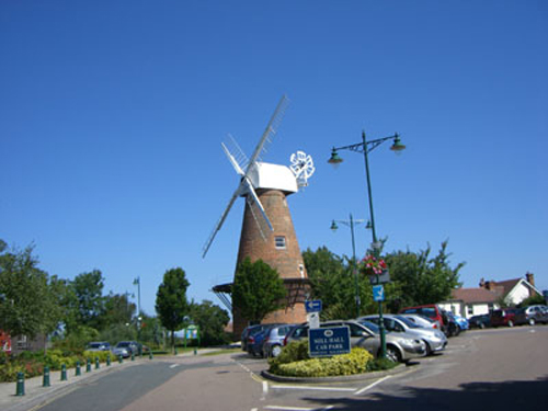 Figure 109: Rayleigh Windmill