Paglesham East End Conservation Area Appraisal and Management Plan
7. Character Appraisal
Spatial Analysis
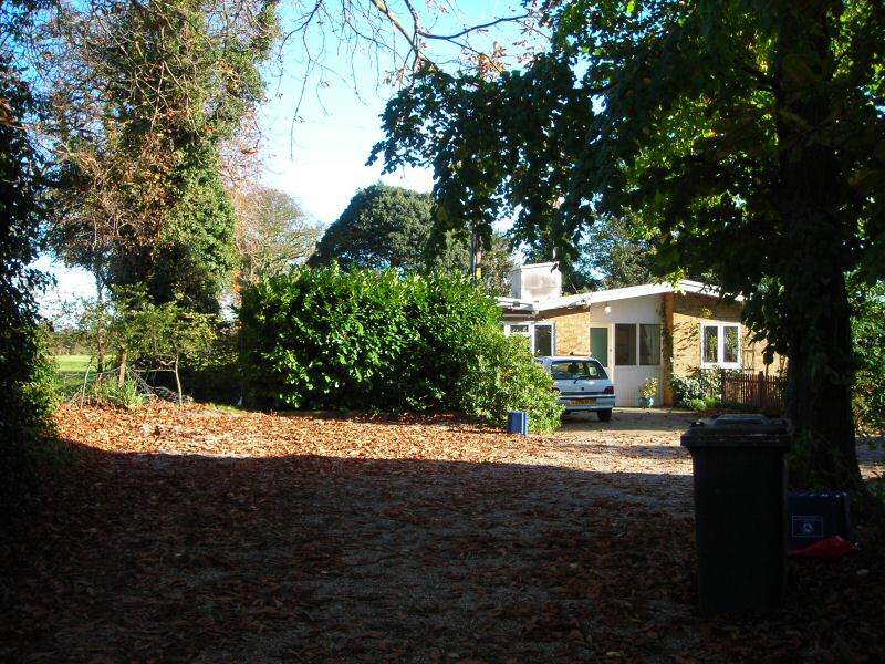
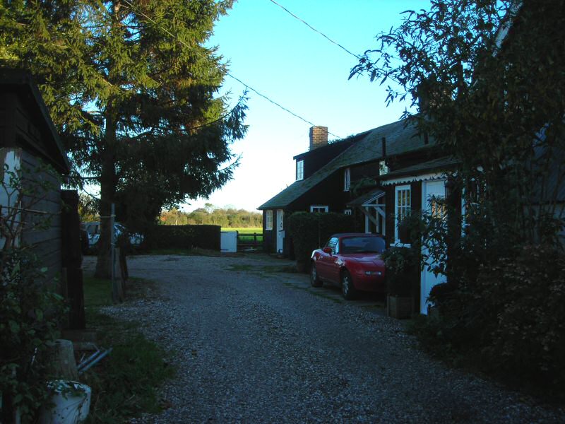
7.1 Paglesham East End conservation area encompasses the historic core of the creekside hamlet, comprising the nucleated settlement at the eastern end of Paglesham Road where the road terminates. Cupola House marks the start of the village at its western edge, but the road beyond is undeveloped as far as the Mission Room. The road curves slightly into the village, and is edged with trees and hedges that allow views out across the arable landscape. At the Mission Room the southern side of the road is built up with an irregular arrangement of buildings (Fig. 10). The road widens in front of the Plough and Sail which marks the centre of the village, and opposite this is a field known as Garden Field that contributes to a more open character at this point. The tall trees lining the drive to The Chase close the view at the eastern end beyond the pub (Fig. 11). Historically the road continued along the drive to the sea wall past Chase Cottages, but the white picket fence and timber gate at the drive entrance indicate that this is no longer a through route. A rough track running south alongside the rear gardens of Chase Cottages and the grounds of The Chase is known as The Chaseway, and is an old estate road that provided rear access to The Chase and to Waterside Farm (Fig. 12). The grounds of The Chase and former estate buildings provide the basis for the conservation area boundary to the south-east, including properties along the drive and along The Chaseway. The well planted boundary of the grounds conceals the main house from view, whilst contributing greenery to the rural quality of the conservation area.
Fig. 10 PagleshamRoad.
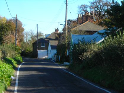
Fig. 11 Entrance to the drive to The Chase.
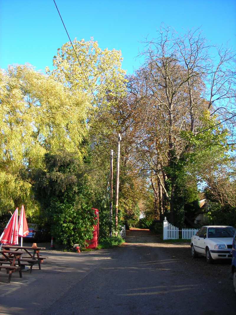
Fig. 12 The Chaseway.

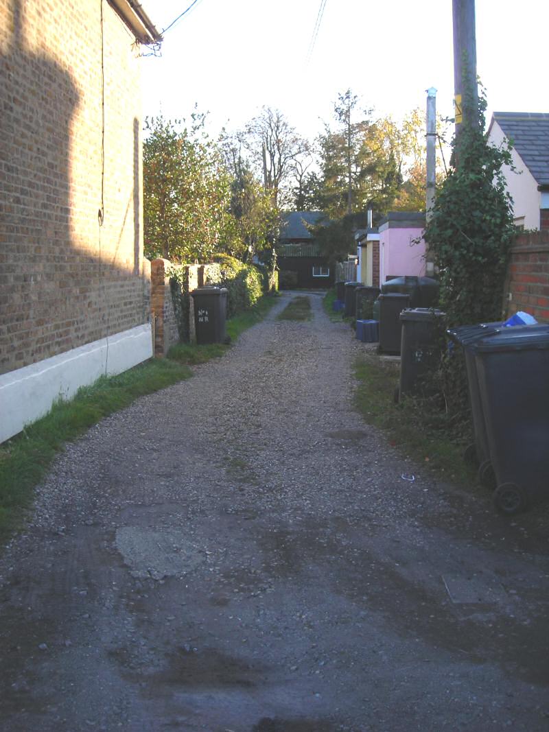
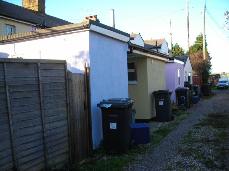
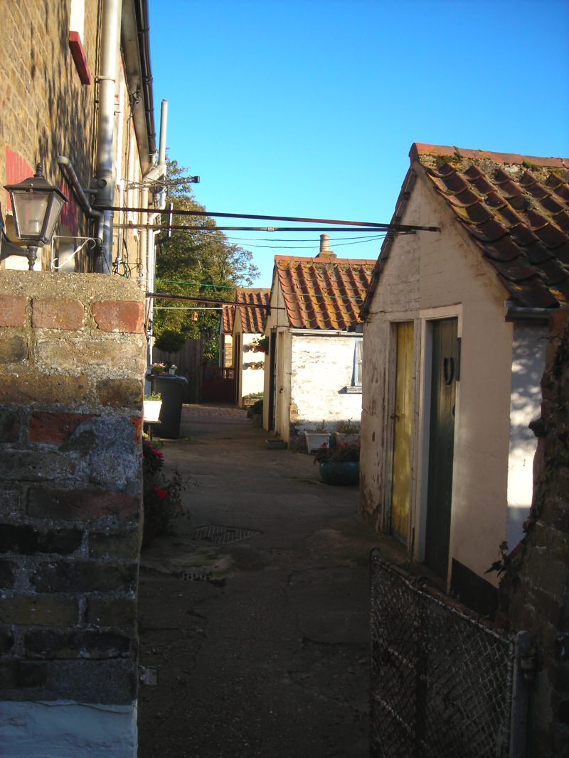
7.2 Waterside Road is an unmade road that passes to the left of the pub (Fig. 13). It provides access to the cottages referred to as 'The Rows', turning sharply east at the late 20th century Cobblers Row (a detached house built on the site of a row of cottages of that name) and continuing towards the boatyard where it terminates. This road confines the compact rectilinear arrangement of The Rows, and although these cottages are provided with long gardens the narrow rear access lanes are tightly enclosed (Fig. 14). The conservation area boundary follows the outer edge of the road, excluding Cobblers Row and an open plot containing an old carpenter's workshop to the north. The garden boundaries of New Row and Boarded Row form the north-eastern edge of the conservation area.
Fig. 13 Waterside Road.
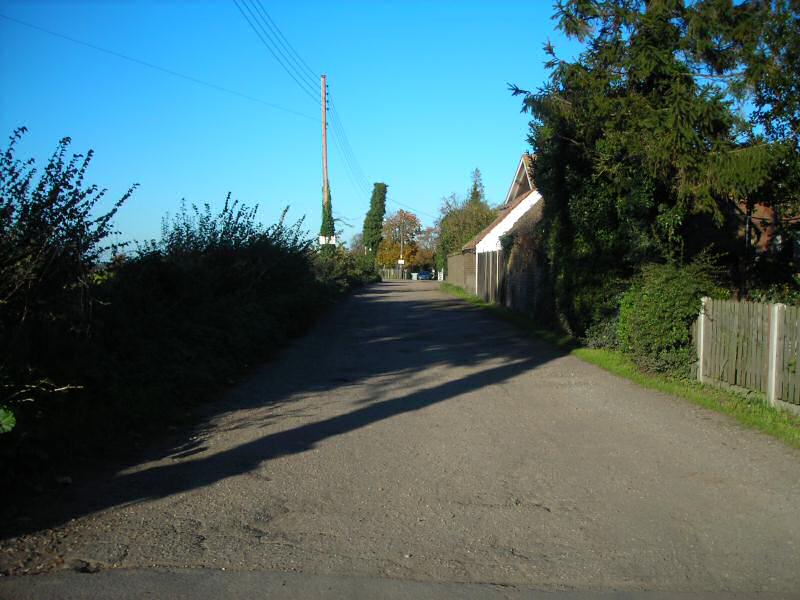
Fig. 14 Rear access to Boarded Row, between New Row and Shop Row.
7.3 A distinctive aspect of the conservation area's special character is the contrast between the closely built-up and confined area of The Rows with the more open and spacious quality of the remainder of the area. The spaciousness derives in part from the higher status properties in large plots such as The Chase and Cupola House, but also from areas of open space contained within the conservation area boundary. The open landscape setting of East End adds to the spatial character, with frequent and expansive views out from Paglesham Road, Waterside Road and south beyond The Chaseway towards the farm. Views to the river to the north and to the boatyard to the south-east beyond New Row serve as a reminder of the coastal location of the settlement (Fig. 15).
Fig. 15 View north from Paglesham Road towards the river.
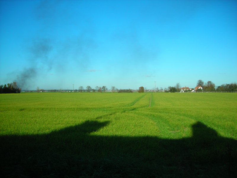
Fig. 16 Estimated dates of construction of buildings in the conservation area.
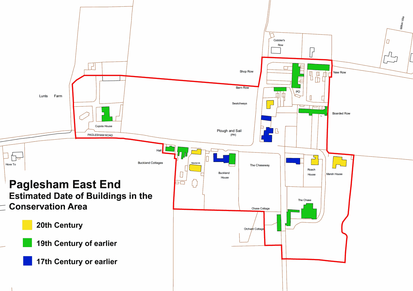
Reproduced by permission of Ordnance Survey® on behalf of the Controller of Her Majesty's Stationery Office. ©Crown Copyright. Licence number LA100019602
Character Analysis
7.4 East End conservation area is predominantly residential in character, with the contrast between large high status properties and small-scale two storey cottages a distinctive element in its special character. The oldest buildings in the conservation area today are 17th century or earlier. Whilst a wide range of trades were present in the settlement at one time, evidence of former uses of properties now resides in little more than occasional place names such as Shop Row. Cupola House, Buckland House and The Chase are larger properties that reflect the prosperity of the oyster industry in the 19th century. All of these are older houses that were upgraded by the wealthy oyster merchants that occupied them. The rows of one and a half and two storey cottages are characteristic of the built environment at East End, and the tight-knit area bounded by Waterside Row and the drive to The Chase largely reflects the patronage of James Wiseman. The pragmatic approach to naming these rows (New Row, Barn Row for example) also contributes to the special character of the conservation area, although the names have changed regularly over time (New Row, for example, was previously known as Brick Row and Tailors Row, Shop Row was known as Rice's Row after a former postmaster and shopkeeper). Wiseman's scheme also involved the laying out of new roads, and he diverted the route to the creek left at the Plough and Sail along what is now Waterside Road. These unmade Victorian roads are an important element in the special character of the conservation area. The Plough and Sail is an attractive landmark building at the heart of the conservation area, and has served as a focus for the village for centuries. There has been very little development in East End over the past 40 years or so. There are some modern properties, but these do not generally intrude on the otherwise unspoilt character of the historic settlement.
Materials and Details
7.5 East End exhibits a varied palette of traditional building materials that add variety and interest to the street scene. White featheredged weatherboard is characteristic of this part of Essex, and the weatherboarded Plough and Sail pub makes attractive use of this material, as does the older west range of Buckland House where it is used only on the upper storey. Black or tarred weatherboard is also seen, as used on Barn Row and Boarded Row. On the Plough and Sail weatherboard is used in the traditional scheme of white on the front elevation and black on the side elevations. Brick is the other dominant walling material, and may be either soft red brick (for example Cupola House) or yellow stock brick (New Row). It is usually left unrendered or unpainted, although in the case of Shop Row the finish is smooth render. The brick bond is typically Flemish, although red brick is used in English bond on Chase Cottages. Brick chimneys are usually left unrendered, and may be of red brick or yellow stock brick. Some timber framed buildings have a smooth render finish, and Chase Cottages have simple rectangular panels of pargetting in the render. Painted buildings are mostly white or cream, although properties in Shop Row have been painted in a pretty palette of pale colours.
7.6 Roofs are typically pitched or hipped, with the flank to the street. Plain clay peg tiles are used on older properties with steeply pitched roofs at 50˚-55˚, with natural slate used on properties from the later 19th century, including the Rows. Slate is generally used on shallower roof pitches of around 35˚-40˚. Clay pantiles are seen on outbuildings, including those to the rear of New Row. Brick chimneys, often with corbelled courses, enliven the roofscape. Dormer windows are not common, but Chase Cottages has prominent gabled attic dormers with plain clay tiles.
7.7 Traditional windows are white painted timber vertically sliding sashes with small panes, sometimes with marginal glazing as seen at Cupola House and Chase Cottages. In brick buildings the windows are recessed with segmental or flat brick arches, and in timber framed buildings they may have simple moulded surrounds sometimes weathered by penticeboards. Traditional doors seen in the conservation area are painted timber and may be boarded, solid panelled or part glazed Victorian doors (17). Most doorways and windows are simple and unadorned, but some are enhanced with timber doorcases (Chase Cottages), stucco surrounds (Buckland House), fanlights (Buckland House) or small porches (Shop Row, earlier range of Buckland House).
Fig. 17 Traditional Victorian window and door, New Row.

7.8 Boundary treatments make an important contribution to the character of a conservation area. Formal domestic boundaries at East End are typically either yellow stock brick or soft red brick walls with soldier brick capping, laid in Flemish bond, as used at Buckland House and rear garden walls at New Row. Picket fences are also traditional and appropriate to the rural context. The white picket fencing around the Chaseway and Chase Cottages is an attractive feature of the conservation area (18). Hedging is used to form boundaries, either informally with natural mixed hedging or formal clipped hedges, and elsewhere boundaries are loosely defined by garden planting.
Fig. 18 Picket fence boundary, Chase Cottages.
Individual contributions to character
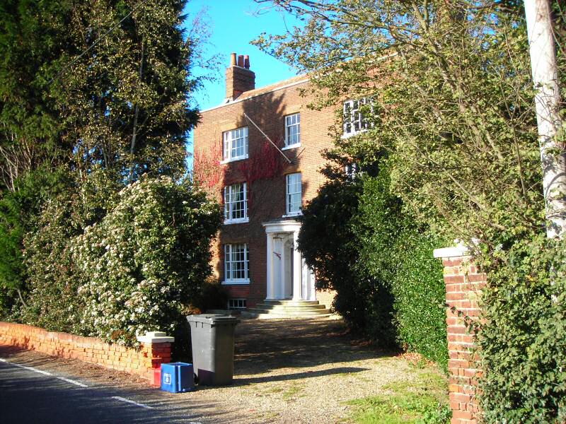
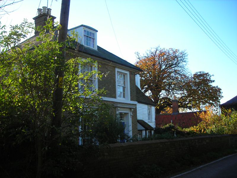
7.9 At the western edge of the conservation area, Cupola House is an impressive red brick house with a fine Georgian façade, although it has earlier origins (Fig. 20). It is the only three storey building in the conservation area with basement, and its typical Georgian features include the parapet and parapet verges, and the semi-circular door canopy supported by pilasters and columns with moulded capitals and bases. It is Grade II listed, and its red brick front garden wall with urns at the gateway is separately listed and also Grade II, although these are believed to be of later date4. The house formerly sported a cupola, which can be seen on an estate map of 1805 showing the building in elevation (Fig. 19 ). The house was previously known as Lunts Farm, and there was a butcher's shop on the site at the end of the 18th century. It was acquired by Thomas Browning, oyster merchant, in 1803, who upgraded the house to its present appearance. Lunts Farm is recorded in a sales catalogue of 1833 as being a 'superior and substantial brick built dwelling house' with 'a cupola fitted up with locker seats'5. The house was approached by a circular drive and small pleasure garden enclosed by a front palisade fence, with a productive garden enclosed by an eight foot brick wall. The associated farm included two cattle yards, a barn and granary with adjoining stables, a harness house, cow house, chaise house, hen houses, sheds, and stack yard. The cupola was taken down in the late 19th century when it became unsafe, but its reinstatement would be welcomed as the building is a prominent feature visible across the surrounding fields.
Fig. 19 Lunts Farm, 1805.
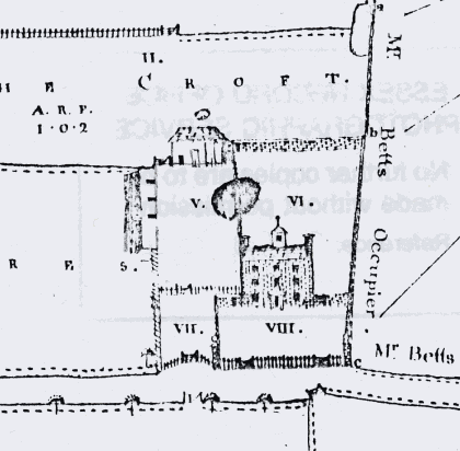
Fig. 20 Cupola House.
7.10 The green corrugated iron Mission Room is a charming and distinctive building on Paglesham Road, visible across fields from the north (Fig. 21). It is a well-preserved Victorian tin chapel, and is an important survival of a once common building type which benefits from remaining in active use as a community building. The mission room is also of local significance having been a gift to the village by the oyster merchant, churchwarden and local benefactor Zachary Pettitt in 1893. Also known as the Tin Chapel, the building was previously on Rochford District Council's Local List of Buildings of Architectural, Historic and Townscape Importance, but the practice of local listing has now been discontinued. Car parking access to the side of the Mission Room is informal and in keeping with the rural character of the area (Fig.22). If any hard landscaping is required in the future it should be carried out with great sensitivity to this special character, with appropriate surface treatment and soft landscaping, as a formal driveway would be harmful to the special qualities of the conservation area. The front of the Mission Room has recently been landscaped with a block work boundary, but consideration should be given in the future to reinstating a picket fence boundary that would be more traditional to the area.
Fig. 21 The Mission Room.
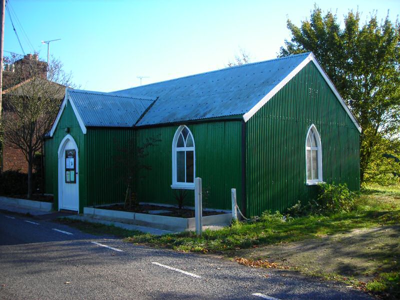
Fig. 22 Car park access.

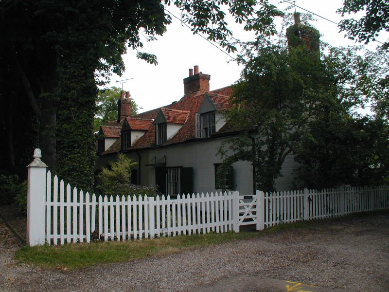
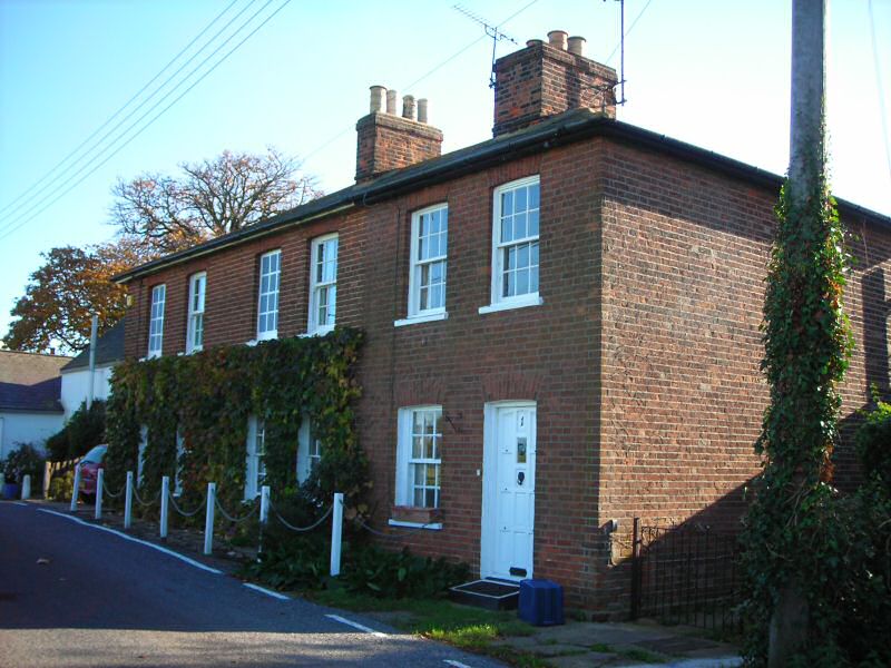
7.11 Adjacent to the Mission Room is a neat row of mid-19th century red brick cottages, called Buckland Cottages (Fig. 23 ). They were built by oysterman Frederick Wiseman in 1849 soon after he inherited the adjacent family house. This he had named Buckland House in honour of his friend, the naturalist and marine biologist Frank Buckland, who had aided the family business by providing advice on oyster diseases. Although there are some modern replacement windows, the cottages are generally well-preserved with small paned vertically sliding sashes including some blind 'window tax' windows6.
Fig. 23 Buckland Cottages.
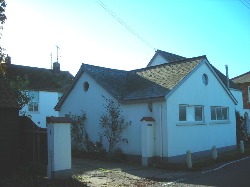
7.12 Representing infilling of gardens between Buckland Cottages and Buckland House, Newlands is a detached two-storey house built in 1957 (Fig.)The main house is set well back from the road and largely hidden behind an ancillary building that flanks the street. It is white rendered and constructed of modern materials. It is well maintained and, whilst it does not enhance the special character of the conservation area, it does not detract from the appearance of the street.
Fig. 24 Newlands House.
7.13 Buckland House is Grade II listed, and has the appearance of two dwellings. There is a modest 17th century or earlier timber-framed and part weatherboarded range to the right with its own front door under a small porch, and a yellow stock brick 19th century range to the left with a fine entrance with stucco doorcase and fanlight (Fig. 25). In fact it is one house that belonged to the Wiseman family, and it was Frederick Wiseman who added the left hand brick range in 1854. The front boundary comprises a characteristic low stock wall with soldier course capping. Outbuildings to the right of the main block add interest and informality to the street scene, and are constructed of a variety of characteristic traditional materials including red brick, yellow stock brick, black weatherboard and pantiles.
Fig. 25 Buckland House.
7.14 The Plough and Sail is a Grade II listed building at the heart of East End, and its name evokes the twin themes of agriculture and coast that have been critical to the settlement's history. It is 17th century or earlier in date, with later alterations and additions, and is timber framed and weatherboarded with a clay tile roof (Fig. 26). Demonstrating continuity of use, the pub has been at the hub of village life for centuries, and its extensive range of outbuildings once included a bakehouse with oven that was available for use by the villagers, and a Pin Shed for ten pin bowling. There was also a large vegetable and fruit garden, piggeries and stables. Garden Field, on the other side of the road, also belonged to the Plough and Sail and was used for summer events. Naturally oysters were once the Inn's most popular dish. The pub was enlarged in the 1930s and completely renovated in 1968 with extensions to the rear. Although there is an unsympathetic flat-roofed rear extension, the main building is well maintained, and its attractive appearance benefits from the absence of advertisements apart from the traditional hanging pub sign. There is a large car parking area to the side that is fairly well maintained and helps to keep parking off the street. This does not significantly intrude on the street scene and is surrounded by trees and planting contributed from surrounding properties (Fig. 27).
Fig. 26 Plough and Sail.
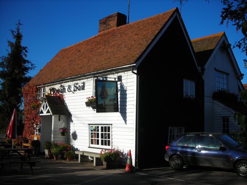
Fig. 27 Plough and Sail car park.

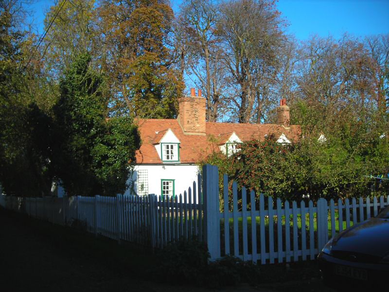
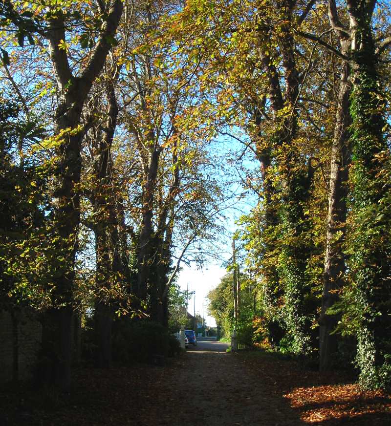
7.15 At the entrance to the driveway, beyond a Grade II listed K6-type telephone box nestling in the hedge, Chase Cottages make a picturesque scene. Of the small cottages in the village, they are amongst the oldest, many older cottages having been pulled down. They are single storey with attics, 17th century or earlier in date, and Grade II listed. They are timber framed and rendered, with red brick end walls laid in English bond, and have gabled dormers with side hung casements (Fig. 28). The informal planting in the front garden along the drive contributes to their attractive appearance. The rear elevations of these cottages contribute to the streetscape as much as the front. They create an attractive view across their long rear gardens from The Chaseway farm track against the backdrop of the tall trees (Fig. 29).
Fig. 28 Chase Cottages.
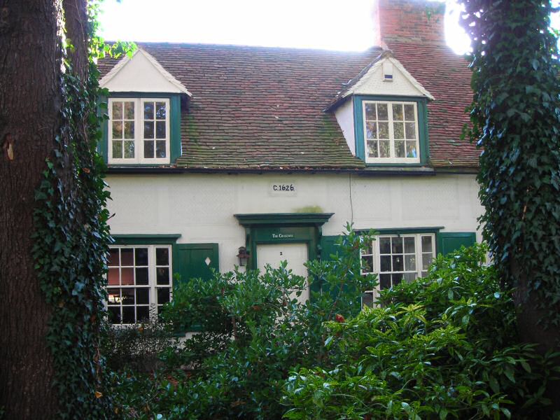
Fig. 29 Chase Cottages viewed across the rear gardens from The Chaseway.
7.16 Prior to James Wiseman redirecting the route of the creek road away from The Chase, there were once two more rows of old cottages along what is now the drive. There are now two modern properties on the site, the two storey detached Roach House and single storey Marsh House that marks the eastern extremity of the conservation area (Fig.)Although these are both of modern appearance and incorporate modern materials that do not reflect the traditional built environment, their discrete location ensures that they do not detract from the overall appearance of the conservation area.
Fig. 30 Marsh House.
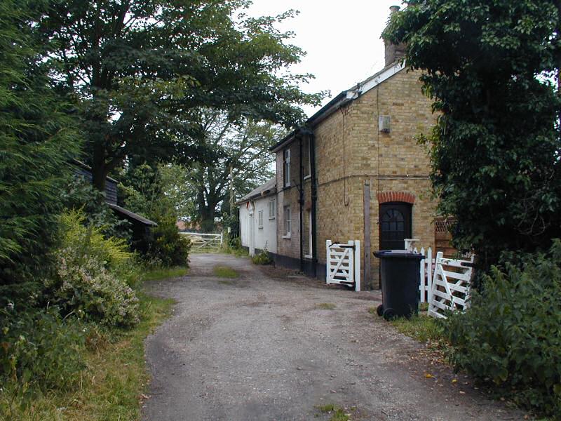
7.17 The private drive to The Chase passes between Roach House and Marsh House, although the house itself is not visible (Fig. 31). James Wiseman inherited The Chase from his father in 1851 when it was still known as Maritime Cottage. The date of the original cottage is unclear, but it is said that parts of original weatherboarding can be seen inside the house. James enlarged the property to an impressive nine bedroom residence with extensive grounds and new farm buildings to the south accessed by The Chaseway. A 1903 sales catalogue reveals the extent of the estate, which included a range of outbuildings (Brew House, Chaise House, Coal and Knife House etc), pleasure grounds with ornamental trees, a one acre kitchen garden with glass houses, one of which was a double span vinery 60 feet by 24 feet, stables with harness room and coachman's cottage (five rooms and small garden), a nut ground of nearly an acre planted with Kentish cobs and filberts, and a farmery comprising a stable, barn, cowhouse, poultry house, open sheds etc, all enclosed in a yard with high boarded doors. This estate forms the basis for the south-eastern portion of the conservation area, although the farm is excluded. The main house is now divided into two dwellings, and what was once used as the rear access to the house off The Chaseway affords the only glimpse of this handsome white rendered property. At the southern extremity of the conservation area The Chaseway passes across pasture and old orchard grounds, beyond which James Wiseman's courtyard farm buildings still stand to the south (Fig. 32). The brick and slate coachman's cottage remains on the Chaseway (Chase Cottage), and was formerly on the District's local list (Fig. 33). The adjoining brick and slate stables, with blue Staffordshire brick paving and roof ventilator, were converted into a dwelling (Orchard Cottage) in the early 1970s. Both these cottages were formerly on the District's local list. Unfortunately the conversion of the stables was carried out to a poor standard, and the building was recently demolished to make way for a new detached bungalow. Although the old property was in a poor condition, the loss of this element of the Wiseman estate is to be regretted.
Fig. 31 Private drive to The Chase.
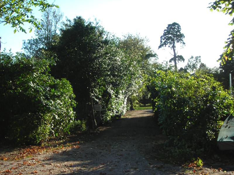
Fig. 32 View to Wiseman's farm buildings.
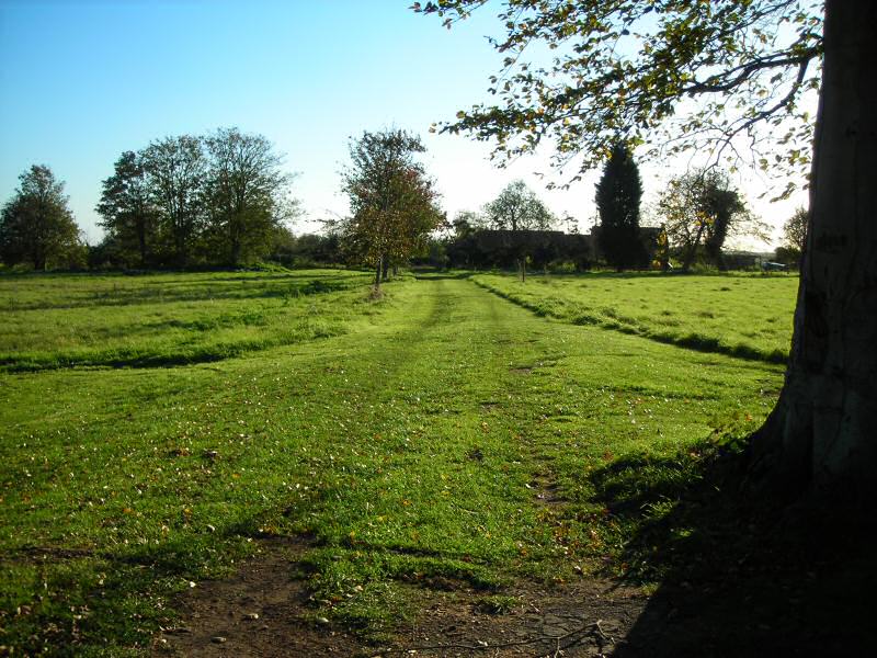
Fig. 33 Chase Cottage (former coachman's Cottage). The single storey former stables beyond have since been demolished.
7.18 Waterside Road provides access to the Rows behind the Plough and Sail pub. Immediately to the rear of the pub, however, is Swatchways, a large detached house built in the 1960s, with stained weatherboard cladding and first floor living accommodation with glazed viewing gallery (Fig. 34). Although this property is completely out of scale with the humble cottages of the Rows, its maritime flavour is not out of place in the conservation area.
Fig. 34 Swatchways.

7.19 Barn Row runs perpendicular to Waterside Road, and was converted into four cottages from an existing barn (believed to have belonged to the Plough and Sail) by the Wisemans in 1836. The cottages were provided with semi-detached wash and coal houses. Barn Row is a black weatherboarded building with a steeply pitched slate roof, refronted in red brick on the garden side, which is being sympathetically converted to a single property (Figs. 35, 36).
Fig. 35 Barn Row, north side.

Fig. 36 Barn Row, south side, with pantiled wash house.

7.20 At the end of the driveway beyond Barn Row is Shop Row, six cottages built as part of the 1873 scheme to provide accommodation for oyster dredgers, with semi-detached wash and coal houses and toilets (Fig. 37). The cottages are brick and rendered with slate roofs, and the right hand cottage at the end of the drive was a shop and post office until 1985. The long front gardens run up to Waterside Road, with informally planted boundaries and a neat clipped hedge along the north roadside edge. The front elevations of these cottages are attractive and largely unaltered, but the rear elevations are much altered with a variety of extensions and UPVC features (Fig. 38 ). These properties back directly onto the access road leading to another of Wiseman's Rows, Boarded Row.
Fig. 37 Shop Row.

Fig. 38 Rear of Shop Row.
7.21 Boarded Row was built as a row of eight weatherboard and slate cottages (currently painted black but painted white in the past) with a wash house each and four shared toilets in outbuildings to the rear. The rear of these cottages back directly onto the access road, but they have long front gardens that stretch south as far as the drive to the Chase. Again, these cottages have been much altered to the rear to provide extra accommodation and indoor facilities incorporating the former outbuildings (Fig. 39 ).
Fig. 39 Boarded Row from rear access road.
7.22 To the north of this access road is the third of Wiseman's Rows, New Row, built as a terrace of six cottages of yellow stock brick, with yellow brick garden walls to the rear and semi-detached pantile and brick wash and coal houses that have survived remarkably well (Figs. 40, 41). This Row fronts directly onto Waterside Road, and has retained many traditional features including some windows and doors. Properties of this type are vulnerable to unsympathetic changes, and in this case the dark stained joinery on the end cottage is not traditional, and some of the doors are less appropriate than others. New Row, Shop Row, and Boarded Row were all formerly on the District's local list.
Fig. 40 New Row.
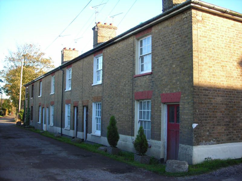
Fig. 41 New Row outbuildings.
Contribution of trees and green spaces.
7.23 The conservation area has a green and rural character, and trees and hedges make an important contribution to this, particularly at the eastern end. Green edges are a feature of East End, as can be seen in the townscape map (Fig. 41) . Elms were once characteristic of the area, but many were lost when Dutch Elm disease hit in the 1970s, although elm can still be found in some hedgerows. The tall trees lining the drive to the Chase are a particularly attractive feature at the eastern end of the conservation area (Fig. 42).
Fig. 41 Paglesham East End townscape map and individual contributions to character.
Reproduced by permission of Ordnance Survey® on behalf of the Controller of Her Majesty's Stationery Office. ©Crown Copyright. Licence number LA100019602
Fig. 42 Trees lining The Chase drive.
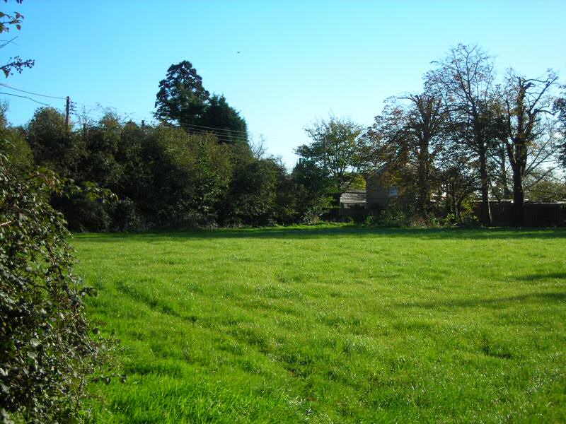
7.24 Although the conservation area includes little in the way of public open space, green open spaces enhance the rural appearance of the conservation area, both those included within the boundary, such as the Garden Field opposite the pub, and those at the fringes of the area, such as the pasture between The Chase and the farm (Fig. 43).
Fig. 43 Garden Field.
7.25 In addition, large areas of domestic gardens included within the conservation area contribute to its green character, with garden planting enhancing the street scene. This applies as much to small domestic properties such as Shop Row and Chase Cottages, which often have large gardens relative to their size, as it does to the grander properties like The Chase and Cupola House.
Problems and Pressures
7.26 Generally East End is an unspoilt conservation area which has suffered little in the way of modern intervention which might detract from it special character, and properties are generally well maintained. Unlisted Victorian properties make an important contribution to the distinctiveness of the conservation area. These are particularly vulnerable to unsympathetic alterations and modernisation carried out as part of permitted development, such as replacement windows and doors, which could undermine the special character of the area. Incremental alterations can cause irreparable damage to the rhythm and cohesion of properties in the rows that are an important element in the distinctive character at East End. To date these unsympathetic alterations have been mainly confined to rear elevations, although these are sometimes visible from public areas, notably from Waterside Road. Many of the former outbuildings that formed part of Wiseman's redevelopment have been lost or incorporated into the main dwelling, which is an understandable modernisation but a sad loss from what was a planned scheme for the settlement.
4Roberts, 1972 Paglesham, Paglesham: M.A. & R. Roberts, p.15
5 ERO D/DGs B119
6 This tax was abolished a year after the cottages were built in 1850.