Paglesham Churchend Conservation Area Appraisal and Management Plan
2. Character Statement
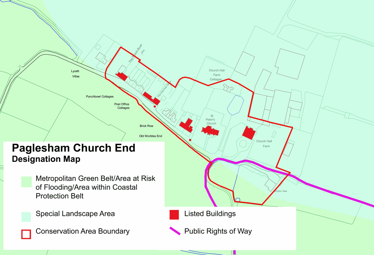
2.1 Church End is a tranquil rural hamlet set in an arable landscape close to the estuarine creeks of the River Crouch, located at the end of a narrow, quiet road. Together with the hamlet of East End on Paglesham Creek, Church End is one of the two foci for Paglesham village, which was notorious from the late 18th century as a centre for smuggling, and from the 19th century for its oyster fisheries. The settlement has medieval origins as a classic church/hall complex. The church of St Peter and former manor house of Church Hall remain landmark buildings, and the settlement has retained its discrete identity and small scale. Church End appears as a one-sided linear development along the north side of the road leading to the church. Views into the settlement from the winding approach road, and views out across the open space to the south, are important elements in the special character. The Punch Bowl Inn is a distinctive building at the western end of the conservation area, attracting visitors to this picturesque spot. Domestic one and a half and two storey cottages in rows or pairs are the typical building form. White weatherboard, soft red brick and plain clay roof tiles are traditional local building materials that characterise the conservation area.
Fig. 1 Paglesham Church End conservation area showing statutory designations
Reproduced by permission of Ordnance Survey® on behalf of the Controller of Her Majesty's Stationery Office. ©Crown copyright. Licence number LA100019602