Shopland Churchyard Conservation Area Appraisal and Management Plan
(1) 3.0 Historical Development and Archaeology
3.1 Although there has only been limited archaeological analysis in the area, field walking and prehistoric and Roman finds suggest occupation and utilisation over a long period of time. The Scheduled Monument of Prittlewell Camp, a partly upstanding earthwork likely to be the remains of an Iron Age Hillfort, lies about a mile to the south west1.
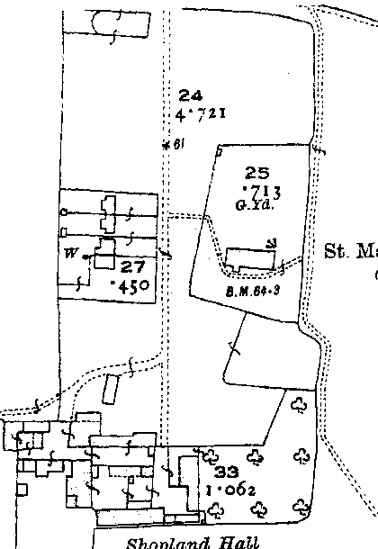
3.2 Medieval occupation was focussed on Shopland Hall, located on the west side of the lane leading up to the church from the Shopland to Barling road. The Chapman and Andre map of 1777 (Figure 5) shows the church and hall at Shopland. It illustrates the dispersed nature of the settlement in the area with church/hall complexes and scattered farmsteads.
3.3 The Hall was converted into two farmworkers' cottages in the late nineteenth century, and was later demolished. Around the same time a new hall was built at the southern end of the lane. This in turn was demolished and replaced with a cattle shed and milking parlour in the 1970s, buildings which now form part of the Shopland Hall Equestrian Centre. A house built in the 1970s now stands on the site of the original medieval hall2.
3.4 The parish church of St Mary Magdalen was one of the oldest churches in Rochford District prior to its demolition in 1957, built principally in the 12th century. The Nave was constructed in the early 12th century, the Chancel was rebuilt and widened in the 13th or 14th century, the South Porch was added early in the 15th century, and the bell-turret in the 16th century. The walls of the church were of rubble covered with cement and roughcast, with dressings of limestone. The roof was tiled and the bell-turret was boarded.3
Figure 4. Wash drawing of St Mary's church by A.M. Bamford, c.1900
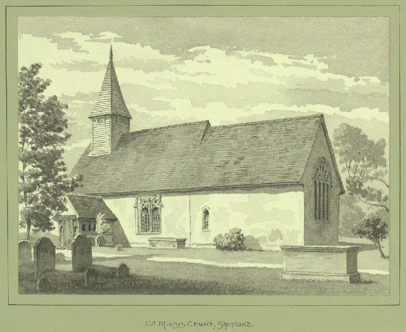
3.5 By the 1920s the church had become ramshackle and unsuitable for worship and a programme of restoration was carried out in 1928-9. Despite this the congregation dwindled during the 1930s, and severe gales caused significant damage to the roof. The congregation received a temporary boost from military personnel in wartime when a large anti-aircraft site was established to the east of Shopland Road known as Butlers Camp. However further damage occurred when a landmine burst nearby, and the church fabric continued to suffer during subsequent bombings. When congregations diminished once more the church was forced to close.4
3.6 The church was controversially demolished in 1957, and some of the stonework, monuments and fittings were dispersed elsewhere, notably a brass memorial to Thomas de Stapel, serjeant-at-arms to King Edward III, dated 1372, which was removed to Sutton church. The timber porch was sent to the parish church at Bradwell-on-sea.5
3.7 The two parishes of Sutton and Shopland are now combined, and responsibility for the care and maintenance of the churchyard lies with the Parochial Church Council for Sutton. An annual open air service is still held at the churchyard every summer in memory of the families that are buried there.
Cartographic Evidence
3.8 The Chapman and Andre map of 1777 and the Tithe Map of 1839 show Shopland Church as part of a small complex with Shopland Hall in a rural setting not linked to a village settlement. This pattern of dispersed settlement is typical in this part of Essex.
3.9 The First Edition OS map shows that trees were significant both in the hedge line of the enclosure and within the open space at that time.
3.10 Subsequent OS Maps show that the isolated nature of the small settlement complex continued.
Figure 5. Chapman and Andre Map, 1777
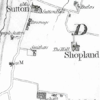
Figure 6. 1839 Tithe Map
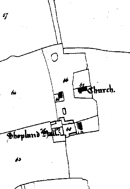
Figure 7. 1st edition OS Map, 1872
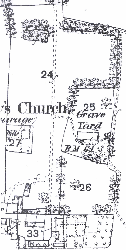
Figure 8. 3rd Edition OS Map c.1923
1 See Rochford District Historic Environment Characterisation Project, 2006
2 Jerram-Burrows. History of Rochford Hundred (Shopland) (Rochford Hundred Historical Society 1979) pp991-2
3 Royal Commission on Historical Monuments (England): Essex Vol. 4 (HMSO 1923) pp135-136
4 Jerram-Burrows pp 1023-4
5 ibid