Canewdon High Street Conservation Area Appraisal and Management Plan
6. Character Appraisal
6.1 The character of an area lies in the particular mix of local architectural details and materials, and the relationships between buildings and spaces which form a distinctive whole. Overall the conservation area has an open, informal and varied appearance which is given structure and coherence by the gentle curve of the High Street. The north side of the High Street has retained a more open and green character, whilst the south side is more developed, although some of the small, closely packed historic plots have been merged to accommodate larger properties. The exception to the informal and open arrangement is the historic core of the High Street where there is tighter enclosure and building up to the street edge, but with variety in eaves line, roofscape and facades.
Spatial Analysis
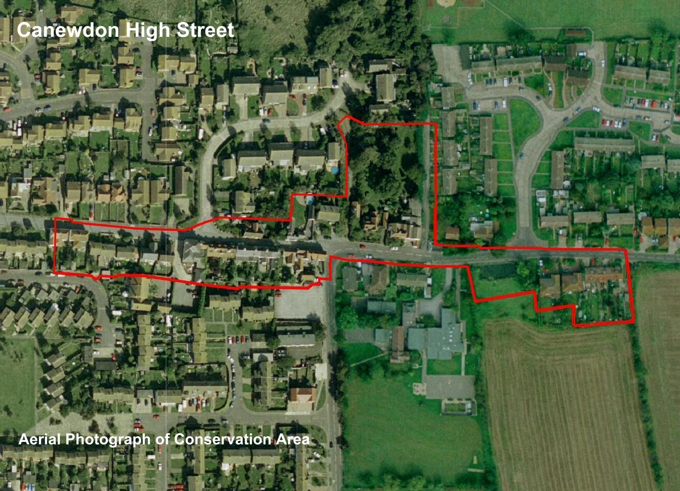
6.2 The Canewdon High Street conservation area is linear in form, encompassing the High Street from West Cottages in the west to Rest Cottages in Lambourne Hall Road in the east. It takes in properties on the south side of the street between West Cottages and the Anchor Public House, then runs along the street edge excluding the school complex and adjacent properties, as far as the village pond. This historic feature is included within the conservation area along with two large modern properties, Finches and Colmore, and Rest Cottages. To the north, the conservation area broadly follows the street edge opposite West Cottages, taking in the junction with Canute Close and properties from the Old Post Office to Rose Cottage, including a footpath running along the side of the gardens of Canute House and the southern end of Gays Lane. The boundary then follows the street edge ending opposite Rest Cottages.
6.3 The High Street and Lambourne Hall Road run continuously along the top of a hill, curving gently along its length to offer unfolding views of facades of varying periods, scale and materials as the street emerges with forward movement.
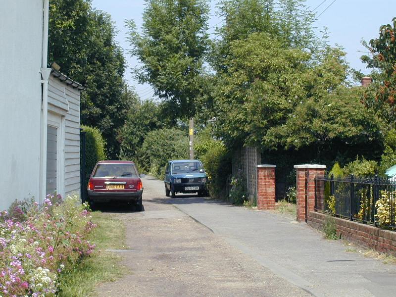
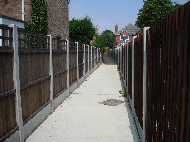
6.4 The east end of the conservation area has an informal arrangement of residential properties set back from the street edge with front gardens and green verges (Fig. 12). The wide junction with Althorne Way emphasises the feeling of openness, as does the village pond with its open green setting. West of the village pond a picket fence forms a boundary between the street and parking for the village school, which is at odds with the historic grain of the settlement. Gays Lane leads north from the High Street between the Village Stores and Rose Cottage, and is a rough gravel lane with level tarmac footway that heads off between properties and closes in to form a hedgerow-lined path following an old route north to the marshes (Fig.13).
Fig 11. Aerial photograph of conservation area.
©UK Perspectives
Fig. 12 Lambourne Hall Road.
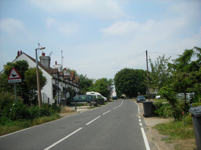
Fig. 13 Gays Lane.
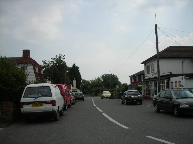
6.5 West of the school the street broadens slightly but is less residential in character with a shop on each side of the road (Fig. 14). The arrangement is still informal with an irregular building line fronting the street. The pedestrian footway is not continuous and at times pedestrians must walk in the road. The volume of traffic is relatively low especially west of Anchor Lane which is a 'no through road', but cars parked on the street around the shops both visually detract from the street scene and force pedestrians further out into the road.
Fig. 14 The High Street with Algiers and the village stores on the left and Costcutter on the right.
6.6 At the junction with Anchor Lane the street opens up with views away to the south. A newly-laid footpath leads north from this junction to Canute Close, and is narrow and enclosed by high panel fencing. A prominent directional sign at its entrance helps visitors get their bearings. The street is visually at its most narrow where Vine Cottage and The Anchor face each other on opposite sides of the road, and there is a sense of enclosure with a tight building line up to the street edge (Fig. 15). At Chequers pub the street scene opens up once more with the wide junction at Canute Close and the open but unkempt plot of the Congregational Chapel on the corner (Fig. 16). Beyond these a row of attractive bungalows with long front gardens lie outside the conservation area but contribute to the open and informal setting. On the south side of the street within the conservation area boundary modern detached and semi detached properties are set back from the street in an irregular building line, until reaching two neat pairs of white semi-detached cottages, West Cottages, that front directly onto the street and mark the west end of the conservation area. Looking further west to the end of the High Street the church is invisible behind mature trees that close the view.
Fig. 15 The High Street looking west with The Anchor pub on the left and Vine Cottage on the right.
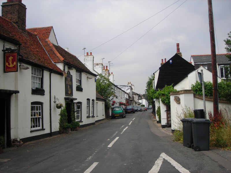
Fig. 16 High Street looking west, Canute Close in the right foreground.
Open Space
6.7 Wide open road junctions such as that with Althorne Way, broad green verges, green space and large plots contribute to the open and informal quality of much of the conservation area (Fig. 18). The exception to this is the historic core between the two village pubs where properties are built up to the street. The village pond with its surrounding green landscaping is particularly important as public open space with amenity value that connects with the agricultural landscape beyond (Fig. 17).
Fig. 17 Green space around the village pond with views beyond.
Fig. 18 Wide verge and trees at the junction with Althorne Way.
Views
6.8 The elevated position of the village becomes evident when occasional views out across the surrounding agricultural landscape are revealed, notably beyond the hedge at the east end of Rest Cottages, through a gap in the hedge surrounding the village pond, and looking south down Anchor Lane as it falls away down the slope of the hill (Fig. 19). This view is marred by the hard rectangular form of Anchor Parade, which is currently the subject of a planning application that would include revision of the roofline (Fig. 20). With careful design this is an opportunity both to enhance the setting of the listed Anchor pub and the view from the conservation area.
Fig. 19 View down Anchor Lane looking south.
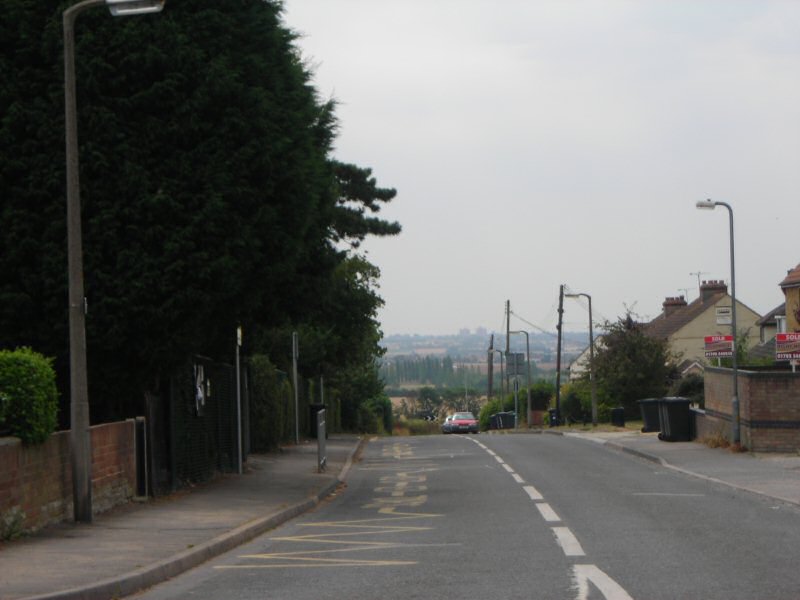
Fig. 20 Anchor Parade.
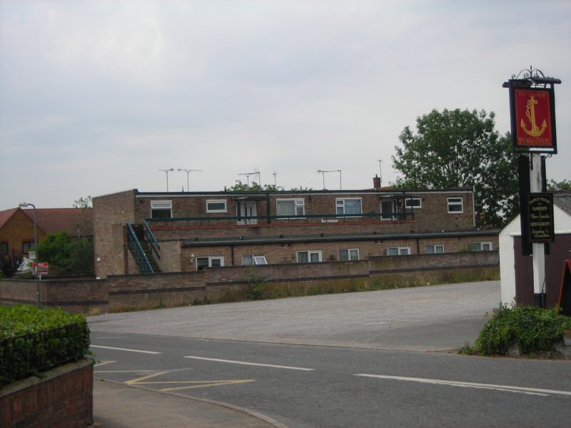
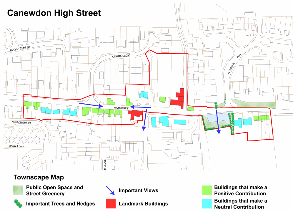
Fig. 21 High Street conservation area townscape map.
Reproduced by permission of Ordnance Survey® on behalf of the Controller of Her majesty's Stationery Office. ©Crown Copyright. Licence number LA100019602
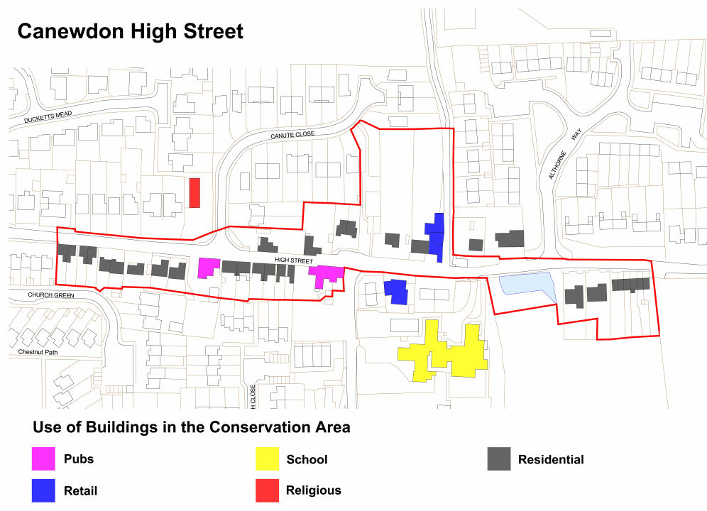
Fig. 22 Use of buildings in the conservation area.
Reproduced by permission of Ordnance Survey® on behalf of the Controller of Her majesty's Stationery Office. ©Crown Copyright. Licence number LA100019602
Character Analysis
6.9 Canewdon High Street has developed since at least the medieval period, providing housing and a range of services and amenities for the local community. It retains its mixed use character today albeit with greater emphasis on residential properties. Evidence of former use is limited, although the village stores adjacent to Algiers demonstrate continuity of use over a long period. Canute House, now a residential property, has a vestigial shop window, and the name 'Old Post Office' is also indicative of former use. Architectural variety today reflects the evolution of the High Street, and includes modest terraced cottages, semi-detached and detached residences, retail premises and pubs (Fig. 22). The late 20th century and 21st centuries have seen an increase in the number of substantial residential properties with gardens, with the loss of some of the smaller cottages and workshops that fronted the street particularly on the south side. However the area between the two village pubs has retained its historic form and grain with a uniform building line and strong cohesion.
6.10 The conservation area exhibits a variety of architectural styles and forms that contribute to its informal character and reflect its historical development. Traditional buildings contribute to the texture and interest of the streetscape. They exhibit a variety of rooflines and roof pitches that create a lively roofscape, including characteristic steep gambrel roofs, pitched roofs flanking the street with gabled and half-hipped side elevations and occasional gables facing on to the street. Roofs are frequently enlivened with brick or rendered chimneys and dormers with catslide, hipped or gabled roofs. The eaves line also varies, and the majority of properties are modest in height with one and a half or two storeys.
Materials and detailing
6.11 The older, traditional buildings share a palette of materials, principally render, weatherboard and red brick laid in Flemish bond (possibly disguising timber framing), with plain clay tiles and later slate used for roofing. Rendered facades are generally painted white with only occasional use of a pale colour. Brick is mainly warm, soft red local brick, as seen on Canute House and The Old Post Office, laid in Flemish bond. In the past exposed brick was more common on elevations than it is today. The extensive use of non-local brick including hard brown brick on modern developments has undermined the contribution made by locally produced brick in the streetscape. Weatherboard was also once much more prevalent on street elevations than it is now, although it is still seen on side elevations as at The Old Post Office and Vine Cottage, and it is generally painted black when used in this way. The notable exception to this is the striking use of white weatherboarding on Algiers and the adjacent Village Stores. The 20th and 21st century buildings in the village feature a range of modern materials including painted render, bricks of varying colour and texture, and concrete.
Fig. 23 Algiers.
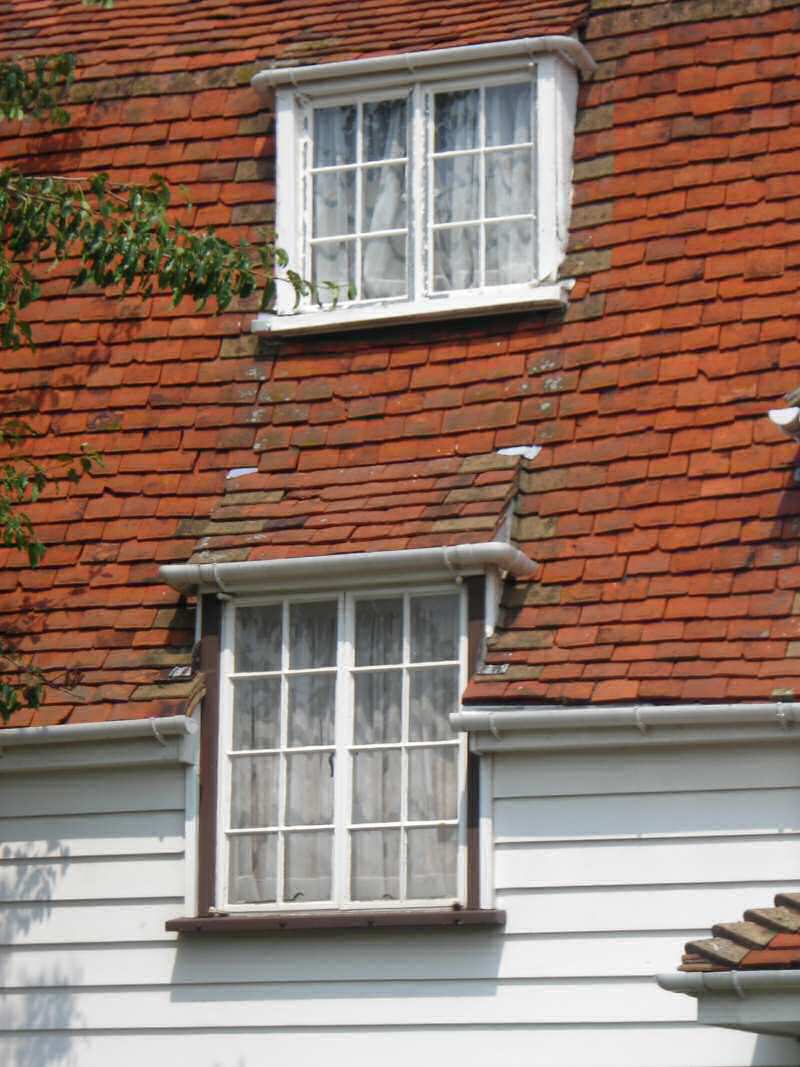
Fig. 24 Old Post Office.
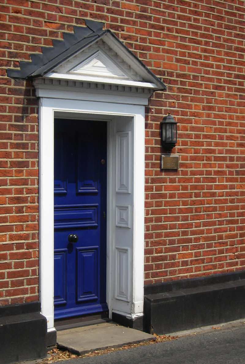
6.12 Window joinery is generally painted white sometimes with black architraves and sills, and small-paned casements and vertically sliding sashes are common on older properties. 20th and 21st century windows tend to be plain casements with night vents. Traditional doors are generally painted and boarded, panelled or part glazed with small panes. Entrances are occasionally embellished with simple catslide or gabled hoods, pediments and flat canopies, but few porches.
6.13 Generally, individual buildings are not heavily ornamented, but some examples of decorative detailing used on traditional buildings include hood moulds (Canute House) and dentilled eaves cornices (The Anchor pub, Whinfell and Russell House).
Fig. 25 Whinfell House.

6.14 Front boundary treatments contribute to the character of the area. These are generally marked by low brick walls or hedges which suit the open and semi-rural character of the High Street. However the use of modern non-local brick for front walls can feel too suburban in the village setting. Less attractive frontages occur where hardstanding and driveways front directly onto the street. Historic photos show that timber post and rail and picket fences were used more widely in the past, as well as simple iron railings, all allowing the greenery of gardens and open spaces to impinge on the High Street and enhance its rural character.
Individual contributions to character
6.15 The most striking and memorable group of buildings is The Algiers and the attached village stores, which provides a focus for the village and dominate the High Street at that point (Fig. 26). These buildings are of 18th century origin with later alterations and additions. The Algiers is a white weatherboarded house with a clay tiled roof over ranges that mark various builds. It is one storey but with two levels of catslide dormers in a half hipped gambrel roof on the main range. The windows are white painted small paned two and three light casements. There is a small hipped clay tiled canopy over the door, half hidden behind a tree and a neat front hedge. The shop to the right consists of two gabled ranges, the one to the left of white weatherboard and to the right of white render. The building is Grade II listed. Adjacent to Algiers is another Grade II listed building, Canute House, which is constructed of soft red brick (Fig. 27). This provides architectural contrast with the white weatherboard of The Algiers, and together they create a picturesque grouping. The house is early 19th century and of two storeys with a clay tile roof, and is unusual in the village for its more self conscious and high quality detailing. It has a lively roofline with a two storey gable to the right and a smaller feature gable to the left, the gables being moulded and dentilled, and red brick chimneys with diagonal shafts. The windows are white painted small paned casements with gauged brick arches and hood moulds, and there is a small paned bay shop window on the left. The house is set in mature gardens with a yellow stock brick wall to the front.
Fig. 26 The Algiers.
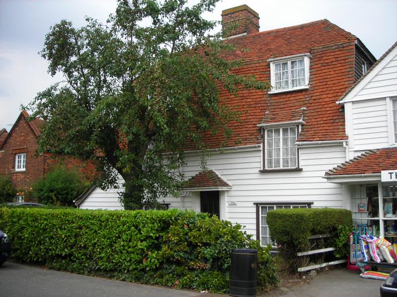
Fig. 27 Canute House.
6.16 The Anchor is another key building in the village, also Grade II listed, and although it is architecturally understated it occupies a prominent position at the junction with Anchor Lane. It is one of the oldest surviving buildings in the High Street, of 16th century or earlier date, with many later alterations and additions. It is of two storeys and timber framed, faced in white painted brick, with a varied roof line of clay tiles on three levels facing the road, hipped to the right and with the gable of a rear range rising above the ridge. The windows are small paned vertically sliding sashes with fine glazing bars, painted white with black frames. The doors have simple surrounds with flat canopies on brackets. Although the rear elevation of the pub viewed from Anchor Lane is appealing with its varied roofline and ranges, it is let down by an unattractive car park which is outside the conservation area but would benefit from some landscaping.
6.17 West of The Anchor as far as Chequers pub the historic character of the High Street is at its most obvious, with several buildings of different periods making important contributions. On the south side there are a pair of single storey Grade II listed cottages, Whinfell and Russell House, of 17th century or earlier date and fronting directly onto the street (Figs 28, 29). They are timber framed and faced in brick, the cottage to the right now painted pink, with weatherboarded returns and clay tiled roofs. Each cottage has a pair of hipped dormers with small paned casements, with small paned sashes to the ground floor. On the other side of the street the elegant façade of the red brick Old Post Office emphasises the visual enclosure of the High Street (Fig. 30). Formerly known as Mayfair, and now Grade II listed, this two storey house is timber framed but with a neat symmetrical red brick principal elevation, weatherboarded on the side returns, with small paned vertical sliding sashes and a dentilled pediment over the door.
Fig. 28 Whinfell House.
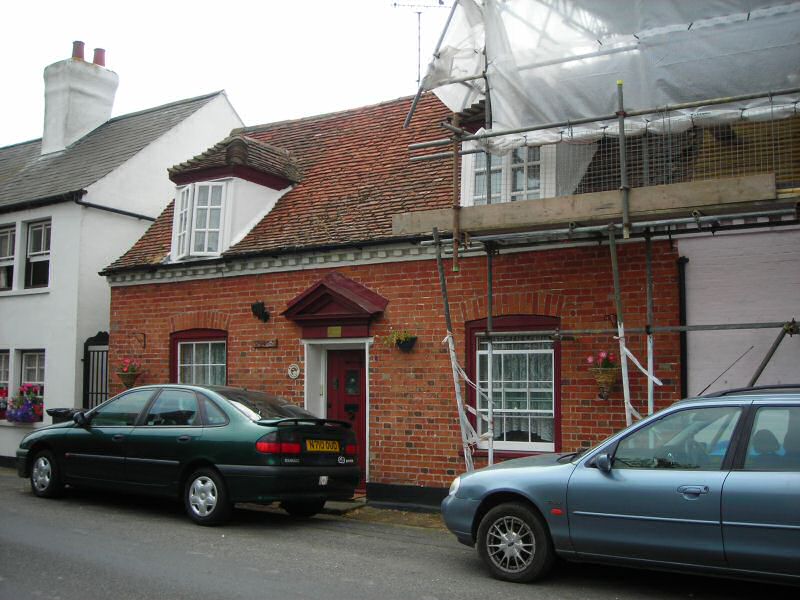
Fig. 29 Russell House.
Fig. 30 The Old Post Office on the left, with Russell Row right.
Fig. 31 Chequers pub.
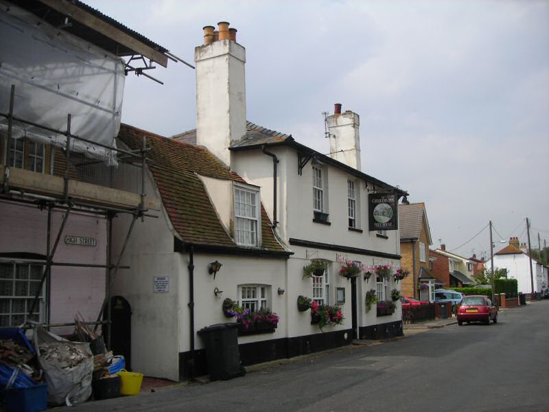
6.18 A number of unlisted buildings make significant contributions to the conservation area. Vine Cottage marks the visual narrowing of the High Street opposite the Anchor (Fig. 32). Its distinctive gambrel roof, slated with black weatherboard to the side returns, is given prominence in the roofscape by the curve of the street. It is a single storey white rendered cottage with catslide dormers and a single storey side extension. Gardens between Vine Cottage and The Old Post Office create a gap in the roofscape, but high panel fencing along the street edge maintain the sense of enclosure. Russell Row is a terrace of four well cared for white rendered cottages opposite the Old Post Office, with characteristically deep recessed sash windows and slate roofs (Fig. 30). With their strong building line they emphasise the tight enclosure of the High Street in this area. Adjacent to Russell House is Chequers pub, an off-white rendered two storey building with a slate roof, tall rendered chimneys at each gable end and a single storey side extension with a clay tiled gambrel roof and catslide dormer (Fig. 31). This much altered building is, along with the Anchor, one of the oldest buildings in the village, and marks the end of the narrow enclosed section of the High Street. Vine Cottage, Russell Row, and Chequers were all previously on the Rochford District Local List of buildings of architectural, historic and townscape which formed part of the Local Plan, but this list has unfortunately been dropped from the Replacement Local Plan.
Fig. 32 Vine Cottage.
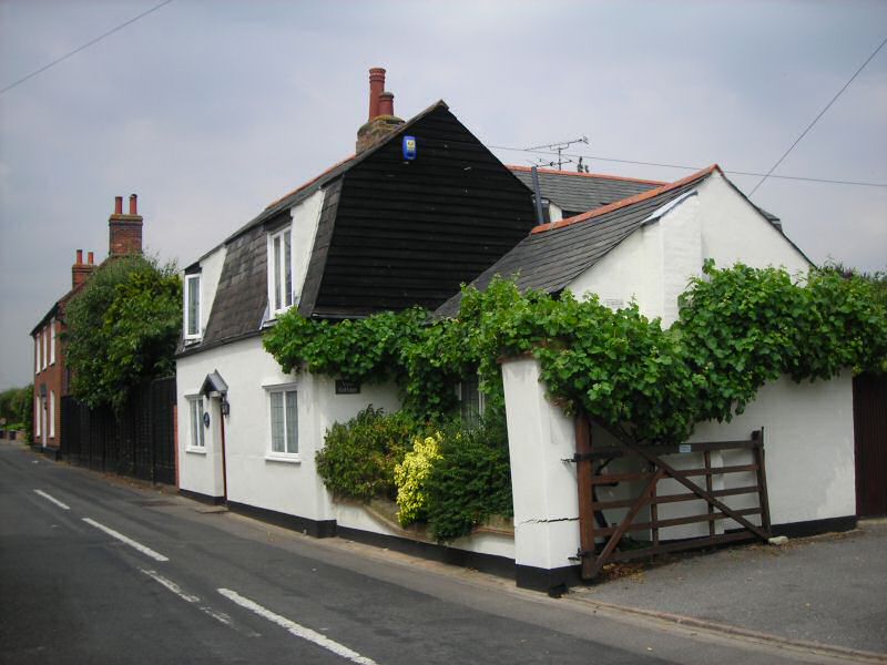
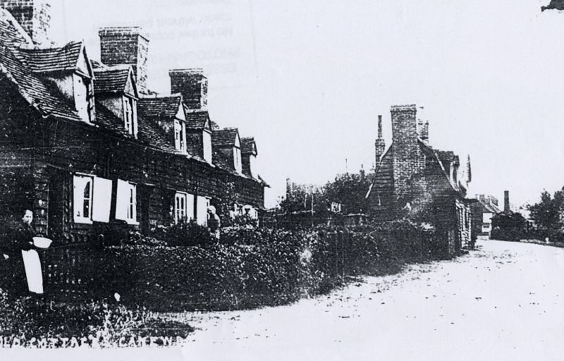
6.19 Another group of unlisted buildings adding interest to the streetscape is West Cottages (Fig. 33). These visually resonate with Russell Row, with their neat white rendered facades and deeply recessed sliding sash windows. These cottages provide a distinctive feature at the west end of the conservation area, marking the end of the historic nucleated village settlement as distinct from the church/hall complex at the west end of the village. They are well maintained and have retained their original windows and some doors, but the original roof has been replaced with concrete pantiles. They are echoed at the east end of the conservation area by another row of white rendered cottages, Rest Cottages, although they are architecturally dissimilar (Figs. 35-7). Rest Cottages have particular historic significance for the village having been constructed in 1785 as the parish workhouse for children. They have suffered from unsympathetic alteration, particularly replacement of original windows with plastic ones, and hard landscaping of front gardens to provide car parking. However they have retained their integrity as a terrace, all rendered in white with a continuous clay tiled roof, gabled dormers and catslide tiled canopies over the doors. West Cottages, Russell Row and Rest Cottages all provide punctuation in the street scene of the High Street. Finally a distinctive creamy rendered single storey cottage, Rose Cottage, with a tall rendered chimney at its gable end, adds interest at the entrance to Gays Lane, and is a prominent feature in the view west out of the village (Fig. 34).
Fig. 33 West Cottages.
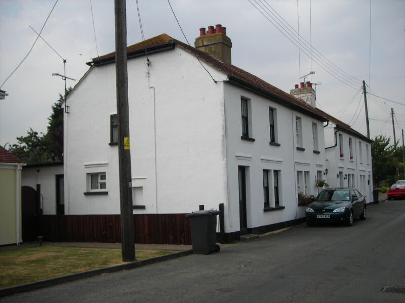
Fig. 34 Rose Cottage.

Fig. 35 Rest Cottages.
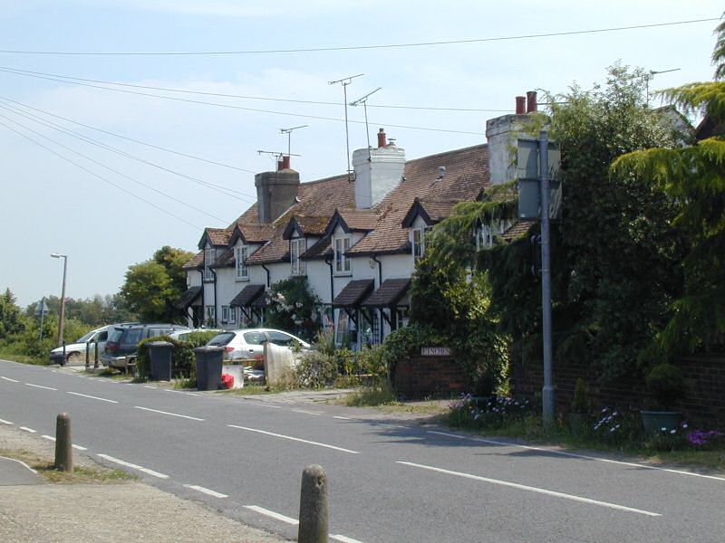
Fig. 36 Rest Cottages.
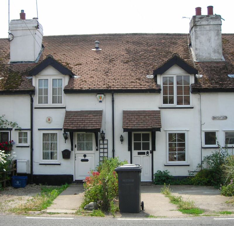
Fig. 37 Rest Cottages, c. 1900.
6.20 The High Street generally has a green and semi-rural character which is derived from green verges, open green spaces and planting and trees in gardens. Domestic gardens, including planted front gardens visible over low front boundaries of brick walls or hedges, make a significant contribution. A significant group of trees in the garden of Beecroft, which currently lies outside the conservation area, makes an important contribution to views looking both west into the High Street and east looking towards Lambourne Hall Road (Fig. 38). Where gardens have been converted to hard standing for parking, as at Rest Cottages, the greening effect is diminished. Broad green verges and trees at the junction between Althorne Way and the High Street, and wide verges bordering the pedestrian footpath outside Crouch View Villas contribute to the open rural character at the east end of the High Street although outside the conservation area boundary. The village pond with its healthy population of ducks and its green setting make a special contribution to the rural character of the conservation area. It once had an open setting with gently sloping banks to allow horses and cattle down to drink, and a simple post and rail fence along the street edge, but it now has utilitarian guard railings that detract from its special character and significance (Fig. 39). Access to the pond and surrounding green is via a path leading between hedges, but this is unsigned and overgrown, and there is a missing sign on the far side of the pond which spoils the attractive setting.
Fig. 38 Trees in grounds of Beecroft.
Fig. 39 Barrier around village pond.
(1) Problems and pressures
Public realm
6.21 The poor quality of some aspects of the public realm within the conservation area detracts from its special qualities. These aspects include the following:
- street lighting is provided by concrete lamp pillars which do not fit well in a semi-rural village context.
- railings outside the school and around the village pond are too utilitarian in appearance and do not enhance the appearance of the conservation area.
- the sign by the village pond is missing, and a road sign at the junction of Althorne Way has been vandalised and detracts from the street scene (although it is outside the conservation area boundary).
- a new street sign and barriers placed at the footpath opposite Anchor Lane are of unsuitable design for a conservation area (Fig. 40). These form part of an unattractive and untidy group of street furniture that is prominent at the road junction especially when approaching the conservation area from Anchor Lane. A traditional white painted finger post would be more appropriate here. This new footpath is on private land and has recently been moved as part of a new housing development to the north of the High Street. The new path is bounded by fence panels between concrete posts, with a white concrete surface treatment which is of a hard urban character (Fig. 41) A brick wall or hedge would be more suitable, reflecting the treatment of the old route of the path, with a bound gravel or pea shingle path as a more fitting surface treatment.
Fig. 40 Street furniture opposite Anchor Lane junction.
Fig. 41 New footpath.
Modern development
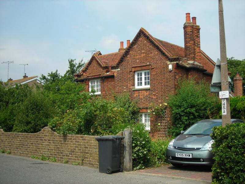
6.22 There has been significant modern development in the High Street conservation area, particularly over the last 30 years, representing infill and replacement of older properties. Generally these properties are fair examples of architecture of their time, well maintained with varied elevational design and use of modern materials including brick and render that contributes to the overall architectural variety of the streetscape. Costcutters is an example of a 20th century building on the High Street, albeit excluded from the conservation area but opposite Algiers, that has clearly attempted to refer to its surroundings, echoing Algiers in its scale and with its white rendered façade and small paned windows. However late 20th and 21st century properties within the conservation area boundary generally do not allude to the traditional architecture of the village, and in this sense cannot be said to make a positive contribution to the special character even where they have architectural merit in their own right. The extensive introduction of modern materials into the conservation area at the expense of traditional vernacular materials such as local brick, weatherboard and clay tiles undermines the contribution of these materials to the distinctive local character of the village. Also modern developments have tended to be of a scale and massing which is out of step with the relatively small scale of the historic settlement. Some of the roofs are of slack pitch, and gable ends too wide, creating an ill-proportioned result that is out of keeping with the traditional buildings. Dormer windows are a feature of the traditional architecture that contribute to the lively roofscape but are largely absent from more contemporary buildings. Local fenestration patterns of small-paned sash or casement windows are also absent, with windows on modern developments principally undivided casements with night vents. Overall, modern development has been at odds with the traditional architecture of the historic settlement and is in danger of overwhelming its special architectural qualities. The effect has been to create a suburban feel to the village at the expense of the more rural aspects of its character.
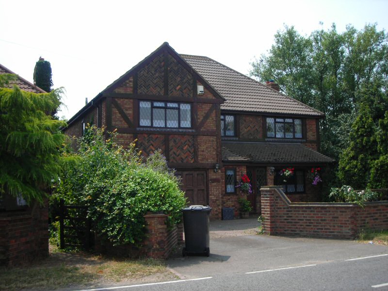
6.23 Tregudda and Grido House are examples of late 20th century properties that make good use of modern materials with varied front elevations, but they are large properties that are out of scale with the more traditional building forms of the village (Fig 42). Finches and Colmore adjacent to the village pond are also large detached properties built in a mock-tudor style that does not reflect the historic architecture and materials of the village (Fig. 43). A pair of semi-detached properties opposite the Anchor Lane junction, although of more modest scale have rather blank exteriors of inappropriate materials including pale stretcher bond brick, plastic windows and doors.
Fig. 42 Tregudda and Grido House.
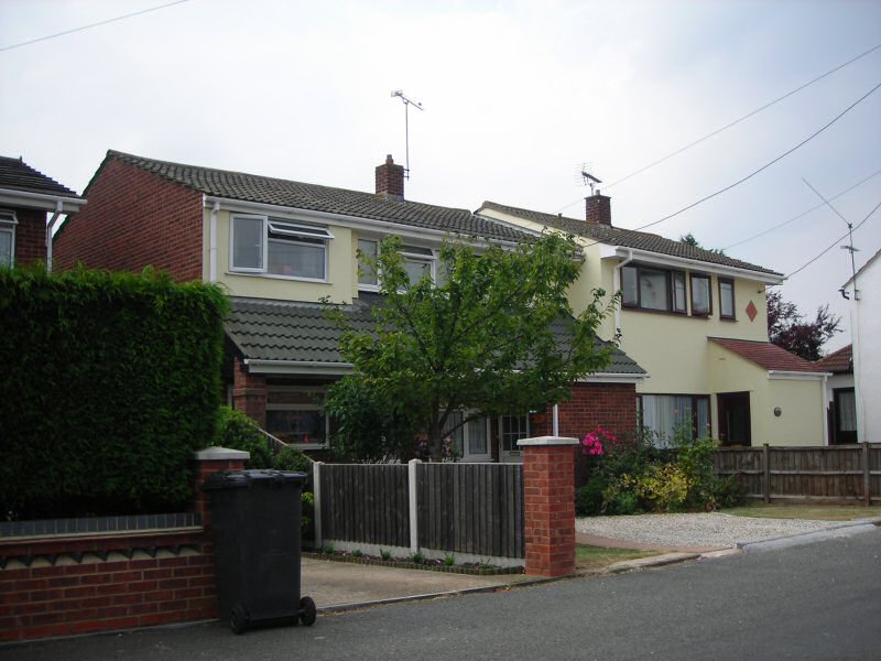
Fig. 43 Colmore House.
Front garden parking
6.24 The introduction of front garden parking in both old and new development threatens to undermine the contribution of planted domestic gardens to the character of the conservation area. The large size of many new properties has been accompanied by an increase in the number of driveways, and the growing number of multi-car families is likely to mean greater pressure for car parking space in the future.
Loss of original features
6.25 The loss of original architectural features and details as a result of modernisation of older properties as part of permitted development threatens the character and appearance of older properties and the contribution that they make to the special architectural qualities of the conservation area. This includes replacement of original fenestration with UPVC windows. Alterations of this kind are a particular threat to unlisted groups of buildings that can lose their architectural integrity if creeping alteration occurs, as can be seen in the case of Rest Cottages. Russell Row and West Cottages are examples of older properties that retain sash windows but these features will be particularly vulnerable to changes in the future.